
★★☆☆☆
41.924486, -72.162718
Yale Forest: Eastford Road Connecticut Blue Blaze Trail in Ashford, CT Parking: North end: Small pull-off near 253-77 Boston Hollow Rd Ashford, CT South end: Shoulder parking… Read more…
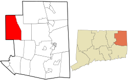
(Part of Windham County)
If you’re looking for the best hiking trails in Ashford this is the complete guide to all the long trails, waterfalls, and history it has to offer.
Ashford has a total of 17 hikes for 39.5 miles of trails, but unfortunately not much for fishing or boating opportunities.
Town Parks
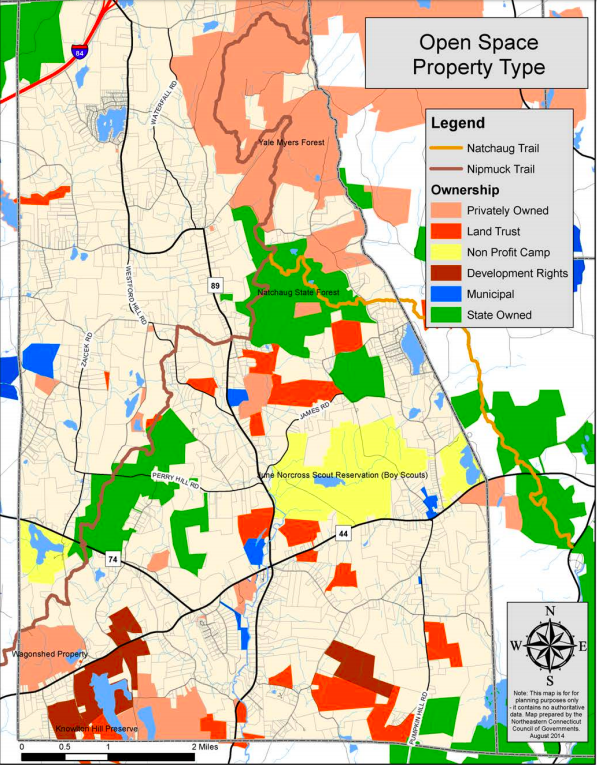
Land Trust
State Parks / Forest
Blue Blaze – Nipmuck and Natchaug in Ashford
The Rest
Ashford was first settled in 1710 and was quickly incorporated as town in October 1714 making it the 44th oldest town in Connecticut. The name is likely named after Ashford in Kent, England.
President George Washington passed through the town on November 7th 1789 after stopping in Pomfret intending to see Israel Putnam. He involuntarily stayed the night in town when the villagers proclaimed it was against the law to travel/hire a carriage on a Sunday. Read his diary entry here.
Now go out and hike Ashford, CT!

★★☆☆☆
41.924486, -72.162718
Yale Forest: Eastford Road Connecticut Blue Blaze Trail in Ashford, CT Parking: North end: Small pull-off near 253-77 Boston Hollow Rd Ashford, CT South end: Shoulder parking… Read more…

★★☆☆☆
41.848349, -72.223530
Nipmuck Trail: Marsh Road Blue Blaze Trail in Willington and Ashford, CT Parking: North end – Shoulder parking near 298 CT-74 Ashford, CT South end – Spur…

★★☆☆☆
41.880034, -72.194366
Natchaug State Forest: Perry Hill Connecticut State Forest and Blue Blaze Trail in Ashford, CT Parking: North end – Shoulder parking near 68-198 Oakes Rd Ashford, CT… Read more…

★★☆☆☆
41.868482, -72.202600
Natchaug State Forest: West Ashford Block Connecticut State Forest and Blue Blaze Trail in Ashford, CT Parking: North end – Small pull-off near 261-381 Perry Hill Rd,… Read more…

★★☆☆☆
81 Knowlton Hill Rd, Storrs, CT 06268
Knowlton Hill Preserve Joshua’s Trust Land Trust 127 acres in Mansfield and Ashford, CT Parking: Small lot for three cars at 81 Knowlton Hill Rd, Storrs, CT Trail… Read more…

★★☆☆☆
109 Westford Rd, Ashford, CT 06278
Rankin Preserve Joshua’s Trust Land Trust 81 acres in Ashford, CT Parking: Shoulder parking near 69 Westford Rd Ashford, CT Trail Map Trails: 1.3…

★★☆☆☆
41.899796, -72.211855
Langhammer Trail Ashford Town Open Space 73 acres in Ashford, CT Parking: Small lot near 100 Lustig Rd, Ashford, CT 06278 Trail Map The Langhammer Trail was…

★★☆☆☆
41.902388, -72.164776
Nipmuck Trail : Pixie Falls / Natchaug Trail: North Terminus Connecticut State Forest and Blue-Blaze Trail in Ashford, CT Parking: South End: Small pull-off near 32 Iron Mine…

★★★☆☆
41.935958, -72.161613
Nipmuck Trail : Boston Hollow Connecticut Blue Blaze Trail in Ashford, CT Parking: North end: Shoulder parking along Barlow Mill Rd Ashford, CT South end: Small pull-off… Read more…