
The Nipmuck Trail

I had thought that this year was going to be the Year of the State Parks, but with several state parks filled to capacity each weekend, I’ve found myself on the quieter blue blaze trails.
This year with other plans for Connecticut Trails Day dashed, I decided to do a solo thru hike of the 41.5 mile Nipmuck Trail. It took two days to hike from the eastern terminus to the Massachusetts border and a trail run the following day to complete the western branch. In total, about 50 miles.
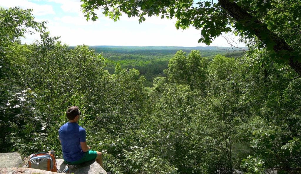
The weather couldn’t have been better, 70 degrees, sunny, and a cool breeze that lasted all day. I set off at about 8AM through southern Mansfield Hollow. The first 15 miles are dominated by water features namely the Fenton River. Both the eastern and western branches have overlooks at Fifty Foot Cliff and Wolf Rock respectively. With the landscape dressed in verdant foliage I couldn’t resist spending a few moments of solitude at both.
I’ve hiked almost every section of the Nipmuck previously including an 11 mile stretch with Steve from CTMQ. A few sections I hadn’t hiked for 3-4 years and I was awash in the memories of time spent with friends and family on the trail. The chance to connect them physically all while forming new memories stayed with me throughout the day in some complex ebb and flow of past, present, and future.
I reach my camp just north of Pixie Falls near 5PM, 22 miles away from my starting point. I set up my tent amidst old pines and got a fire going, fueling it for the few hours until dark. I saw fewer than 10 people all day, but was more surprised that I hadn’t seen much wildlife, just a few mallards in the Fenton.
In the morning I woke early and got moving quick in brisk temperatures. The northern stretches of the trail are much more rugged with plenty of elevation and a real sense of remoteness. The overlook above Boston Hollow is a narrow vista earned through a steep climb. The stretches beyond include Walker Mountain and Coye Hill (the highest elevation on the trail) but neither provide much of a view.
In the last leg, the park enters Bigelow Hollow gently rolling to Breakneck Pond to follow the surprisingly rough shoreline. I was caught up in the completion of the thing, pushing the pace through dense laurel, past clearings along the water until I broke into the final stretch along an old road.
There sits the state line border marker, below the east rim of the Hollow. I thought of the hike as the Hike of the Three Hollows. And I got the same sense of discovery and challenge as any trip to Vermont or New Hampshire. Hike a blue blaze trail for yourself, not only will you find some solitude but perhaps a rugged challenge right in your own neck of the woods.
Updated and Added Pages
- Nipmuck Trail Guide – Several new and updated pages here
- Shenipsit Trail: South Terminus
- Shenipsit Trail: Dickinson Rd
- Nayantiquit Trail
- Woodland Warbler
Education
- I read A History of Pine Acres Farm about James Goodwin’s farm before he donated his land to the state for Goodwin State Forest. See my notes here.
- I also read Twentieth-Century New England Land Conservation which may form the basis for next month’s newsletter!
Best wishes for a thoughtful and adventure filled month. Please send any news, comments, homemade trail guides, and CT history notes to matt@explorect.org
