
Nipmuck
Trail Guide
Hike the Nipmuck Trail
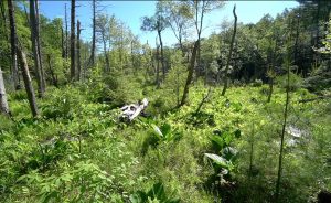
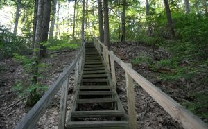
The Nipmuck Trail runs 41.5 miles from Mansfield to the Massachusetts border following peaceful rivers, passing overlooks and small waterfalls. The southern sections are dominated by water features and well traveled with largely easy to moderate difficulty.
The northern sections are more challenging, rugged and remote forest with lots more elevation change.
I hiked the entire trail for Connecticut Trails Weekend in June 2020 and remember it as the Hike of Three Hollows.
There are currently two races that use the Nipmuck as a course.
- Nipmuck Marathon has been running for 35+ years in the rugged northern sections and is a classic New England race (see more info here)
- Nipmuck South Trail Race started in 2014 and is part of the Blue-Blazed Trail Running Series. It takes place annually in June (see more info here)
Fastest Known Time (use this link for all FKTs)
- East Branch – Dan Grip (6h 33m 12s on July 19th, 2020)
- West Branch – Tony Bonnano (6h 29m 11s on May 13th, 2020)

Highlights
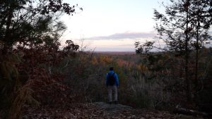
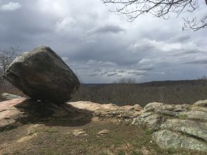
Overlooks
Water Features
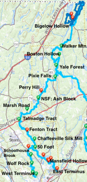
Section List
West Branch – 5.2 miles
- Parking on Puddin’ Lane
- Western Terminus – 1.9 miles – Starting behind a large rock off Puddin’ Ln this rocky and rooty beginning follows Sawmill Brook for a stretch
- Wolf Rock – 0.6 miles – A steep uphill to a great overlook with the namesake glacial erratic perched atop the overlook
- Parking on Crane Hill Rd
- Cross Crane Hill Rd between houses through a short 0.2 mile rocky section that exits along someone’s side yard to cross Brown’s Rd
- Parking on Clover Mill Road
- Schoolhouse Brook – 2 miles – This section cuts through a large network of trails on rocky terrain, crosses Clover Mill Rd, passes small cascades along Schoolhouse Brook, turns at Bicentennial Pond, and exits along someone’s side yard to Spring Hill Rd
- 0.2 mile road walk along Spring Hill Rd to cross Rt. 195 and enter Fifty Foot
East Branch – 6.4 miles
- Parking off North Windham Road
- Eastern Terminus – 2.3 miles – Starting in a large field this hilly section provides quiet views of Mansfield Hollow Lake
- Parking on Bassetts Bridge Road
- Mansfield Hollow – 1.7 miles — Passing through the boat launch, picnic area, and through deep woods the Nipmuck is one of the less traveled trails in this busy state park
- Parking at Southeast Park
- Rt 89 Iron Bridges – 2.3 miles – Crossing two pony truss bridges relocated to the trail in the late 90s this section criss crosses the Fenton River
- Trail Notice: The north bridge washed out in 2022 so the trail has been rerouted to the west side of the Fenton
- Parking on Chaffeeville Road
- Cross Chaffeeville Rd and enter Fifty Foot (skip to North of the Junction below)
North of the Junction – 29.9 miles
- Parking on Rt. 195
- Fifty Foot Cliff – 1.8 miles – The best overlook along the trail with views southeast over Mansfield Hollow the east and west branches join just past the overlook
- Parking on Chafeeville Road
- Chaffeeville Silk Mill – 1.4 miles – The overgrown remains of the silk mill and bridge start this section of narrow trail along the banks of the Fenton
- Parking on Stonemill Road
- Torrey Preserve — 0.5 miles — Short section along the Fenton from the Gurleyville Gristmill Museum to the Torrey Preserve
- Parking on Gurleyville Road
- Fenton Tract – 2 miles – Following a winding section of the Fenton River on remote trail in this UCONN owned property
- Trail Notice: Temporary (since summer 2018) reroute around a meadow flooded by beaver activity
- Parking on Old Turnpike Road
- 0.3 mile roadwalk along Old Turnpike Rd turn left where it meets Rt.44 and walk .1 miles to cross Rt.44 at the Nipmuck road sign
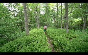
- Talmadge Tract – 1.9 miles – Leave the Fenton River behind and exchange river views for forest, fern, and rock
- Parking on Mason Road
- Marsh Road – 2.7 miles – Rerouted in 2017 this long stretch passes the backside of a farm to meet old roads and Knowlton Brook before crossing Rt. 74
- Camping area near Rt. 74
- Parking on Rt. 74
- Natchaug State Forest: West Ashford Block – 1.2 miles – After crossing Rt. 74 enter designated “old forest” with steep slopes and dense mountain laurel
- Parking on Perry Hill Road
- Natchaug State Forest: Perry Hill – 2.3 miles – Gradual terrain passes through land rebounding from a timber harvest
- Turn right for a 0.7 mile road walk along Oakes Rd, cross Rt. 89 diagonally and head 0.2 miles down Iron Mine Ln
- Parking on Iron Mine Lane
- Pixie Falls – 2.1 miles – This section features old foundations, Pixie Falls, a stretch of the 400 year old Old Connecticut Path, and Ladies Room Rock
- Camping Area just past Pixie Falls
- Parking on Eastford Road
- Yale Forest: Eastford Road – 1.6 miles – A largely forgettable section that passes along a small ridge through alternating mountain laurel and open forest
- Parking on Boston Hollow Road
- Yale Forest: Boston Hollow – 4.2 miles – The most rugged stretch of the entire trail with a steep climb to a narrow vista then dense laurel, hills, and valleys
- 0.1 mile road walk along Barlow Mill Rd
- Parking on Barlow Mill Road
- Yale Forest: Walker Mountain – 1.9 miles – This section heads up and up and up with a new spur trail to the Walker Mountain summit and then down through the Yale Forestry school
- Parking on Rt. 171
- Bigelow Hollow (North Terminus) – 3.6 miles – Half hilly terrain and half along the rough yet peaceful shores of Breakneck Pond
- Camping Area and Lean-to Shelter along Breakneck Pond
Coming soon!
{{label}}: {{displayValue}}
{{displayValue}}
{{displayValue}}
{{locationDetails}}
Browse sub-categories
Showing 1 result
Showing {{ showing }} out of {{ foundPosts }} results
