Site logo
    • Explore
      • Blue-Blaze Trails
      • Land Trusts
      • State Parks and Forests
      • By Town
    • exploreCT+
      • Membership
      • Shop
      • Events
    • Blog
    • Town Guides
    Sign in or Register
    Listing cover image

    Mansfield Hollow State Park

    • Trails
      20 miles
    • Rating
      ★★★★☆
    • Address
      151 Bassetts Bridge Road, Mansfield, Mansfield Center, CT 06250, USA
    • Explore
    • Trail Map
    • Reviews 0
    • New Page
    • prev
    • next
    • Bookmark
    • Share
    • Get directions
    • Report
    • prev
    • next
    At A Glance

    Connecticut State Park and Wildlife Management Area

    251 acres in Mansfield, CT

    Parking: A number of lots and pull offs along Bassett’s Bridge Rd Mansfield Center, CT

    Trail Map               Trails: 20 miles             Rating: ★★★★☆

    Mansfield Hollow is a large and varied park that offers hiking, picnicking, and boating.  It is also a popular gathering place for groups on the weekends and large events like the annual cyclocross race.  There are over 16 miles of trails between the park and wildlife areas.  This includes a nearly 8 mile section of the blue blazed Nipmuck Trail to its eastern terminus.  Highlights of the trails include sections along Mansfield Hollow Lake, the Mount Hope and Fenton Rivers, and pine groves throughout.

    Hiking

    East of the Lake

    This section of trails can be accessed from the small pull off just north of the boat launch or from the Nipmuck Trail East Terminus.  The Nipmuck section here is a 2 mile hilly stretch with an overlook on the water.  Mountain bike trails run along the waters edge and are some of the most secluded trails in the park.  There is also an easy paved path (a road that ran through the hollow before it was turned into a lake) runs right to the water’s edge.

    Blue Blaze Nipmuck Trail

    Heading South – Nipmuck Trail: East Terminus

    Though the eastern terminus starts in the Mansfield Hollow WMA this description covers the 1.7 mile section from Bassett’s Bridge Road to Rt. 89. 

    From the Mansfield Hollow boat launch the Nipmuck continues into the woods at the corner of the lot.  The Nipmuck heads up into the pines before passing the main picnic area, briefly along the raised dam path, and back into the trees.  Though Mansfield Hollow is a popular spot the Nipmuck is one of the quieter trails through the park.  It is hilly but only gradually so and is usually dry and easy to follow.  It can be combined with a number of other crossing trails for longer hikes.

    Heading North – Nipmuck: Iron Bridges

    History

    Established as a state park in 1952 upon completion of the Mansfield Hollow Dam.  The dam was built in response to disastrous floods resulting from the 1938 hurricane.  Plans were drawn up in 1940 for three dams: one at Mansfield Hollow on the Natchaug River, one at South Coventry on the Willimantic River and one at Andover on the Hop River.

    While the Coventry and Andover plans were ultimately dropped the Mansfield project continued though it was modified after heavy protests from town residents.  The U.S. Government acquired 2,300 acres and began construction of the dam in 1949.

    Links

    Friends of Mansfield Hollow Facebook Page

    The Geology of Mansfield Hollow State Park

    Peter Marteka – Kayak Allows New Looks at Hollow (2001)

    Peter Marteka – The Ghost Bridges Of Mansfield Hollow (2012)

    Tags
    • ★★★★☆
    • 2015
    • 2016
    • 2017
    • 2018
    • 2019
    • 2020
    • 2021
    • 2022
    • 2023
    • 2024
    • 2025
    • Explored
    • Geology
    • Natchaug River
    • Nipmuck Trail
    • State Park
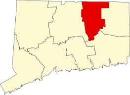
    • Tolland County
    • Wildlife Management Areas
    Last Updated

    The information shown here is for general reference purposes only. exploreCT.org gives no warranty, expressed or implied, as to the accuracy or reliability of this data. Parking in all areas, whether designated here or not, is at your own risk. exploreCT.org is not responsible for any damage or loss to vehicles or contents. Last Updated August 12, 2019

    Trail Map
    Location
    • 151 Bassetts Bridge Road, Mansfield, Mansfield Center, CT 06250, USA

      Get Directions
    Gallery
    Categories
    • Hiking
    • Boating
    • Fishing
    • Trail Running
    Gallery
  • No comments yet.
  • Add a review

    Leave a Reply · Cancel reply

    Your email address will not be published. Required fields are marked *

    Overall Rating

    You May Also Be Interested In

    Spruce Brook Falls

    • ★★★★★
    • 16 miles
    Featured
    FW6F+CW Beacon Falls
    • Quick view
    • Bookmark

    Bartholomew Open Space

    • Unexplored
    • 0.6 miles
    72 Buttonball Rd
    • Quick view
    • Bookmark

    Avery Nature Preserve

    • Unexplored
    • 2.6 miles
    60R Scotch Cap Rd
    • Quick view
    • Bookmark

    Hi, I’m Matt.

    I’m building ExploreCT to be the guide for all your outdoor adventures. All the trails, views, and waterways this great state has to offer.

    Now get out and explore!

    Monthly Newsletter

    Each month I share site updates or an interesting article in my newsletter. It’s short, sweet, and practical.

    600+ explorers read it, I’d love for you to join.

    Thank you!

    You have successfully joined our subscriber list.

    X-twitter Youtube Envelope Instagram

    Cart

      • Facebook
      • X
      • WhatsApp
      • Telegram
      • LinkedIn
      • Tumblr
      • Reddit
      • VKontakte
      • Mail
      • Copy link
      • Share via...
      • Threads
      • Bluesky