
Explore Salem, CT
Salem at a Glance
Part of New London County
If you’re looking for the best hiking trails in Salem this is the complete guide to all the long trails, hidden cars, and history it has to offer.

Hiking
Town Parks
- Harris Brook Trail – 0.9 miles – Unexplored aka Salem Multipurpose Trail
- Salem Community Park –★★– 1.2 miles — Old woods road trails that overlap with the disc golf course
Land Trust
- Salem Land Trust
- Ahnert Preserve –★– No trails – Small area to explore along the brook (Parking Link)
- Big Brook Gorge Preserve –★★– .6 miles — A short trail that dead ends in a gorge with an option to climb its high bank
- Bingham Preserve –★★– .5 miles – A short trail with a view of a beaver pond at the back side
- Darling Road Preserve –★★★– 3 miles – The loop requires a bit of a roadwalk but also has a section of the Richard Goodwin Trail and the tri-town marker
- Salem Riverside Preserve –★★– .25 miles – A short well maintained lollipop loop with a view of the Eightmile River
- Smuggler’s Rock Preserve –★★– 1.8 miles – Short trails climb to a balanced rock and a seasonal view
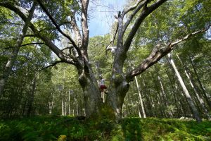
- Tatson’s Woods –★– 1.2 miles – A seldom used trail to old farm fields and the remains of a grand old oak
- Walden Preserve –★★★– 6 miles – Formerly a Nature Conservancy property with a hidden Pierce Arrow car and great varied trails
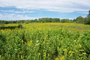
- Woodland Warbler Preserve –★★– 2.6 miles – The trust’s newest property!
- Zemko Sawmill Preserve –★★– 2.2 miles – Expanded trails now explore either side of Whittlesey Swamp
- Salem Land Trust
State Parks / Forest
- Gardner Lake State Park –★★– No trails – Boat launch and small beach area
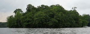
- Minnie Island State Park –★★– Footpaths – A tiny island in Gardner Lake
- Zemko Pond Wildlife Management Area –★★– 1 mile – Not much for trails, but a picnic area and pond for fishing
- Nehantic State Forest –★★– 5 miles – Many unexplored trails in this large block of the state forest
The Rest
- Richard H. Goodwin Trail – 13 miles
- Salem’s portion of this long trail is in the Darling Road Preserve
- Richard H. Goodwin Trail – 13 miles
Boating/Fishing/Swimming
Disc Golf
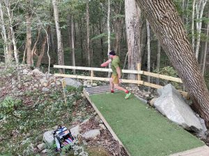
- Salem Woods – Difficult 18 hole course with new shorter tee pads being added
The 121st oldest town in Connecticut. Salem in Hebrew means “peace”; but the town was named from Salem, Mass., and incorporated as New Salem, from Colchester, Lyme and Montville in May 1819.
{{label}}: {{displayValue}}
{{displayValue}}
{{displayValue}}
{{locationDetails}}
Browse sub-categories
Showing 1 result
Showing {{ showing }} out of {{ foundPosts }} results