
Explore Thompson, CT
Thompson at a Glance
Part of Windham County
If you’re looking for the best hiking trails in Thompson this is the complete guide to all the overlooks, waterways, and history it has to offer.
Thompson protects over 3,500 acres of open space hosting:
- 12 hiking areas for 28.5 miles of trails
- 3 boating areas
- 3 spots for fishing
- 1 disc golf course
My Highlights
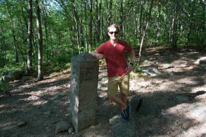
- The tri-state border marker
- The long loop around West Thompson Lake
- A little bit of everything at Quaddick State Park
Hiking
Town Parks
- Border Trail –★– <1 mile – Like the North South Trail in Thompson, just a gravel road
- Fisherman’s Walk Trail –★– 0.6 miles – Paths definitely geared more towards fishing than hiking
- Riverside Park and North Grosvenordale River Trail –★★– 1.6 miles – One part urban hike, one part French River views
Land Trust
- Wyndham Land Trust
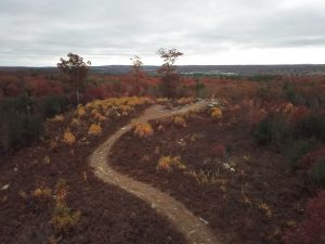
- Bull Hill Project –★★– 2 miles – A short trail to an expansive overlook
- LeClair Preserve – Trail Closed [Last updated Sept. 2022]
- Long Pond Preserve –★★– 2 miles – Rough trails through old fields and I couldn’t find a view of the pond
- Robbins/O’Leary/Blain Preserve –★★– 2.2 miles – Underwhelming but easy walk with a couple interesting views
- Tamler Preserve –★★– 0.65 miles – An old road leads to a short rocky loop
- Wyndham Land Trust
State Parks / Forest
- Air Line Trail State Park – 7.3 miles run through town
- Small lot near 113 Riverside Dr Thompson, CT
- Shoulder parking near 301 Sunset Hill Rd, North Grosvenor Dale, CT
- Shoulder parking near 368 Sand Dam Rd, Thompson, CT
- Small pull-off near E Thompson Rd, Thompson, CT
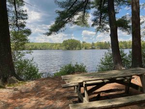
- Quaddick State Park –★★– 1.5 miles – Hiking, swimming, and boating, plus plenty of area for picnicking in nature
- Quaddick State Forest –★★– 1 mile – Just an abandoned stretch of gravel road popular with offroaders and access to the Buck Hill Scout Reservation in RI
- Air Line Trail State Park – 7.3 miles run through town
Blue Blaze
- None
The Rest
- Tri State Border Marker CT, MA, RI –★★★– 2 miles – A bit off the Air Line Trail is this tri-state border marker
- West Thompson Dam/Lake Trails –★★★– 7.4 miles – Hiking, camping, disc golf, boating, and more in this huge property
Boating/Fishing
Disc Golf
- West Thompson Lake – 18 hole course, can be fun/challenging, but upkeep is spotty and wayfinding is its own challenge
Thompson was historically the territory of the Nipmuck tribe, they called the area “Quinnatisset” or ‘little long river’. In colonial times was the location of the Manexit ‘praying indians’ village along the Old Connecticut Path near present day village of Fabyan.
The first settler in the area was Richard Evans of Rehoboth, MA who purchased 200 acres near Quinnatisset Hill. The town was officially incorporated in 1785 was named for the largest landowner in the area, Sir Robert Thompson of Middlesex, England.
{{locationDetails}}