Site logo
    • Explore
      • Blue-Blaze Trails
      • Land Trusts
      • State Parks and Forests
      • By Town
    • exploreCT+
      • Membership
      • Shop
      • Events
    • Blog
    • Town Guides
    Sign in or Register
    Listing cover image

    Tamler Preserve

    • Trails
      1 miles
    • Rating
      ★★☆☆☆
    • Address
      W5PR+M8 Thompson, CT, USA
    • Explore
    • Trail Map
    • Reviews 0
    • New Page
    • prev
    • next
    • Bookmark
    • Share
    • Get directions
    • Report
    • prev
    • next
    At A Glance

    Wyndham Land Trust

    220 acres in Putnam and Thompson, CT

    Parking: Shoulder parking near 128 Elmwood Hill Rd Thompson, CT

    Trail Map       Trails: 0.65 miles         Rating: ★★☆☆☆

    Hiking

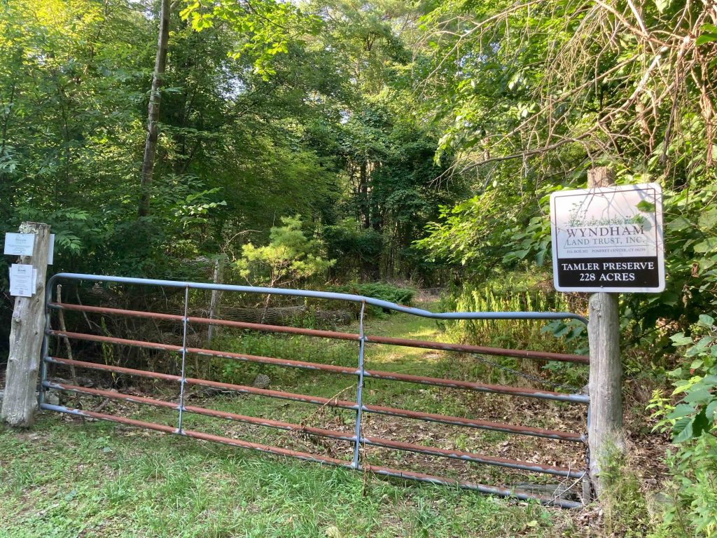
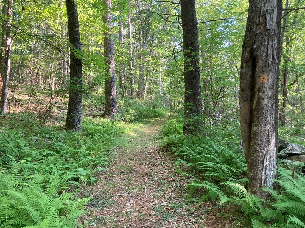
    The Tamler Preserve has a short old forest road that leads to a loop trail added by Eagle Scouts in 2002.  The distance is about a half mile.

    The hike was fairly simple, a wide old road known as “Widow Hannah Barrett Road” leads to a short rocky loop along Elmwood Hill ridge.  The forest is peaceful and the trail lets you experience nature for about 15 minutes.  It’s been 20 years since a new trail was added here and I think an addition is long overdue to extend hikes here into the properties other parcels.

    From the Wyndham Land Trust site, “It’s wild, remote, untouched, hilly, wooded, and rocky,” said Jeff Stefanik, who surveyed the property and is a board member of the land trust.  The most striking thing to me is how this property is contiguous to or near three different state forests–the Quaddick State Forest in Connecticut, Buck Hill Wildlife Management Area in Rhode Island, and the Douglas State Forest in Massachusetts. The end result is a massive forest block. I don’t think folks are aware of the significance of this block is because it is divided between the three different states. The Tamler Preserve fits right into that.”

    History

    Protected since 1990 that to a donation by Nettie Tamler with acreage added in 1993 and 2015.

    Links

    Geocache on the property

    Tags
    • ★★☆☆☆
    • 2022
    • Explored
    • Putnam
    • Thompson
    • Windham County
    • Wyndham Land Trust
    Last Updated

    The information shown here is for general reference purposes only. exploreCT.org gives no warranty, expressed or implied, as to the accuracy or reliability of this data. Parking in all areas, whether designated here or not, is at your own risk. exploreCT.org is not responsible for any damage or loss to vehicles or contents. Last updated July 17th, 2022

    Trail Map
    Location
    • W5PR+M8 Thompson, CT, USA

      Get Directions
    Gallery
    Categories
    • Hiking
    Gallery
  • No comments yet.
  • Add a review

    Leave a Reply · Cancel reply

    Your email address will not be published. Required fields are marked *

    Overall Rating

    You May Also Be Interested In

    Spruce Brook Falls

    • ★★★★★
    • 16 miles
    Featured
    FW6F+CW Beacon Falls
    • Quick view
    • Bookmark

    Bartholomew Open Space

    • Unexplored
    • 0.6 miles
    72 Buttonball Rd
    • Quick view
    • Bookmark

    Avery Nature Preserve

    • Unexplored
    • 2.6 miles
    60R Scotch Cap Rd
    • Quick view
    • Bookmark

    Hi, I’m Matt.

    I’m building ExploreCT to be the guide for all your outdoor adventures. All the trails, views, and waterways this great state has to offer.

    Now get out and explore!

    Monthly Newsletter

    Each month I share site updates or an interesting article in my newsletter. It’s short, sweet, and practical.

    600+ explorers read it, I’d love for you to join.

    Thank you!

    You have successfully joined our subscriber list.

    X-twitter Youtube Envelope Instagram

    Cart

      • Facebook
      • X
      • WhatsApp
      • Telegram
      • LinkedIn
      • Tumblr
      • Reddit
      • VKontakte
      • Mail
      • Copy link
      • Share via...
      • Threads
      • Bluesky