
Connecticut River
Connecticut River
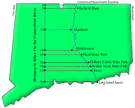
The headwaters of the Connecticut River start in a small pond 300 yards south of the Canadian Border in New Hampshire and runs 406 miles to Long Island Sound. The Connecticut section of the river is 65.5 miles from the Massachusetts border to the headwaters at Old Saybrook Point.
“Connecticut” is a French corruption of the Mohegan word ‘quinetucket’, which means “beside the long, tidal river”. The first documented exploration was by Adriaen Block in 1614 who made it as far north as what is now the Enfield Dam.
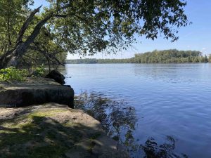
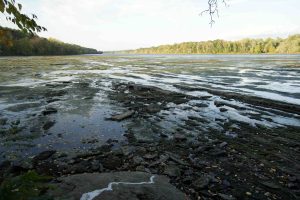
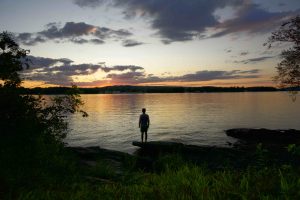
I kayaked the Connecticut section over three days in the summer of 2019 starting at the Massachusett’s border to the Old Saybrook lighthouse camping along the way.
The Connecticut was named an American Heritage River on July 27th, 1998 by then Vice-President Al Gore. As an American Heritage River, the Connecticut and surrounding environs (most notably wetlands) received federal protections, and future cleanup and conservation efforts became eligible for special federal funding.
Al Gore, American Heritage Rivers announcement (video), C-SPAN


Links
- https://explorect.org/tag/ct-river-boat-launch/
Section List
(North to South, miles to the mouth of the river)
- Nearest boat launch north of Connecticut is 2.4 miles away at Riverfront Conservation Area in Longmeadow
- 65.5 miles – Massachusett’s Border
- 63.5 miles – Barnes Boat Launch in Thompsonville
- 61.5 – Kings Island Boat Launch
- 61 miles – Kings Island
- Camping Area
- Windsor Locks Public Ramp – 1530 Palisado Ave Windsor, CT
- Linear Park Launch – 4 Vibert Rd South Windsor, CT
- Windsor Meadows State Park
- Riverside Park
- Great River Park
- Charter Oak Landing
- Wethersfield Cove Public Ramp
- Keeney Cove
- Glastonbury Rivefront Park
- Rocky Hill Public Ramp
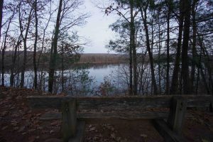
- River Highlands State Park
- Camping Area
- Harbor Park
- Hurd State Park
- Camping Area
- Haddam Meadows State Park
- Salmon River Ramp
- East Haddam Town Landing
- Chester Town Boat Landing
- Chapman Pond
- Camping Area
- Gillette Castle State Park
- Camping Area
- Deep River Town Landing
- Selden Neck State Park
- Camping Areas
- Pratt Cove
- Lyme Town Boat Access
- Little Point Street Ramp
- Bushnell Park
- Essex Town Dock
- Novelty Lane Water Access Area
- Scholes Lane Sater Access Area
- Middle Cove, Essex Town Park
- Nott Lane Open Space Access
- Alt Water Access
- Mack Lane Access Area
- Essex Town Dock
- Baldwin Bridge State Boat Launch
- North Cove Town Ramp
- Lynde Point Light
- Saybrook Breakwater Light
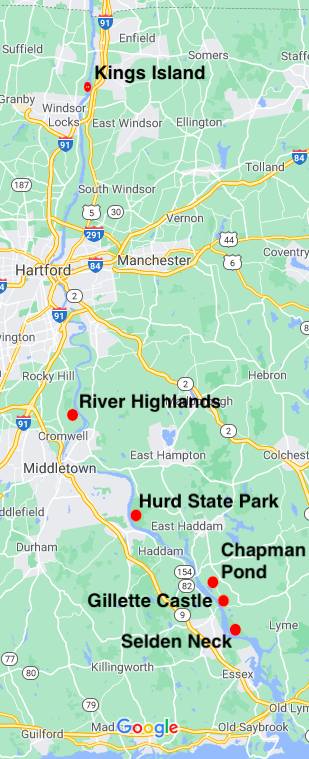
There are six legitimate camping areas along the Connecticut River.
Four provided by the state at River Highlands State Park, Hurd State Park, Gillette Castle, and Selden Neck State Park. And two provided by the Connecticut Chapter of the AMC at Kings Island and Chapman Pond. Each offers “primitive” riverside sites with fireplaces and outhouses for individuals and groups traveling on the river.
- State sites are available from May 1 through September 30. The length of stay is limited to one night. All have a fee of $5 dollars (plus a $9 “transaction fee” to Reserve America). The entire process is done online: Create an account on Reserve America, select your camping area, choose your stay using an availability calendar, pay, and receive a confirmation email. I always carry a printout on my trips, but haven’t needed it yet.
- AMC sites are free and first come first served. They hope to create a chain of campsites, one every five miles along the length of the river.
Six Camping Areas
- Single area with two wooden platforms on the eastern side of the island. There is also a bear box as a safety precaution.
River Highlands – Reserve America reservation link
- 2 sites with a max of 6 campers at each – One site near the shore and another set back amongst the trees. Both are low along the water so may occasionally flood during high water
Hurd State Park – Reserve America reservation link
- One site for a maximum of 12 campers. River campers must break camp by 9 a.m. There are no ground fires allowed and fire pits are not provided. There are pedestal grills and picnic tables.
- A bit hidden from the river by Rich Island and a short paddle across the pond, the site has two tent platforms which can accommodate up to 10 people or four tents.
Gillette Castle – Reserve America reservation link
- One site for a maximum of 20 campers in the clearing next to the boat launch. River campers must break camp by 9 a.m. There are no ground fires allowed on the Castle grounds and fire pits are not provided. There are pedestal grills and picnic tables.
Selden Neck – Reserve America reservation link
- Cedars Camp – Down the north end of Selden Creek is the wide and clear Cedars Camp. There is a small beach, fire pit, picnic tables, and a pit toilet. At the western side of the camp is access to the white Paul Robertson trail. Maximum of 20 campers.
- Hogback Camp – This camp is easy to access and sits on a low bluff named Hogback overlooking the river. At low tide it can be a muddy/silty walk to get to water deep enough for boats. The sloping site has a flat area with room for a couple tents and there are two picnic tables, a fire pit, and an outhouse. Short paths lead to overlooks facing southwest. Short of bushwhacking there is no access to the trails from this site. Maximum of 6 campers.
- Spring Ledge Camp – A nice semi-secluded spot right next to the river and easy to access. It has a fire pit with stone seating, picnic tables, and a pit toilet. There is a trail heading uphill that connects up main trails near the red/white junction. Maximum of 8 campers.
- Quarry Knob – This site is the most difficult to access. There is a small break in the growth along the bank where as tree has fallen. Even at low tide it can be difficult to get secure footing and your boat up the bank over the log. There is an easier spot to access a couple hundred feet south. Once up on the bank there are 2-3 flat areas with fire pits and a nearby pit toilet. This site has easy access to the red, blue, and white trails. Maximum of 12 campers.
{{locationDetails}}
