Photos

Description

Kings Island

Eversource Land Trust

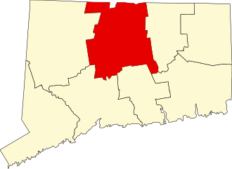
120 acres in Enfield and Suffield, CT

Parking: Access by water only, nearest boat launch is Kings Island Boat Launch

Trail Map        Trails: Informal fishing paths        Rating: ★★★☆☆


Note: During periods of seasonal low-water you will likely have to walk the majority of the distance from the boat launch to the island. 

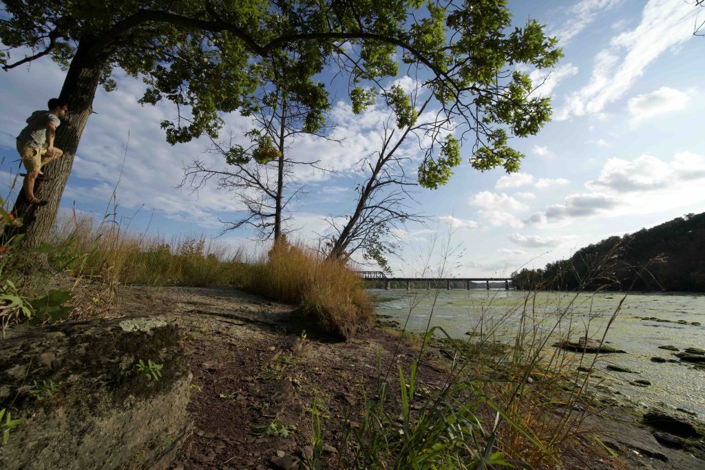
I first visited Kings Island in a drought at the beginning of Fall 2020.  The Connecticut River was so low in this northern section at this time that I walked my kayak out a ways beyond the boat launch, paddle over a brief deeper channel and then walked over slippery rocks through the shallows the remaining 2/3rds to the island.  I stopped at the north point of the island and climbed up a steep bank to its plateau. The island has a well developed forest and a clear understory so walking cross-island was pretty easy.

River Camping

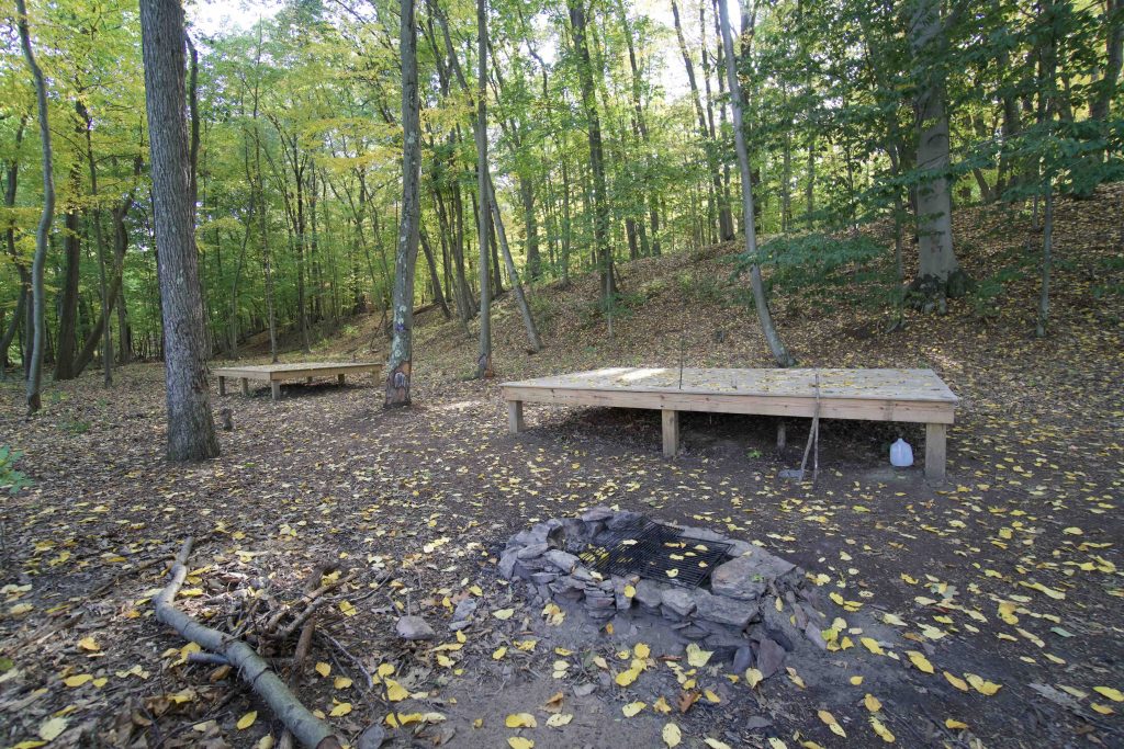
I passed the AMC’s new river campsite which was built in early 2019.  It is located about a quarter of the way down the island from the north on the eastern side and is easy to access from the water.  There are two raised platforms for tents, a bear box, and fire pit with an outhouse a short distance away.  The campsite is used on a ‘first come first served’ basis and is capable of holding up to 12 campers.  I counted at least three other unofficial campsites along the eastern side which I’m sure are officially discouraged.

Hiking

There are no official trails on the island though at times I came across faint paths.  The island is just shy of a mile long and I was able to easily do a full circuit tromping through the woods.  All the interesting points of note seem to be on the eastern side including the foundations of the Terry homestead.   These are located above a swale about 1000ft from the southern tip.  There was even an old horseshoe hanging from a tree.  The southern point has a couple fire pits, rough benches, and a rope swing for when the water is high enough.

I hiked back north along the western side of the island through the gorgeous fall colors, but found little of note.

NU Kings Island WMA

Map

Kings Island also falls under the state’s wildlife management areas as the NU (Northeast Utilities now Eversource) Kings Island WMA.  The designation is for waterfowl hunting.

History:

The earliest history of the island is as a Native American fishing camp who would string nets across the river to catch shad.  According to lore there are several burial grounds on the island.

The earliest documents from the colonial period date back to 1641 when a Native American woman named Quashebuck tried to sell the island to a man named John Lewis.  However, a Reverend Ephraim Huit of Windsor petitioned the Connecticut General Court that Quashebuck’s father had already sold him the island.  The court ruled with Huit and he became the first “official owner” of Kings Island.

Other owners included:

  • 1670-???? – A Massachusetts court awarded the island to John Pynchon for his work surveying the boundary between Massachusetts and Connecticut
  • 1717-???? – Reverend Ebenezer Devotion and Joshua Leavitt of Suffield
  • 1764-1774 General Phinehas Lyman
  • 1774-1787 – Roger Enos of Windsor
  • 1787-1800? – Colonel John Ely who built a dam across the west side and operated a sawmill
  • Unknown dates – King family who also owned land on the Suffield side shore and operated a ferry on the river to Enfield

By far the most interesting owner of the island is a DeWitt Clinton Terry (named after the Erie canal builder?) who owned the island from 1864-1889.  So interesting that the island was known for a long time as Terry’s Island.  Terry was known in his time as a good farmer and a ferry operator but is remembered for being a Millerite (a sect of Adventists) who predicted the end of days.  Groups of Millerites would gather on the island to celebrate before the end.  The most notable of these predictions was in 1873 when it was mentioned in the New York Times.

Terry eventually sold the island in 1889 and the house he built was moved from the island to somewhere on Suffield Street in Windsor Locks by the new owner.

The most recent owner, dating at least as far back at the late 1950s, was Connecticut Light & Power (now Eversource).  The company had hoped to use the island and section of the river for hydroelectric power, but nothing came of it.  The company kept the park as open public land and still maintains a page describing it.  An article from July 2020 about a fire that occurred on the north point quotes an official saying it was previously owned by Eversource and is now public property, but I’m unsure if it is at a town or state level.


Links:

The information shown here is for general reference purposes only. exploreCT.org gives no warranty, expressed or implied, as to the accuracy or reliability of this data. Parking in all areas, whether designated here or not, is at your own risk. exploreCT.org is not responsible for any damage or loss to vehicles or contents.
Last updated September 28th, 2020

Video

Visited 5905 times, 4 Visits today

Related Listings

Westfield Falls

★★★☆☆

41.580506, -72.714953

Westfield Falls Middletown Town Park 4 acres in Middletown, CT Parking: Shoulder parking near 267 Miner St Middletown, CT Trail Map           Trails: 0.3…

Ironwoods Preserve

Unexplored

201 Race Hill Rd, Madison, CT 06443

Ironwoods Preserve Madison Land Trust 71.8 acres in Madison, CT Parking: Small lot near 201 Race Hill Rd, Madison, CT Trail Map           Trails:…

Boggy Hole Preserve

Unexplored

17 Boggy Hole Road, Old Lyme, CT, USA

Boggy Hole Preserve Old Lyme Land Trust 44 acres in Old Lyme, CT Parking: Shoulder parking near 5 Boggy Hole Rd, Old Lyme, CT Trail Map   …