Willimantic River Paddler's Guide

Willimantic River Paddler’s Guide

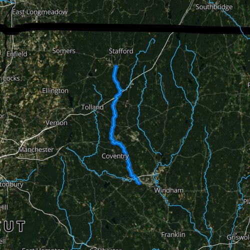
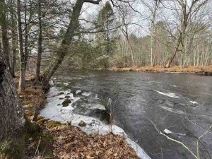
The Willimantic River runs 25 miles from near Stafford Springs to where it joins the Natchaug River past Willimantic to form the Shetucket River.

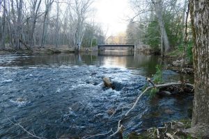
There are a number of parks (listed below) along the river which offer a mix of hiking, boating, and even swimming.

Hiking

About a dozen parks offer trails along the river including sections of the Air Line Trail and Hop River Trail.

  • See the options at the bottom of the page.

There is a 7 mile multi-town hiking trail which currently runs from Mansfield to Tolland.  I hiked the length of this long trail in spring 2021

Paddler’s Trail

The Willimantic River Paddlers Trail can take you nearly the entire 22.5 miles from Stafford Springs to Willimantic.  It was designated a National Recreation Trail in 2012.  There is one portage at the Eagleville Dam.

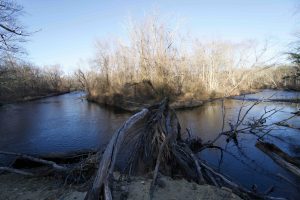
Whitewater – American Whitewater cites two stretches:

  • 1. Eagleville Dam to Bridge Street – Class I-II – This one is a popular flatwater float
  • 2. Bridge St. to the Thread Mill – Class III-IV – A Willimantic group is trying to build a whitewater park here though progress has been slow and given the three dams in this stretch it is currently un-runnable
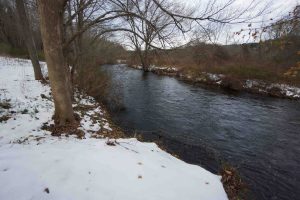
Boat Launch List

(Printable version)

Willimantic Whitewater Park

★☆☆☆☆

28 Bridge St, Willimantic, CT, USA

Willimantic Whitewater Park Willimantic Town Park 1 acre in Windham, CT Parking: Small lot near 28 Bridge St, Willimantic, CT Trail Map         Trails: No…

Schmid Overlook

★☆☆☆☆

41.738309, -72.263433

Schmid Overlook Joshua’s Trust 20 acres in Coventry, CT Parking: Shoulder parking near 88 Flanders Road, Coventry, CT Trail Map         Trails: 0.6 miles   …

Nye-Holman State Forest

★★☆☆☆

41.881992, -72.307428

Nye-Holman State Forest Connecticut State Forest 818 acres in Tolland, CT Parking: River Access/Walking – Small lot near on Tolland Stage Rd  Archery/Camping – Medium lot near… Read more…

Heron Cove

★★☆☆☆

41.876902, -72.310465

Heron Cove Tolland Town Park 35 acres in Tolland, CT Parking: Large lot at 125 South River Road, Tolland, CT Trail Map        Trails: Less than…

King Riverside

★★☆☆☆

41.83767,-72.31231

King Riverside Conservation Area Tolland Town Park 30 acres public access, 173 total in Tolland, CT Parking: Medium sized lot near 15 Dimock Road Tolland, CT Trail…

Riverview Trail Park

★★☆☆☆

41.824215, -72.314093

Riverview Trail Park Coventry Town Park 10 acres in Coventry, CT Parking: Shoulder parking near 13 Merrow Rd, Storrs, CT Trail Map         Trails: Less…

Williams Preserve

★★☆☆☆

41.787645, -72.299129

Williams Preserve Coventry Town Park 55 acres in Coventry, CT Parking: Small pull-off near 179 Cooper Ln Coventry, CT Trail Map          Trails: 2…

Potter Meadow

★★☆☆☆

41.713640, -72.245125

Potter Meadow Preserve Joshua’s Trust Land Trust 34 acres in Columbia, CT Parking: At the end of the cul-de-sac near 98 Commerce Dr, Columbia, CT Trail Map … Read more…

River Park & Becker Conservation Area

★★☆☆☆

41.861779,-72.307724

River Park & Becker Conservation Area Tolland Town Parks 60.85 combined acres in Tolland, CT Parking: Large lot near 461 South River Road, Tolland, CT Trail Map   …

Merrow Meadow

★★☆☆☆

41.822443, -72.313051

Merrow Meadow Park Mansfield Town Park 33 acres in Mansfield, CT Parking: Small lot near 13 Merrow Rd, Storrs, CT Trail Map         Trails: Less than…