
Explore Hebron, CT
Hebron at a Glance
Part of Tolland County
If you’re looking for the best hiking trails in Hebron this is the complete guide to all the town trails, waterfalls, and history it has to offer.
Hebron protects nearly 2,900 acres of open space which hosts:
- 13 hiking areas for 18.9 miles of trails
- 2 boating/fishing areas
Trails range in difficulty from the easy and flat paths of the Air Line Trail and Raymond Brook to rocky rolling woods loops in the Salmon River State Forest.

My Highlights
- The cascades at Grayville Falls
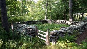
- The ruins of Gay City
- Getting lost in the maze of Salmon River
Hiking
Town Parks
- Bernstein Property – (Parking) No trails as of November 2024
- Burnt Hill Park –★★– 1 mile – Mainly sports fields, but a well kept trail leads around the outskirts of the park
- Cardillo Property – (Parking) No trails as of November 2024
- Chesnut Hollow –★– 1 mile – A forgotten park starts next to the historical “old town pound”. Trails are short, overgrown, and fade away the further in you go
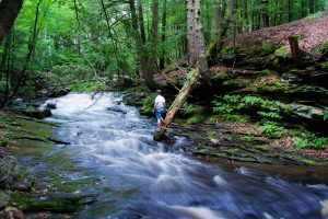
- Grayville Falls –★★★– Less than a mile – Long sloping waterfall just off the Air Line Trail
- Harasimowitz Property –★– Less than a mile – Unblazed path to a small pond, then trail fades away
- Hebron Center Trail –★– Less than a mile – Simple and good for casual strolls along an access road, the back of private property, and a loop along Rt. 66 if you’re so inclined
- Niles Road Open Space –★– Less than a mile – Old woods road, but path to Pepperbush Drive appears to be missing
- Old Hibbert Property –★★– 1.1 miles – One clear short loop, other rough trails, nice view of Raymond Brook
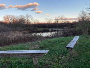
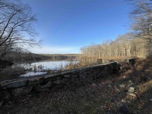
- Raymond Brook Preserve –★★– 1.5 miles – Flat easy trail for casual strolls and nice picnic area view of the pond
- St. Peter’s Preserve –★– Less than a mile – The loop has been forgotten but has a fire pit built by Hebron’s first female Eagle Scout
Land Trust
- None
State Parks / Forest
- Air Line Trail State Park –★★– 3.75 miles – Several road crossings that can be extended in either direction
- Shoulder parking near 92 Grayville Rd, Amston, CT
- Small lot on Rt. 85 near 510 Church St, Amston, CT
- Small lot near 79 Lebanon Rd, Amston, CT
- Gay City State Park –★★★– 9 miles – Varied trails, swimming, mountain biking, and the ruins of the old town
- Holbrook Pond –★★– 2 miles – Large pond mainly for boating/fishing but rough trails around the edge
- Meshomasic State Forest – Small parcel intertwined with Holbrook Pond
- Raymond Brook WMA – No trails – Though the Air Line Trail passes through the area
- Salmon River State Forest –★★– 11 miles – Large network of mostly unblazed trails that are geared towards mountain biking and can be confusing
- Air Line Trail State Park –★★– 3.75 miles – Several road crossings that can be extended in either direction
Blue Blaze
- None
The Rest
- Prophet’s Rock –★★– 0.1 miles – Short trail to a large split erratic
Boating/Fishing
- Fishing at the Raymond Brook Preserve pond
- Holbrook Pond Boat Launch (Parking Link)
Swimming
- Gay City State Park – small pond with a beach for swmming, check beach status before visiting
Hebron was settled in 1704 and incorporated in May 1708 as the 41st oldest town in Connecticut. It was named in 1707 from Heb. Hebron (derivation doubtful); “an association,” “a league,” and “confederacy,” are meanings given this word by various authorities.
{{label}}: {{displayValue}}
{{displayValue}}
{{displayValue}}
{{locationDetails}}
Browse sub-categories
Showing 1 result
Showing {{ showing }} out of {{ foundPosts }} results
