Site logo
    • Explore
      • Blue-Blaze Trails
      • Land Trusts
      • State Parks and Forests
      • By Town
    • exploreCT+
      • Membership
      • Shop
      • Events
    • Blog
    • Town Guides
    Sign in or Register
    Listing cover image

    Valley Falls

    • Trails
      9 miles
    • Rating
      ★★★☆☆
    • Address
      300 Valley Falls Rd, Vernon, CT 06066, USA
    • Explore
    • Trail Map
    • Reviews 0
    • New Page
    • prev
    • next
    • Bookmark
    • Share
    • Get directions
    • Report
    • prev
    • next
    At A Glance

    Valley Falls Park / Andrew Kenneth Webster Preserve

    Vernon Town Park and Northern Connecticut Land Trust

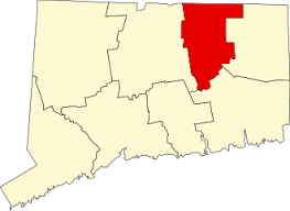
    196 acres in Vernon, CT

    Parking: Large lot near 300 Valley Falls Rd, Vernon, CT

    Trail Map         Trails: 9 miles        Rating: ★★★☆☆

    Often known as “Vernon’s Jewel”, Valley Falls has a lot to offer from simple loops around the pond, a short stretch of the Shenipsit Trail, easy access to the Hop River Trail, wooded old farm roads, and steep climbs to Echo Ridge overlook.

    Hiking
    • Shenipsit Trail – Blue Blaze – 0.2 miles
      • At only 0.2 miles this blue blaze trail descends steeply off the Hop River Trail to a bench with a rough view of the pond before taking steps down to the rebuilt dam.  You’ll quickly pass the falls and head along the entrance road.  So good views packed into this tiny stretch, but serves more as access trail to other parts of the park.
        • Heading south: Hop River Trail
        • Heading north: Belding Wildlife Management Area
    • Valley Falls Loop Trail – Blue/Yellow Blaze – 3.8 miles
      • Unexplored
    • Railroad Brook Trail – Yellow Blaze – 2.0 miles
      • Unexplored
    • Pond Loop –  Orange Blaze – 0.6 miles
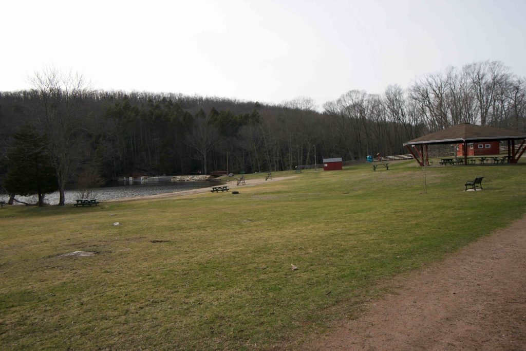
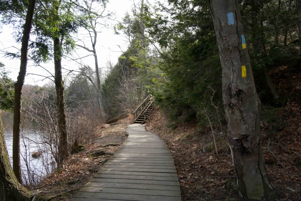
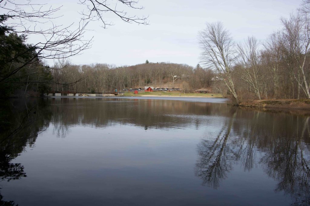
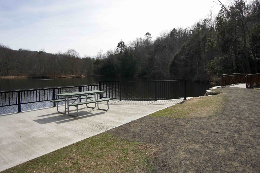
      • From the parking area you can head either direction around the pond.  Hiking counter clockwise you’ll head over the rebuilt dam with a views of the falls and the spillway.  The trail starts to head uphill then descends some stairs.  Though it hugs the water line for much of the trail there aren’t many views once you enter the trees.  At the backside of the loop you’ll pass over a bridge crossing Railroad Brook, enter an open field, and return along a wide gravel path with fitness stations.
    • Lookout Trail – White Blaze – 0.6 miles
      • See below

    Andrew Kenneth Webster Preserve

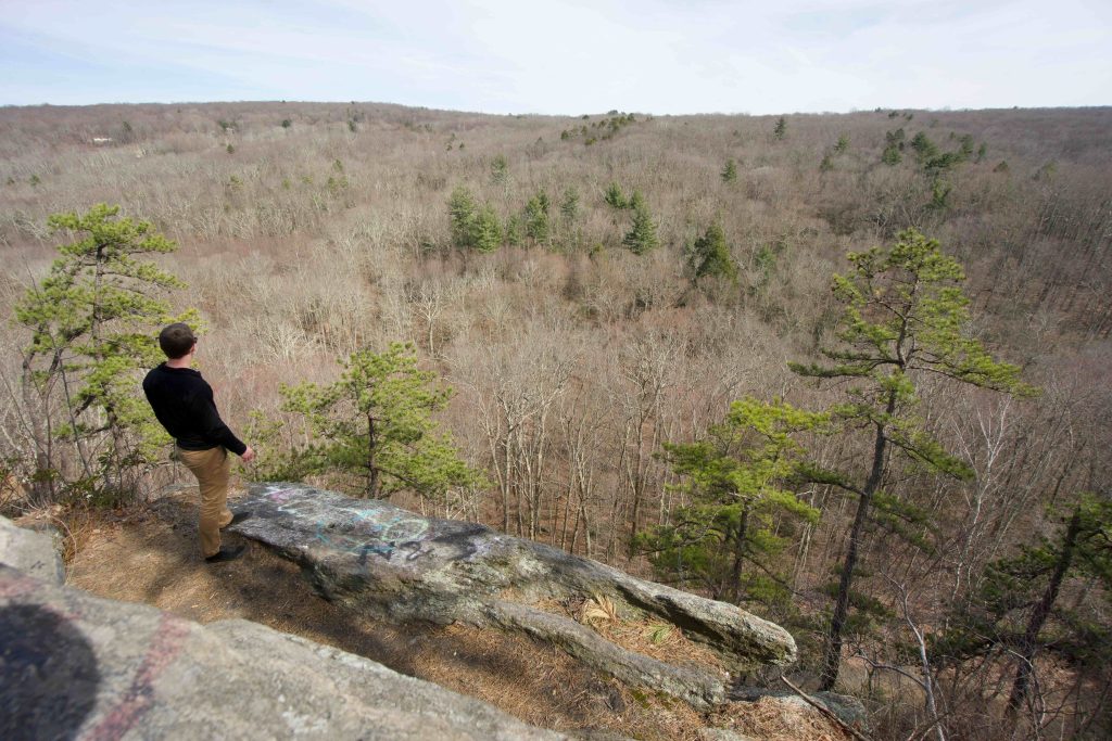
    Crossing over the Hop River Trail from Valley Falls leads into this Northern Connecticut Land Trust Property which is a functional extension of Valley Falls.  The main trail is a short loop uphill known as the Lookout Trail (though the trail map above shows it as an out and back) through mountain laurel to Echo Ridge an eastern overlook perfect for sunrise views.

    There are also the Boulder Crest inner and outer loops that are just over a mile long combined.  These trails are much less often used so are a bit harder to follow. Largely a wooded walk with at least one steep climb the trail does briefly pass the backside of private property in a couple places.  Google Maps shows it as the Bouldercrest Lane Property which is a large maintained field which the trail skirts the edge of.  There are also suggestions of a rocky overlook at the backside of the loop, but it turned out to be a rocky knob with a view through the trees of some nearby rooftops.  The trail then works its way back down to the Hop River Trail.

    History

    Valley Falls was established as a park in 1964. Read a complete history here.

    The Webster Preserve was sold to the Northern Connecticut Land Trust for $94,000 by Andrew Knapp in 2004.  It is named the Andrew Kenneth Webster Preserve, after Andrew Knapp’s great-grandfather.  The land was originally a farmer’s wood lot until it was sold to the Knapp family around 1900.

    Links

    Friends of Valley Falls

    CTMQ – Valley Falls Park Trails (2023)

    Peter Marteka – Tiptoeing Under The Tulip Trees In Vernon (2014)

    Peter Marteka – Land Trust Adds ‘Wood Lot’ In Vernon (2004)

    Tags
    • ★★★☆☆
    • 2020
    • 2023
    • Explored
    • Hop River Trail
    • Northern Connecticut Land Trust
    • Overlooks
    • Peter Marteka
    • Shenipsit Trail
    • Sunrise Views
    • Tolland County
    • Vernon
    Last Updated

    The information shown here is for general reference purposes only. exploreCT.org gives no warranty, expressed or implied, as to the accuracy or reliability of this data. Parking in all areas, whether designated here or not, is at your own risk. exploreCT.org is not responsible for any damage or loss to vehicles or contents. Last updated June 12th, 2023

    Trail Map
    Location
    • 300 Valley Falls Rd, Vernon, CT 06066, USA

      Get Directions
    Gallery
    Categories
    • Hiking
    • Swimming
    • Fishing
    Gallery
  • No comments yet.
  • Add a review

    Leave a Reply · Cancel reply

    Your email address will not be published. Required fields are marked *

    Overall Rating

    You May Also Be Interested In

    Spruce Brook Falls

    • ★★★★★
    • 16 miles
    Featured
    FW6F+CW Beacon Falls
    • Quick view
    • Bookmark

    Thach Preserve

    • ★★☆☆☆
    • 1 miles
    123 Brush Hill Rd
    • Quick view
    • Bookmark

    Mendell's Folly

    • ★★★★☆
    • 3.8 miles
    390 Beacon Rd
    • Quick view
    • Bookmark

    Hi, I’m Matt.

    I’m building ExploreCT to be the guide for all your outdoor adventures. All the trails, views, and waterways this great state has to offer.

    Now get out and explore!

    Monthly Newsletter

    Each month I share site updates or an interesting article in my newsletter. It’s short, sweet, and practical.

    600+ explorers read it, I’d love for you to join.

    Thank you!

    You have successfully joined our subscriber list.

    X-twitter Youtube Envelope Instagram

    Cart

      • Facebook
      • X
      • WhatsApp
      • Telegram
      • LinkedIn
      • Tumblr
      • Reddit
      • VKontakte
      • Mail
      • Copy link
      • Share via...
      • Threads
      • Bluesky