Site logo
    • Explore
      • Blue-Blaze Trails
      • Land Trusts
      • State Parks and Forests
      • By Town
    • exploreCT+
      • Membership
      • Shop
      • Events
    • Blog
    • Town Guides
    Sign in or Register
    Listing cover image

    Tri-Mountain State Park

    • Trails
      4 miles
    • Rating
      ★★★☆☆
    • Address
      99 N Branford Rd, Wallingford, CT 06492, USA
    • Explore
    • Trail Map
    • Reviews 0
    • New Page
    • prev
    • next
    • Bookmark
    • Share
    • Get directions
    • Report
    • prev
    • next
    At A Glance

    Connecticut State Park

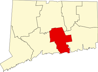
    157 acres in Durham and Wallingford, CT

    Parking: Shoulder parking near Howd Rd, Durham, CT

    Trail Map       Trails: 4.1 miles    Trail Difficulty: Moderate to Strenuous     Rating: ★★★☆☆

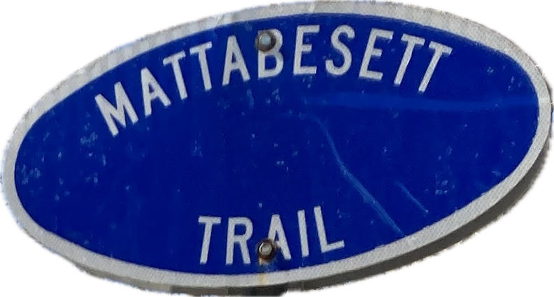
    Tri-Mountain State Park must qualify as one of Connecticut’s ‘scenic reserve‘ state parks, meaning it is undeveloped and under-appreciated. Thankfully it is trailed by a section of the blue blaze Mattabesett Trail part of the 235 mile New England Trail. These ridges are part of the greater Metacomet Ridge and while historically the area was known as the Three Notches, I believe the trail crosses the first 2, but the third has been overtaken by Tilcon.

    Hiking

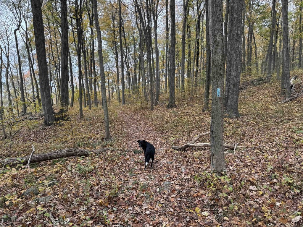
    Starting from Howd Road heading northbound the trail climbs through Wallingford Water Department property to a view of Pistapaug Pond to the south.  It is a fairly steep and long climb with little respite.  Once you gain the top of the ridge you’re likely in the state park property which is a simple wide trail through surprisingly open forest.  The trail is a fair distance off the actual ridgeline so doesn’t provide any fantastic views.  You’ll also likely be within earshot of the gunshots from Blue Trail Range but there’s no need to worry.

    Leaving the state park property the trail descends on some easy switchbacks on rolling terrain until reaching the base of a scree field.

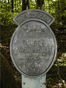
    There is a Washington Trail monument here placed in 1932 commemorating the route of George Washington in 1775 and 1789. In 1932 this was a stop on the George Washington Trail and during colonial times was an old stagecoach road known as the Wadsworth Farm Road.  The actual plaque has been missing for over 15+ years and is now just a cement column in the woods. It is actually 1 of 17 such markers in Durham alone.

    At the end of this slope the trail heads straight up on traprock gravel footing.  This is one of most challenging climbs of the entire Mattabesett Trail though it is only several hundred feet.

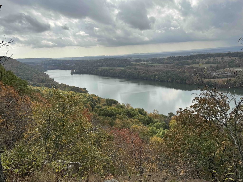
    Thankfully you are rewarded with two great overlooks of Ulbrich Reservoir and Wallingford to the west. The trail then makes a long gradual descent towards Rt 68 through some varied forest owned by Tilcon and at least one view of their quarry.

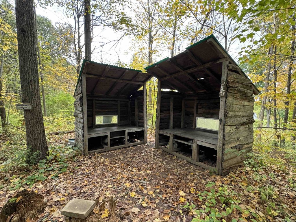
    As you near the road and right next to private property you’ll pass the Cattails Shelter.

    This camping spot is on private property, is first come first serve, doesn’t allow fires, and doesn’t have potable water nearby.  There are two small lean-tos that serve as raised sleeping platforms but not really enough room among the trees for a tent. I’d be curious how many overnights these shelters see.  There is also a trail register that on my October 2024 visit dated back to earlier in the year.

    Heading north: Black Pond

    Heading south: Pistapaug Mountain

    Camping

    This backpacking camping spot is on private property, is first come first serve, doesn’t allow fires, and doesn’t have potable water nearby.  There are two small lean-tos that serve as raised sleeping platforms but not really enough room among the trees for a tent. I’d be curious how many overnights these shelters see.  There is also a trail register that on my October 2024 visit dated back to earlier in the year.

    History

    Established as a state park in 1925.  From the 1926 Report to the State Park Commission:

    The Three Notches is a well known landmark in the trap rock range south of Reed’s Gap, but the name sometimes applied by the first settlers, Trimountain, has been revived for the park name.

    In an effort to protect this mountain from disfiguring quarry operations, Mr. John B. Kendrick of Wallingford, in 1906 acquired a parcel of six acres on the summit of the south peak, which in 1925 he donated to the State for park purposes.

    Lack of purchase funds has prevented suitable recognition this gift, but citizens of Meriden have formed the Trimountain Park Association, which is soliciting funds for the purchase of 415 acres adjoining, including the two northern peaks, to be added to the park if and when the necessary funds are raised.

    Such efforts deserve more encouragement by active assistance than the Commission has been able to give, but abundantly demonstrate the popular interest in and support of the Commission’s

    Links

    Molasses & Sidetrack’s Hiking Page – Pistapaug Mountain – Trimountain – Reed Gap – Route 17 – Route 68 (2010)

    CTMQ – Mattabesett Trail: Section 4 (2008)

    Report of the State Park Commission 1926 pg. 21

    Tags
    • ★★★☆☆
    • 2024
    • Explored
    • Durham
    • Mattabesett
    • Middlesex County
    • New England Trail
    • Overlooks
    • State Park
    • Wallingford
    Last Updated

    The information shown here is for general reference purposes only. exploreCT.org gives no warranty, expressed or implied, as to the accuracy or reliability of this data. Parking in all areas, whether designated here or not, is at your own risk. exploreCT.org is not responsible for any damage or loss to vehicles or contents. Last updated October 14th, 2024

    Trail Map
    Location
    • 99 N Branford Rd, Wallingford, CT 06492, USA

      Get Directions
    Gallery
    Categories
    • Hiking
    • Camping
    Gallery
  • No comments yet.
  • Add a review

    Leave a Reply · Cancel reply

    You must be logged in to post a comment.

    You May Also Be Interested In

    Spruce Brook Falls

    • ★★★★★
    • 16 miles
    Featured
    FW6F+CW Beacon Falls
    • Quick view
    • Bookmark

    Meadow Woods Preserve

    • Unexplored
    • 0.7 miles
    257 River Rd
    • Quick view
    • Bookmark

    Mile Creek Preserve

    • Unexplored
    • 1.2 miles
    191 Mile Creek Road
    • Quick view
    • Bookmark

    Hi, I’m Matt.

    I’m building ExploreCT to be the guide for all your outdoor adventures. All the trails, views, and waterways this great state has to offer.

    Now get out and explore!

    Monthly Newsletter

    Each month I share site updates or an interesting article in my newsletter. It’s short, sweet, and practical.

    600+ explorers read it, I’d love for you to join.

    Thank you!

    You have successfully joined our subscriber list.

    X-twitter Youtube Envelope Instagram

    Cart

      • Facebook
      • X
      • WhatsApp
      • Telegram
      • LinkedIn
      • Tumblr
      • Reddit
      • VKontakte
      • Mail
      • Copy link
      • Share via...
      • Threads
      • Bluesky