Site logo
    • Explore
      • Blue-Blaze Trails
      • Land Trusts
      • State Parks and Forests
      • By Town
    • exploreCT+
      • Membership
      • Shop
      • Events
    • Blog
    • Town Guides
    Sign in or Register
    Listing cover image

    Nayantaquit Trail

    • Trails
      5 miles
    • Rating
      ★★★☆☆
    • Address
      9MWV+95 Lyme, CT, USA
    • Explore
    • Trail Map
    • Reviews 0
    • New Page
    • prev
    • next
    • Bookmark
    • Share
    • Get directions
    • Report
    • prev
    • next
    At A Glance

    Nehantic State Forest: Nayantaquit Trail

    Connecticut State Forest and Blue Blaze Trail

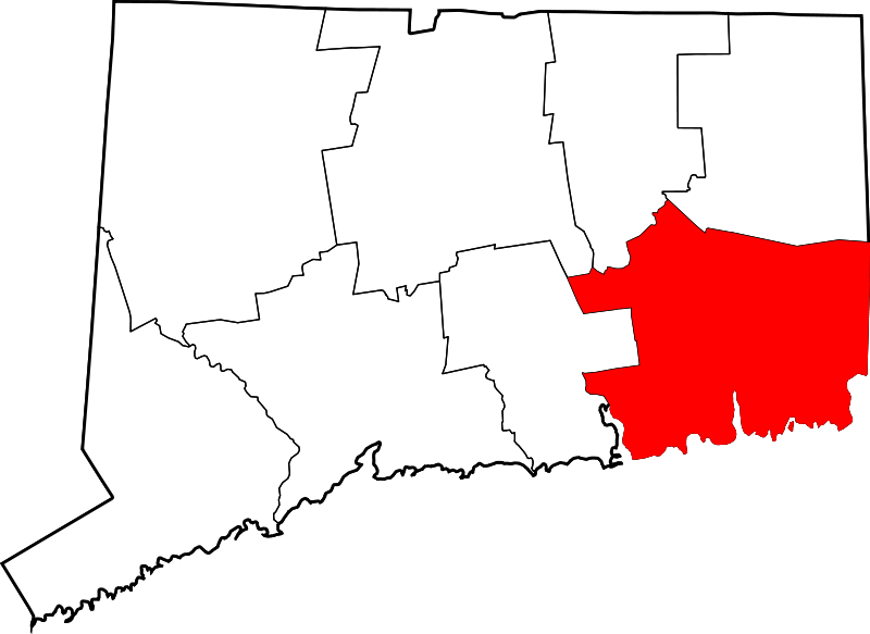
    1,667 acres in Lyme, CT

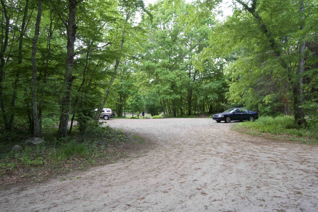
    Parking: Large lot near Keeny Rd, Lyme, CT

    Trail Map            Trails: 4.6 miles         Rating: ★★★☆☆

    This Lyme Block is one of five Nehantic State Forest parcels in the area, trailed by old woods roads and the blue blaze Nayantaquit Trail

    Hiking

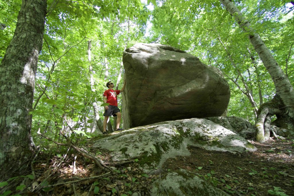
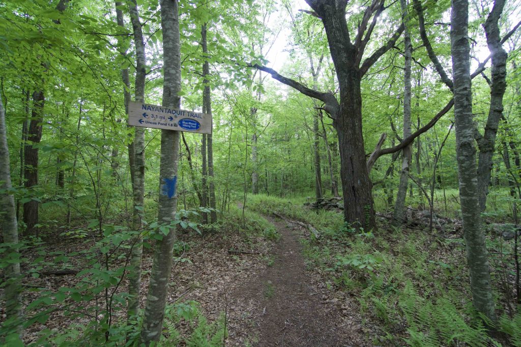
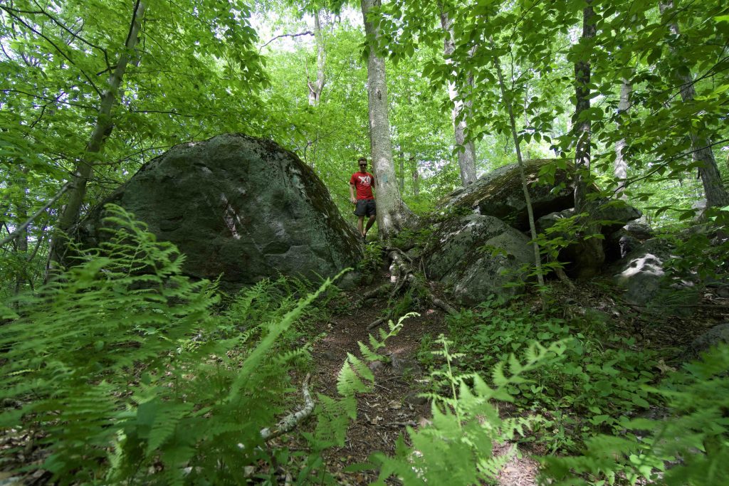
    This hike was fantastic and I’m not entirely sure why.  From the parking at the north end of Keeny Road the trail starts narrow but well traveled past a large perched erratic picking its way between rocky outcrops and fern covered hills.

    At about a mile into the hike comes to a junction of several woods roads and trails.  The trail is obviously wider here and begins a stretch up Nickerson Hill.  Despite the mix of trails coming and going the Nayantaquit Trail was easy to follow wherever it went.  There is a fairly steep 0.25 mile stretch up to a small clearing with a couple boulders that has a tiny peek at a view.  Perhaps in the winter the view is better.

    From here the trail descends down the other side for about another mile to return to the parking.  I’m struggling to describe why I enjoyed the hike so much.  Perhaps hike it for yourself and see it captures you the same way.

    The naming is an interesting mix for the Nehantic Tribe who ranged through this area between Wecapaug Brook in Rhode Island and the Connecticut River.  The trail itself is named for the Nayantaquit Tribe though almost every reference to it lazily tops out at, “named after a native tribe that once inhabited the area”.

    The 1909 Dictionary of American-Indian Place and Proper Names in New England lists Nayantaquit the same as Niantic and Nehantic the, “territory about Pawcatuck, Thames, and Niantic Rivers “At a point of land on a tidal river””.  So it seems that it could be listed as the Nehantic (Nayantaquit) Trail in Nehantic State Forest about 6 miles from the borough of Nehantic (Niantic).

    The forest road was built when the Federal Transient Bureau built a camp for 300 transients during the Great Depression.

    History

    The naming is an interesting mix for the Nehantic Tribe who ranged through this area between Wecapaug Brook in Rhode Island and the Connecticut River.  The trail itself is named for the Nayantaquit Tribe though almost every reference to it lazily tops out at, “named after a native tribe that once inhabited the area”.

    The 1909 Dictionary of American-Indian Place and Proper Names in New England lists Nayantaquit the same as Niantic and Nehantic the, “territory about Pawcatuck, Thames, and Niantic Rivers “At a point of land on a tidal river””.  So it seems that it could be listed as the Nehantic (Nayantaquit) Trail in Nehantic State Forest about 6 miles from the borough of Nehantic (Niantic).

    The forest road was built when the Federal Transient Bureau built a camp for 300 transients during the Great Depression.

    Links

    Peter Marteka – To Really Enjoy This Hike in Lyme, Go at a Glacial Pace (2009)

    CTMQ – Nayantaquit Trail (2007)

    Tags
    • ★★★☆☆
    • 2020
    • 2024
    • Explored
    • Lyme
    • Nehantic State Forest
    • New London County
    • Peter Marteka
    • State Forest
    Last Updated

    The information shown here is for general reference purposes only. exploreCT.org gives no warranty, expressed or implied, as to the accuracy or reliability of this data. Parking in all areas, whether designated here or not, is at your own risk. exploreCT.org is not responsible for any damage or loss to vehicles or contents. Last updated June 1st, 2020

    Trail Map
    Location
    • 9MWV+95 Lyme, CT, USA

      Get Directions
    Gallery
    Categories
    • Hiking
    Gallery
  • No comments yet.
  • Add a review

    Leave a Reply · Cancel reply

    You must be logged in to post a comment.

    You May Also Be Interested In

    Spruce Brook Falls

    • ★★★★★
    • 16 miles
    Featured
    FW6F+CW Beacon Falls
    • Quick view
    • Bookmark

    Stenger Farm Park

    • Unexplored
    • 1.2 miles
    128 Clark Ln
    • Quick view
    • Bookmark

    Stewart Hill Preserve

    • Unexplored
    • 0.5 miles
    287 Wyassup Rd
    • Quick view
    • Bookmark

    Hi, I’m Matt.

    I’m building ExploreCT to be the guide for all your outdoor adventures. All the trails, views, and waterways this great state has to offer.

    Now get out and explore!

    Monthly Newsletter

    Each month I share site updates or an interesting article in my newsletter. It’s short, sweet, and practical.

    600+ explorers read it, I’d love for you to join.

    Thank you!

    You have successfully joined our subscriber list.

    X-twitter Youtube Envelope Instagram

    Cart

      • Facebook
      • X
      • WhatsApp
      • Telegram
      • LinkedIn
      • Tumblr
      • Reddit
      • VKontakte
      • Mail
      • Copy link
      • Share via...
      • Threads
      • Bluesky