Mohawk Mountain State Park and Forest

Connecticut State Park / State Forest

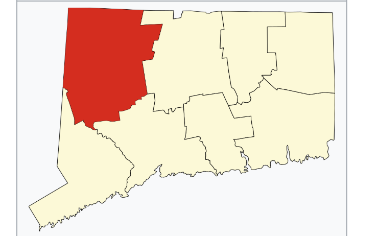
4,016 acres in CornwallGoshen, and Litchfield, CT

  • State Park – 273 acres
  • State Forest – 3,743 acres

Parking: Main parking at the start of Toomey Rd near 1 Toomey Rd West Cornwall, CT

Trail Map – North  Trail Map – South


This is largely an incomplete listing as I have only explored Cunningham Tower (see below).

Mohawk Mountain is a collection of a state park, state forest, private ski area, and the Black Spruce Bog Natural Area Preserve.  The mountain summit is 1,683 ft above sea level and features a “tower” that serves to relay radio transmissions.

The state park and forest combine for at least 15 miles of trails and forest roads.  This includes a section of the 26 mile blue-blaze Mohawk Trail that connects to the Mattabasset.

Cunningham Tower

The one area of the park that I’ve explored is Cunningham Tower.  Small pull-off (Parking Link)

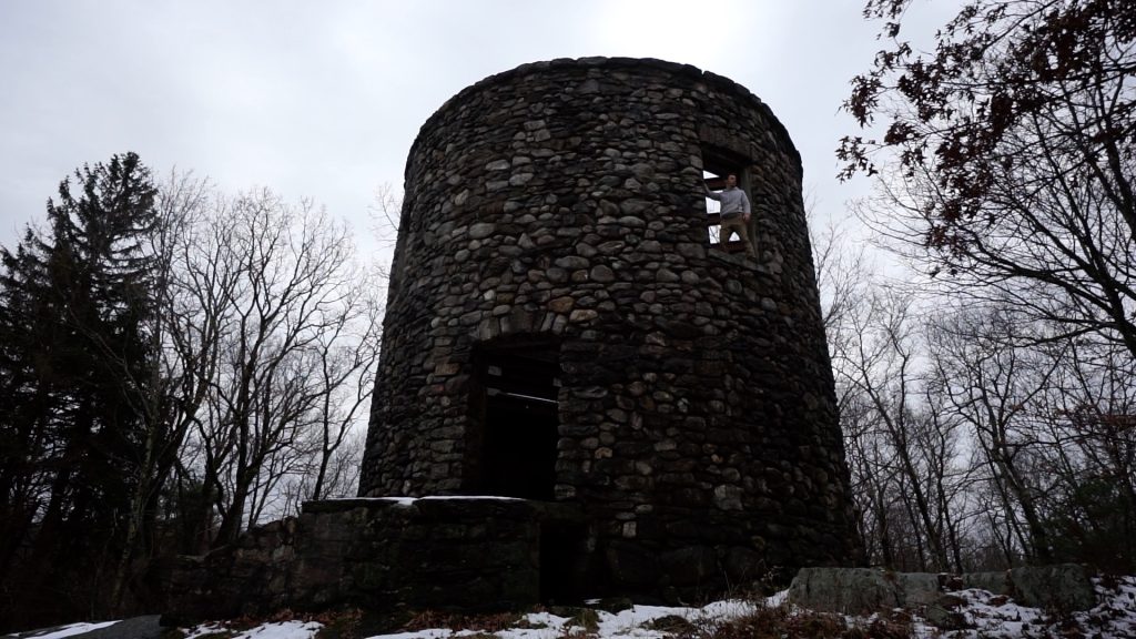
The tower is incredibly easy to access from Toomey Rd there is a small pull-off across from a gated trail.  Taking the trail leads you about 450′ into the woods where you join with the blue blazed Mohawk Trail.  The tower sits at the back of a small clearing past a swing set on a lone tree.

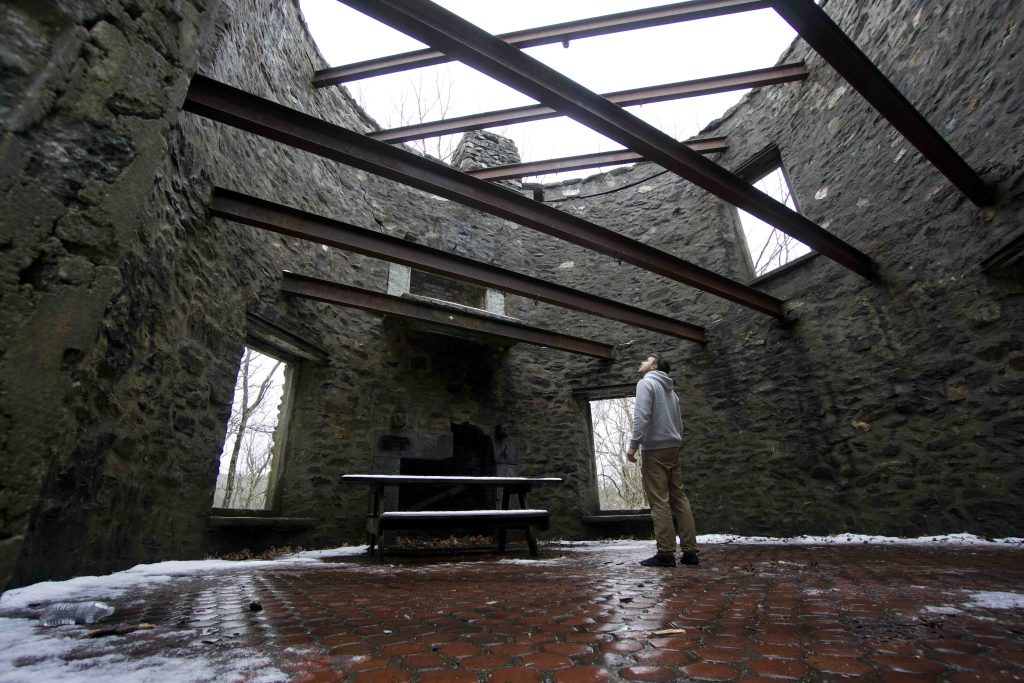
The stone tower, also known ‘Aerie’, was built in 1915 by Seymour Cunningham and is 30ft tall and 30ft in diameter.  The tower had two floors with a stairway of stone steps jutting from the walls in a spiral as well as a rooftop parapet.  The floor is red tile with a large fireplace opposite the door and another on the second floor.  The mantle of the first fireplace is carved ‘Seymour Cunningham Fegit MCMXV’ which translates to ‘built 1915’. High on the back of the tower is a ram’s head gargoyle waterspout.

Today the roof and second floor are nothing but steel beams open to the sky and the steps have been removed.  At 100 years old the tower is a shell of its former glory but still an amazing place to seek out and explore.

History:

Established in 1921. Mohawk Mountain was featured in both the 2015 and 2019 Sky’s the Limit Hiking Challenges.

The mountain was not inhabited by the Mohawk tribe, but was used by the Tunxis and Potatuck tribes who would climb to the summit in search of threatening Mohawks and to warn of their approach.

The land was owned by a series of iron companies in the 1800s who used the forests to make charcoal for their furnaces.  The only company name I’ve found is the last, Hunts Lyman Iron Company.

The Mohawk Tower Association was formed in 1882 by residents of Litchfield, Goshen and Cornwall, Connecticut to provide an observation tower on Mohawk Mountain.  A wooden tower was built later that year by Cyrus W. March and his son Charles which garnered 552 visitors.  Just ten years later the tower was unusable and collapsed soon after.

In 1912, Seymour Cunningham purchased Schlittenhart Farm from Harrison Ives, as well as the adjoining farms of William H. Baldwin and Luke Richards.  A year later he acquired all the holdings of the Mohawk Tower Association and attempted a sheep farm and tree nursery.  Cunningham had his stone tower built in the same spot as the wooden one in 1915.  By 1920 the sheep farm was proving unsuccessful and Cunningham accepted an offer from Alain White to acquire all his land.

In 1921 Alain White donated the first 250 acres to the state for public use and the White Memorial Foundation has contributed a total of 2,900 acres over the years.

In the 1930’s the Civilian Conservation Corps. established Camp Toumey, located near what is now the Forest Headquarters. Remnants of buildings and fireplace chimneys can be found in this area.  As he men from Camp Toumey built the first downhill trail in 1939 under the direction of Rolf Holdvedt and the Connecticut Ski Council.

In 1946, Walter R. Schoenknecht (pronounced “shawn-connect”) began leasing the northwest side of Mohawk Mountain from the state and developed a ski resort area. It opened in 1947 with six trails and tows.

In 1949-50, a winter with no snow, Schoenknecht shipped in 700 tons of ice and chopped it up to spread on the slope.  It was one of the first uses of fake snow on a ski slope and he later built and refined the system to create artificial snow.


Links:

The information shown here is for general reference purposes only. exploreCT.org gives no warranty, expressed or implied, as to the accuracy or reliability of this data. Parking in all areas, whether designated here or not, is at your own risk. exploreCT.org is not responsible for any damage or loss to vehicles or contents.

Visited 6764 times, 1 Visits today

Related Listings

Babcock Pond

★☆☆☆☆

653 Middletown Rd, Colchester, CT, USA

Babcock Pond WMA Connecticut Wildlife Management Area 1,524 acres in Colchester, CT Parking: Boat launch: Small lot near 653 Middletown Rd, Colchester, CT Trails: Small lot near…

Mount Higby

★★★★☆

41.539191, -72.744306

Mount Higby Blue Blaze Trail and The Nature Conservancy in Middlefield and Middletown, CT Parking: Middle: Shoulder parking at the end of Preston Ave, Meriden, CT South… Read more…

Sunset Rock State Park

★★★★☆

41.660733, -72.845229

Sunset Rock State Park / Crescent Lake Connecticut State Park and Southington Town Park 18 acres in Plainville and Southington, CT Parking: Large lot near 403-, 537…