Site logo
    • Explore
      • Blue-Blaze Trails
      • Land Trusts
      • State Parks and Forests
      • By Town
    • exploreCT+
      • Membership
      • Shop
      • Events
    • Blog
    • Town Guides
    Sign in or Register
    Listing cover image

    Indian Council Caves

    • Trails
      2 miles
    • Rating
      ★★★☆☆
    • Address
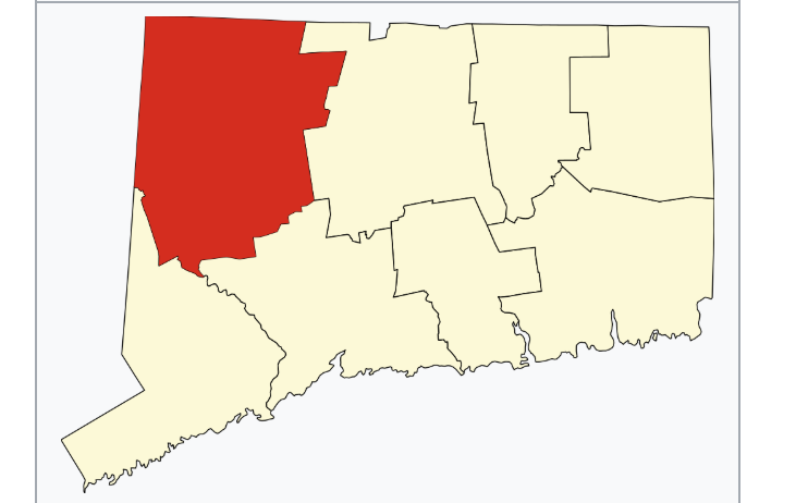
      W3XC+M6 Barkhamsted, CT, USA
    • Explore
    • Trail Map
    • Reviews 0
    • New Page
    • prev
    • next
    • Bookmark
    • Share
    • Get directions
    • Report
    • prev
    • next
    At A Glance

    Tunxis Trail

    Unknown acres in Barkhamstead, CT

    Parking:

    • Tunxis Trail: Small pull-off near 199 E Hartland Rd, Barkhamsted, CT
    • Fire Road from Rt. 179: Small pull-off near 7 Legeyt Rd Barkhamsted, CT

    Trail Map              Trails: 2.2 miles        Rating: ★★★☆☆

    Hiking

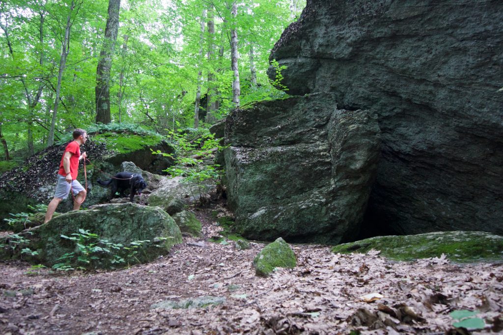
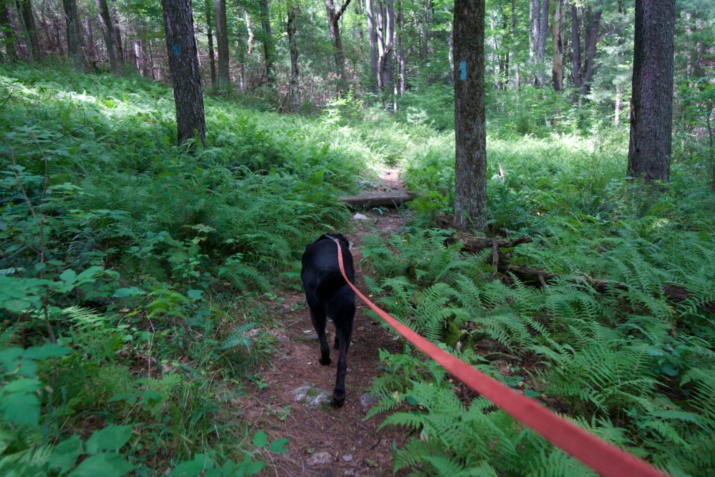
    While pet-sitting, I hiked this with my parent’s dog on a late summer day.  The pair of us got the last parking spot at the pull-off on Rt. 219 and after crossing the road and hoping the guardrail headed off on the Tunxis Trail toward the caves.  The trail was muddy and wet in several sections, but long stretches of mountain laurel, ferns, and mossy rocks more than made up for it.

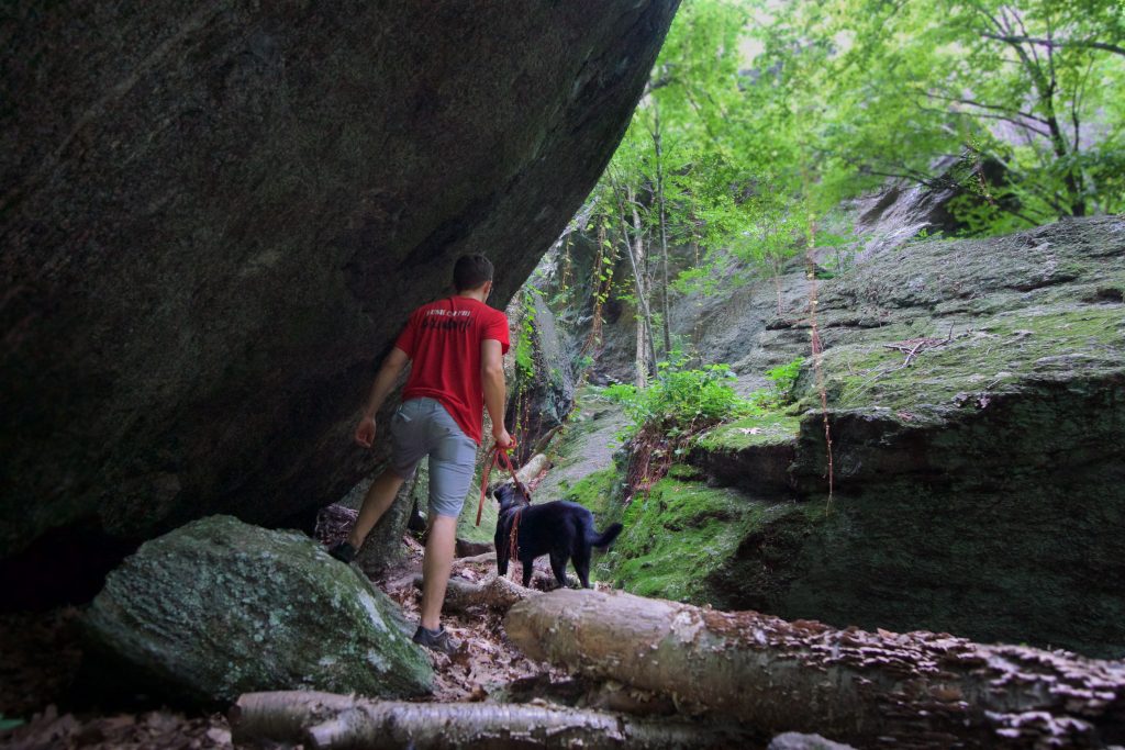
    At 4.5 miles round trip, the hike is satisfying and includes many picturesque locations.  Just before the caves is a small overlook.  Though the view isn’t much its a nice rest spot as evidenced by the two women enjoying their lunch on the ledge during my hike.  From the overlook, it is a steep climb down to the boulders below.

    Winding through the rocks and house-sized boulders are several tunnels, crevasses, and dark recesses.  While caves are typically large underground chambers, we play fast and loose with that kind of definition in Connecticut.  So there are no ‘true’ caves, but there is certainly a large area to explore and a great hike.

    You can also hike the fire road from Rt. 179 for a 3.3 mile hike roundtrip.

    Links

    Peter Marteka – The Beckoning of the Indian Council Caves (2013)

    CTMQ – Indian Council Caves (2013)

    Tags
    • ★★★☆☆
    • 2018
    • Explored
    • Barkhamsted
    • Caves
    • Litchfield County
    • Overlooks
    • Peter Marteka
    • Tunxis
    Last Updated

    The information shown here is for general reference purposes only. exploreCT.org gives no warranty, expressed or implied, as to the accuracy or reliability of this data. Parking in all areas, whether designated here or not, is at your own risk. exploreCT.org is not responsible for any damage or loss to vehicles or contents. Last updated Oct. 29, 2018

    Trail Map
    Location
    • W3XC+M6 Barkhamsted, CT, USA

      Get Directions
    Gallery
    Video
    Categories
    • Hiking
    Gallery
  • No comments yet.
  • Add a review

    Leave a Reply · Cancel reply

    Your email address will not be published. Required fields are marked *

    Overall Rating

    You May Also Be Interested In

    Spruce Brook Falls

    • ★★★★★
    • 16 miles
    Featured
    FW6F+CW Beacon Falls
    • Quick view
    • Bookmark

    Bartholomew Open Space

    • Unexplored
    • 0.6 miles
    72 Buttonball Rd
    • Quick view
    • Bookmark

    Avery Nature Preserve

    • Unexplored
    • 2.6 miles
    60R Scotch Cap Rd
    • Quick view
    • Bookmark

    Hi, I’m Matt.

    I’m building ExploreCT to be the guide for all your outdoor adventures. All the trails, views, and waterways this great state has to offer.

    Now get out and explore!

    Monthly Newsletter

    Each month I share site updates or an interesting article in my newsletter. It’s short, sweet, and practical.

    600+ explorers read it, I’d love for you to join.

    Thank you!

    You have successfully joined our subscriber list.

    X-twitter Youtube Envelope Instagram

    Cart

      • Facebook
      • X
      • WhatsApp
      • Telegram
      • LinkedIn
      • Tumblr
      • Reddit
      • VKontakte
      • Mail
      • Copy link
      • Share via...
      • Threads
      • Bluesky