Site logo
    • Explore
      • Blue-Blaze Trails
      • Land Trusts
      • State Parks and Forests
      • By Town
    • exploreCT+
      • Membership
      • Shop
      • Events
    • Blog
    • Town Guides
    Sign in or Register
    Listing cover image

    Forster Pond State Park

    • Trails
      1 miles
    • Rating
      ★★☆☆☆
    • Address
      Forster Pond State Park, 360 Rte 80, Killingworth, CT 06419, USA
    • Explore
    • Trail Map
    • Reviews 0
    • New Page
    • prev
    • next
    • Bookmark
    • Share
    • Get directions
    • Report
    • prev
    • next
    At A Glance

    Connecticut State Park

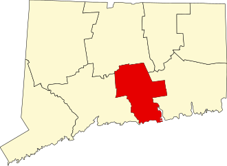
    148 acres in Killingworth, CT

    Parking: Small lot near 360 CT-80, Killingworth, CT

    Trail Map       Trails: Less than a mile     Rating: ★★★☆☆

    Forster Pond is one of Connecticut’s more mysterious state parks and can effectively be broken into its eastern and western sides.  The eastern side of the pond is largely closed to public access and but contains a number of historic buildings and access to the pond.

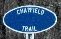
    The western side is open to the public and is trailed by the northern terminus of the 4.2 mile blue blaze Chatfield Trail.  The best parking access is from Chatfield Hollow State Park so if that park is busy you can just cross the road for a great (much quieter) hike.

    Hiking

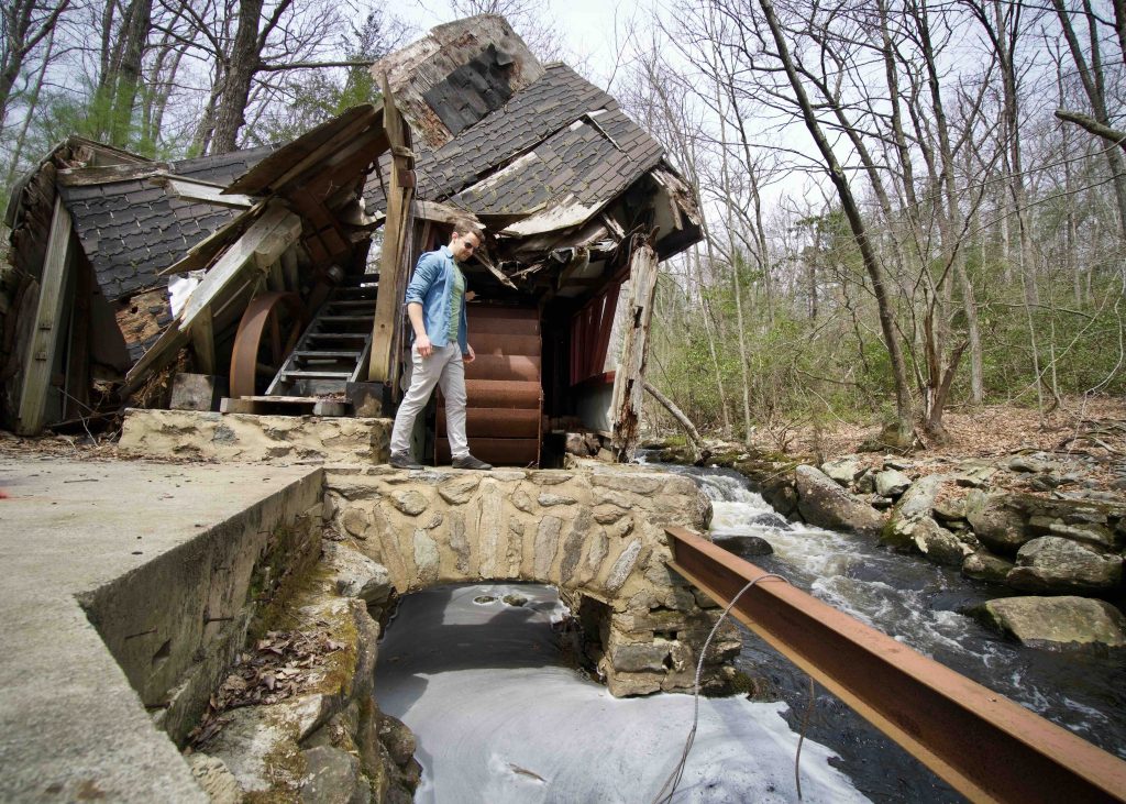
    After crossing Route 80 the trail starts off into the woods over a short bridge and heads parallel to the road until crossing Chatfield Hollow Brook.  A side trail the follows the brook downstream leads to a dam on the brook and the ruins of an old waterwheel and pump house.  Normally these have all been torn down long ago but this one has been left to collapse over the past 50 years yet still gives a sense of what is used to look like.

    Continuing on the Chatfield Trail heads up out of the hollow to a series of rocky ridges until it heads south along the steep banks of the Forster Pond. I was a bit disappointed that there aren’t any opportunities to get to the water’s edge.  Heading away from the pond the forest changes from oak/hickory to tall pines with a dense understory of mountain laurel. By now you’ve left the state park and have actually been hiking in Cockaponset State Forest for a bit.  Click on to the Chatfield Trail page for a complete description of the trail.

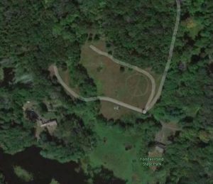
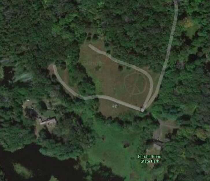
    Fun fact: I actually met Tom the DEEP biologist who oversees the area while on vacation out in Oregon, he mows a design into the field (usually a peace sign) at Forster Pond each year.

    History

    Established as a state park in 1963.  The have been attempts to turn the former estate into a museum.

    The area is named for Frank Forster, a famed architect who built a country estate on the property in 1935 attempting to create an inland Mystic Seaport.  He had Chatfield Hollow Brook damed to create the pond.

    The state purchased an adjacent 41 acres to the west in 1972 from Oscar Swenson, an inventor who brought electricity to his house with power generated by a water-wheel mill on the east branch of the Hammonasset River that flows into the pond.

    Other state purchases:

    • 1993 – 3.6 acre Mitchell property and house
    • 1998 – 10 acre Fox property for $185,000

    In 1992, the DEEP’s Inland Fisheries Division was given use of the pond and the Forster house for the Connecticut Aquatic Resources and Education (CARE) program. The program uses volunteers to teach families how to fish at various locations around the state.

    Links

    Christine Woodside – The Mystery of Forster Pond State Park. Connecticut Woodlands Spring 2014. pg 10.

    Peter Marteka – Old Hydroelectric Mill Speaks To The Preservation Of Killingworth’s Past (2014)

    Stan Fisher – Famed architect’s buildings could become museum in Killingworth (2012)

    Peter Marteka – The Park View Few People See (2001)

    Tags
    • ★★☆☆☆
    • 2022
    • Chatfield Trail
    • Cockaponset State Forest
    • Explored
    • Killingworth
    • Middlesex County
    • Peter Marteka
    • Ruins
    • State Park
    Last Updated

    The information shown here is for general reference purposes only. exploreCT.org gives no warranty, expressed or implied, as to the accuracy or reliability of this data. Parking in all areas, whether designated here or not, is at your own risk. exploreCT.org is not responsible for any damage or loss to vehicles or contents. Last updated April 24th, 2022

    Trail Map
    Location
    • Forster Pond State Park, 360 Rte 80, Killingworth, CT 06419, USA

      Get Directions
    Gallery
    Video
    Categories
    • Hiking
    Gallery
  • No comments yet.
  • Add a review

    Leave a Reply · Cancel reply

    Your email address will not be published. Required fields are marked *

    Overall Rating

    You May Also Be Interested In

    Spruce Brook Falls

    • ★★★★★
    • 16 miles
    Featured
    FW6F+CW Beacon Falls
    • Quick view
    • Bookmark

    Bartholomew Open Space

    • Unexplored
    • 0.6 miles
    72 Buttonball Rd
    • Quick view
    • Bookmark

    Avery Nature Preserve

    • Unexplored
    • 2.6 miles
    60R Scotch Cap Rd
    • Quick view
    • Bookmark

    Hi, I’m Matt.

    I’m building ExploreCT to be the guide for all your outdoor adventures. All the trails, views, and waterways this great state has to offer.

    Now get out and explore!

    Monthly Newsletter

    Each month I share site updates or an interesting article in my newsletter. It’s short, sweet, and practical.

    600+ explorers read it, I’d love for you to join.

    Thank you!

    You have successfully joined our subscriber list.

    X-twitter Youtube Envelope Instagram

    Cart

      • Facebook
      • X
      • WhatsApp
      • Telegram
      • LinkedIn
      • Tumblr
      • Reddit
      • VKontakte
      • Mail
      • Copy link
      • Share via...
      • Threads
      • Bluesky