Site logo
    • Explore
      • Blue-Blaze Trails
      • Land Trusts
      • State Parks and Forests
      • By Town
    • exploreCT+
      • Membership
      • Shop
      • Events
    • Blog
    • Town Guides
    Sign in or Register
    Listing cover image

    Dismal Brook Wildlife Preserve

    • Trails
      3 miles
    • Rating
      ★★★★☆
    • Address
      253 Loomis St, North Granby, CT, USA
    • Explore
    • Trail Map
    • Reviews 0
    • New Page
    • prev
    • next
    • Bookmark
    • Share
    • Get directions
    • Report
    • prev
    • next
    At A Glance

    Granby Land Trust

    210 acres in Granby, CT

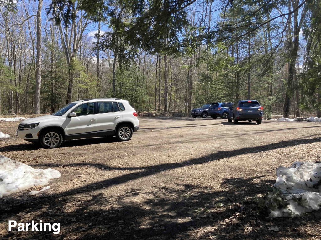
    Parking: Medium sized lot near 253 Loomis St, North Granby, CT

    Trail Map            Trails: 3.14 miles        Rating: ★★★★☆

    Dismal Brook is an amazing location that’s bound to become one of the top hiking spots in this part of the state.

    Hiking

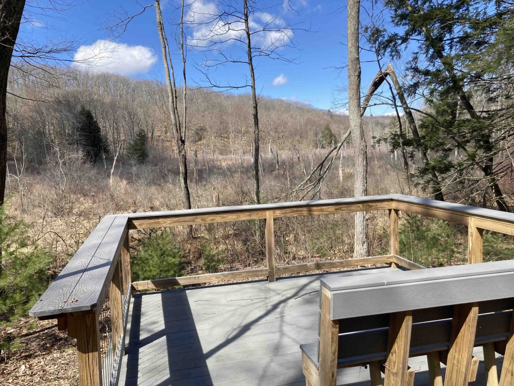
    From the parking area the yellow trail starts off gradually downhill before turning hard left.  The green trail heads right here for a short 0.28 mile around a small vernal pool/kettle hole. Continuing on the yellow brings you past a viewing platform of the north marsh and then into the open Stevenson Field both great habitats for bird viewing depending on the season.  At the corner of Stevenson Field the yellow trail forks into its 2 mile loop and I took the left fork which connects to a wide gravel trail that was clearly the former driveway of the property.

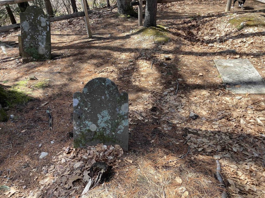
    On a small knoll to the right is Day Cemetery, purported to be one of the oldest in Granby.  The five gravestones are incredibly weathered but thanks to the efforts of the Salmon Brook Historical Society we know that the oldest gravestone dates to Elijah Truman who died of smallpox in 1795 and the most recent belongs to William Read from 1850.  There is a crossing trail here but I continued on the yellow over the Dismal Brook bridge.  There is soon another bird viewing platform with expansive views looking over south marsh.

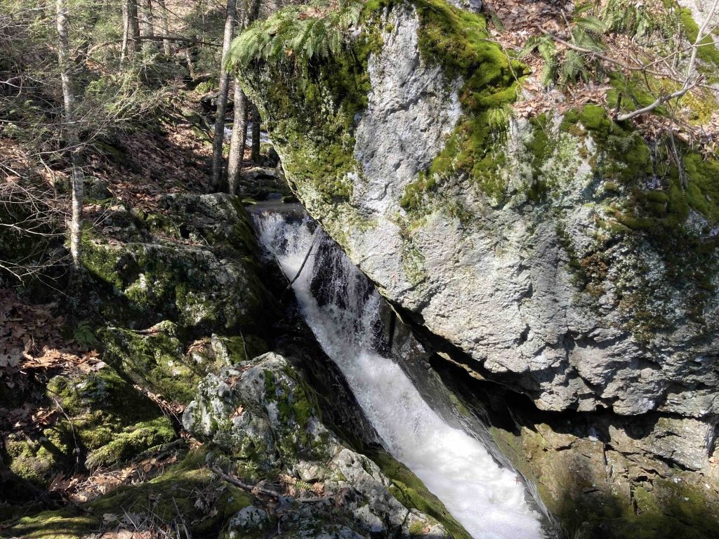
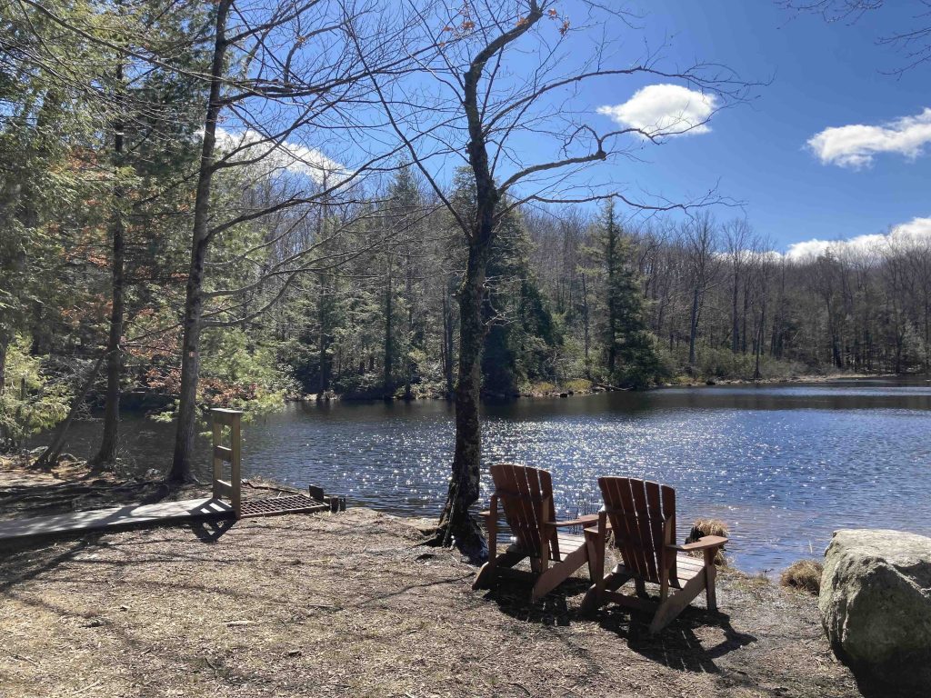
    The yellow trail continues to gain elevation until reaching Creamer Pond which is a gorgeous view next to the old dam.  There are active beavers here so it requires frequent effort to keep the dam spillways clear.  A pair of adirondack chairs sit on the edge of the pond for a peaceful rest.  Continuing over the dam leads to the short Orange spur which leads up to an small overlook of the pond with a bench for an even more secluded rest.  Not indicated on the trail map but there are also man made and natural cascades just downstream from the pond with a fantastic narrow gorge not too far off trail.

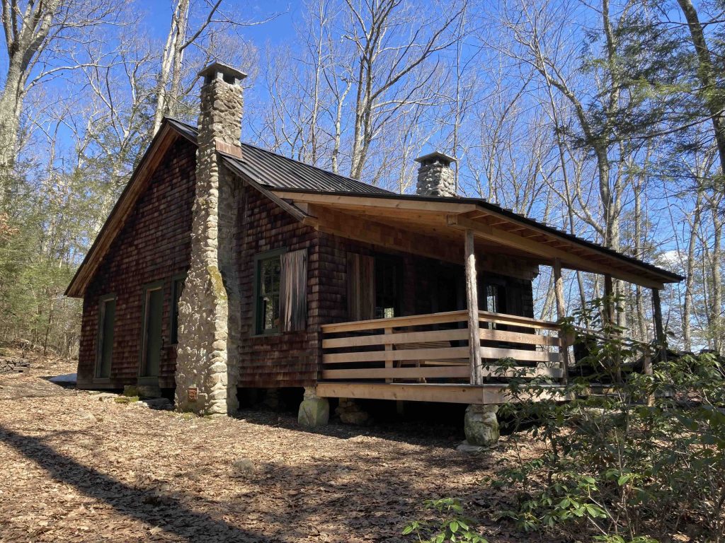
    Backtracking just a bit from the pond is Glazier Cabin which is one of the most picture perfect cabins I’ve ever had the pleasure of seeing.  Well maintained in and out the cabin has an covered porch with rocking chairs with a view down to the pond.  The Glaziers were certainly spoiled by this summer retreat.

    Beyond the cabin you can either take the yellow trail left to complete the full loop or the blue trail for a shorter option.  Both take you through remote feeling forest though the blue trail follows a ridge line on the property which gives hints of views during the winter months.

    The yellow trail descends down a very steep notch in the ridgeline to return to Dismal Brook and a well crafted curved bridge and a quick return to the parking area.

    History

    Preserved in 2020 when it was donated by Jamie Gamble.  The Granby Land Trust provides a complete history here.

    Links

    History of the Dismal Brook Wildlife Preserve (2020)

    Day Cemetery Gravestone Project (2008)

    CTMQ – Dismal Brook Wildlife Preserve (2020)

    Tags
    • ★★★★☆
    • 2023
    • Explored
    • Granby
    • Granby Land Trust
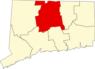
    • Hartford County
    Last Updated

    The information shown here is for general reference purposes only. exploreCT.org gives no warranty, expressed or implied, as to the accuracy or reliability of this data. Parking in all areas, whether designated here or not, is at your own risk. exploreCT.org is not responsible for any damage or loss to vehicles or contents. Last updated March 26th, 2023

    Trail Map
    Location
    • 253 Loomis St, North Granby, CT, USA

      Get Directions
    Gallery
    Categories
    • Hiking
    Gallery
  • No comments yet.
  • Add a review

    Leave a Reply · Cancel reply

    Your email address will not be published. Required fields are marked *

    Overall Rating

    You May Also Be Interested In

    Spruce Brook Falls

    • ★★★★★
    • 16 miles
    Featured
    FW6F+CW Beacon Falls
    • Quick view
    • Bookmark

    Thach Preserve

    • ★★☆☆☆
    • 1 miles
    123 Brush Hill Rd
    • Quick view
    • Bookmark

    Mendell's Folly

    • ★★★★☆
    • 3.8 miles
    390 Beacon Rd
    • Quick view
    • Bookmark

    Hi, I’m Matt.

    I’m building ExploreCT to be the guide for all your outdoor adventures. All the trails, views, and waterways this great state has to offer.

    Now get out and explore!

    Monthly Newsletter

    Each month I share site updates or an interesting article in my newsletter. It’s short, sweet, and practical.

    600+ explorers read it, I’d love for you to join.

    Thank you!

    You have successfully joined our subscriber list.

    X-twitter Youtube Envelope Instagram

    Cart

      • Facebook
      • X
      • WhatsApp
      • Telegram
      • LinkedIn
      • Tumblr
      • Reddit
      • VKontakte
      • Mail
      • Copy link
      • Share via...
      • Threads
      • Bluesky