
Explore Brooklyn, CT
Brooklyn at a Glance
Part of Windham County
If you’re looking for the best hiking trails in Brooklyn this is the complete guide to all the forgotten town trails, magnetic rocks, and history it has to offer.
Brooklyn has seven hiking spots for 10 miles of trail, a boat launch and fishing on the Quinebaug River, and a disc golf course.
My Highlights
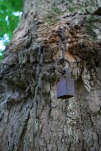
- Locket in a tree at Prince Hill Park
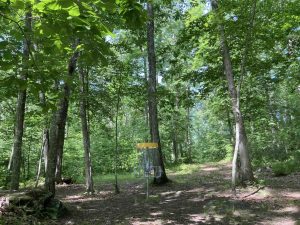
- Disc golf at Davis Forest
Hiking
Town Parks
- Blackwell Brook –★– 1.6 miles – Still my least favorite hike ever, but maybe trail conditions have improved?
- Brooklyn Riverside Park –★★– 0.65 miles – Easy crushed stone walking path
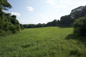
- Davis Forest –★★– 1 mile – Faint loop trail here mostly overtaken by the disc golf course and a path along the river
- Prince Hill Park/Carol Randall Trail/Creamery Brook Trail –★★– 3.5 miles – These three areas combine for an interesting hike that is surprisingly well traveled
- Milo Appley Conservation Showcase –★– <1 mile – Trails had faded to nothing on my last visit in 2018
Land Trust
- Eversource Land Trust
- Quinebaug Trail – (Not to be confused with the blue blaze Quinebaug Trail or nearby Killingly’s Quinebaug River Trail) I can’t quite bring myself to hike this 0.9 mile utility corridor and field edge walk
- Wolf Den Land Trust
- Ferguson/Williams Conservancy –★★– 2 miles – A bit overgrown on my last visit but trails pass magnetic rocks and the ‘Fried Egg Trail’
- White Brook Sanctuary –★ There is a trail map for the property, but supposedly starts and ends down two private driveways, I stopped and there is a nice roadside spot with a bench and water view but wasn’t willing to poke past the houses for a trail
- Wyndham Land Trust
- Booth Preserve – No trails
- Eversource Land Trust
State Parks / Forest
- None
Blue Blaze
- None
The Rest
- None
Boating/Fishing
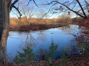
- Quinebaug River
- Boat Launch at Riverside Park
- Davis Forest has fairly short access to the river, possible fishing spot
- Quinebaug River
Disc Golf
- Davis Forest –Popular 18 hole disc golf course
Originally the area was once part of the lands claimed by the Mohegan chief, Uncas it was peopled by the Wabbaquassets. The land was deeded to Capt. James Fitch in 1680 and was sold to the first local settlers in 1703.
An area of the town was formerly known as Mortlake. It had been purchased in 1686 by Puritans who lived a separate life from surrounding towns until it was finally included in the community in 1752.
Brooklyn was named in 1752 as the ‘brook line’ (the Quinebaug River) with neighboring towns. It was incorporated from Canterbury and Pomfret in May 1786 making it the 87th oldest town in the state.
{{locationDetails}}