Site logo
    • Explore
      • Blue-Blaze Trails
      • Land Trusts
      • State Parks and Forests
      • By Town
    • exploreCT+
      • Membership
      • Shop
      • Events
    • Blog
    • Town Guides
    Sign in or Register
    Listing cover image

    Bluff Head

    • Trails
      3 miles
    • Rating
      ★★★☆☆
    • Address
      4391 Durham Rd, Guilford, CT, USA
    • Explore
    • Trail Map
    • Reviews 0
    • New Page
    • prev
    • next
    • Bookmark
    • Share
    • Get directions
    • Report
    • prev
    • next
    At A Glance

    Guilford Land Conservation Trust

    700 acres in Guilford, CT

    Parking: Large lot near 4391 Durham Rd, Guilford, CT

    Trail Map             Trails: 3 miles          Rating: ★★★☆☆

    Hiking

    I made a quick stop to Bluff Head in 2014 after exploring Guilford. I took the steep trail from the parking lot up along the ridge to the overlook and wanted to continue hiking but ended up in a confusing network of poorly blazed trails.

    Cut to ten years later when I returned to the property while thru-hiking the New England Trail. The property is now part of the 'Northwoods Trail System' and the blue blazed Mattabesett Trail has been rerouted to the more gradual climb (likely to reduce erosion on the original steep trail).

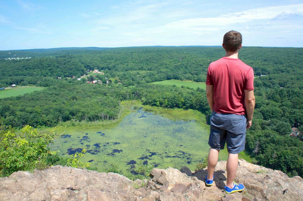
    Views were socked in on my recent visit but usually the beautiful traprock ridge overlook provides a great view above Meyerhuber Pond.

    Heading north: 0.5 mile road walk to Pistapaug Mountain

    Heading south: Broomstick Ledges

    History

    From the land trust site,

    “The land trust began buying land at Bluff Head in the 1960s. Today, it owns more than 700 acres there, including most of the area around the sheer, 500-foot traprock cliff as well as the adjoining areas of Totoket Mountain

    Links

    Peter Marteka – Eight Of Connecticut’s Challenging Hikes (2017)

    Tags
    • ★★★☆☆
    • 2024
    • Explored
    • Guilford
    • Guilford Land Trust
    • Mattabesett
    • New England Trail
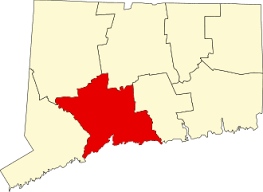
    • New Haven County
    • Overlooks
    Last Updated

    The information shown here is for general reference purposes only. exploreCT.org gives no warranty, expressed or implied, as to the accuracy or reliability of this data. Parking in all areas, whether designated here or not, is at your own risk. exploreCT.org is not responsible for any damage or loss to vehicles or contents. Last updated: 2024

    Trail Map
    Location
    • 4391 Durham Rd, Guilford, CT, USA

      Get Directions
    Gallery
    Categories
    • Hiking
    Gallery
  • No comments yet.
  • Add a review

    Leave a Reply · Cancel reply

    You must be logged in to post a comment.

    You May Also Be Interested In

    Spruce Brook Falls

    • ★★★★★
    • 16 miles
    Featured
    FW6F+CW Beacon Falls
    • Quick view
    • Bookmark

    White Oak Preserve

    • Unexplored
    • 0.2 miles
    600 Raymond Hill Rd
    • Quick view
    • Bookmark

    Woodlands Nature Preserve

    • Unexplored
    • 0.5 miles
    99 Beacon Hill Dr
    • Quick view
    • Bookmark

    Hi, I’m Matt.

    I’m building ExploreCT to be the guide for all your outdoor adventures. All the trails, views, and waterways this great state has to offer.

    Now get out and explore!

    Monthly Newsletter

    Each month I share site updates or an interesting article in my newsletter. It’s short, sweet, and practical.

    600+ explorers read it, I’d love for you to join.

    Thank you!

    You have successfully joined our subscriber list.

    X-twitter Youtube Envelope Instagram

    Cart

      • Facebook
      • X
      • WhatsApp
      • Telegram
      • LinkedIn
      • Tumblr
      • Reddit
      • VKontakte
      • Mail
      • Copy link
      • Share via...
      • Threads
      • Bluesky