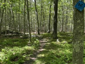
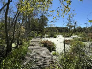
The Avalonia Land Conservancy is one of the largest land trusts in Connecticut preserving 4000 acres in the southeastern part of the state within the towns of Griswold, Groton, Ledyard, North Stonington, Preston, and Stonington.
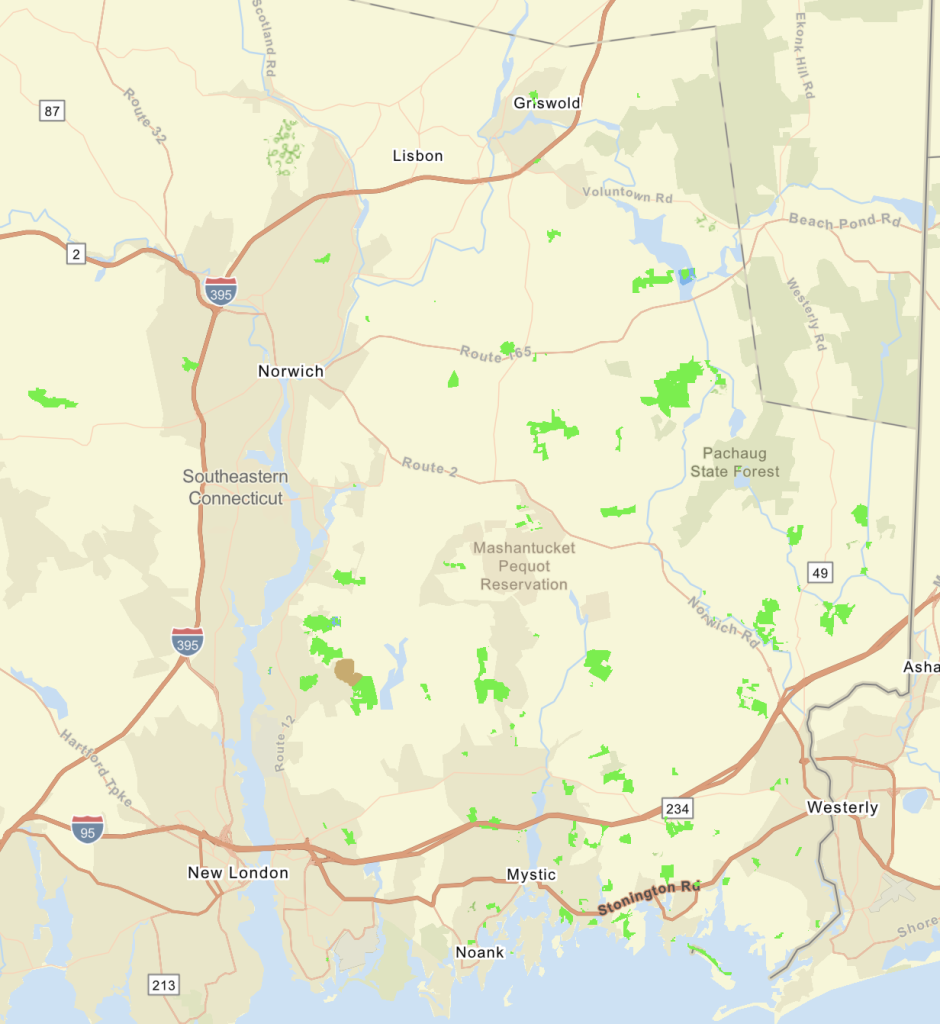
The information shown here is for general reference purposes only. exploreCT.org gives no warranty, expressed or implied, as to the accuracy or reliability of this data. Parking in all areas, whether designated here or not, is at your own risk. exploreCT.org is not responsible for any damage or loss to vehicles or contents.
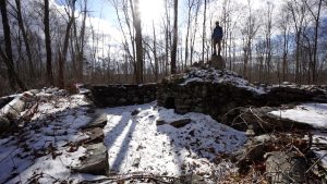
Avery Preserve the preserved portion of the Amos Avery Homestead split into two parcels by Avery Hill Road. Highlights include a sheep wash pen, and old dam, and a rhododendron sanctuary.
Hiking
The main hiking is west of Avery Hill Rd across from the parking area. Right off the road is a short trail to the sheep wash pen a curved corral right against Billings-Avery Brook which would have been used to hold the sheep releasing them through the brook prior to shearing. It is certainly a unique structure.
The main trail is the orange blazed loop around the edge of the property which is close to a mile long. The trail map notes “stone hand basin” that I expected to see right along the trail, but besides guessing none of the rocks were obvious candidates. There is a nice footbridge built by Eagle Scout Travis Joyce in 2015 over a wet patch and a bit beyond that is the mill pond dam.
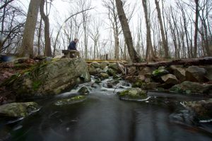
The dam creates a small cascade on the brook and a bench has been placed to sit and enjoy the view. Trails appear to continue beyond the dam, but are an old woods road on private property.
Continuing on the orange trail the terrain becomes more rolling and bumps along old stonewalls. An odd section with the orange trail blazes heading off in multiple directions caused me a bit of confusion, but they just connect to the white crossing trail in rapid succession. I stayed on the outside loop coming close to houses on private property until returning to the parking area.
East Section
On the same side as the parking area there is a short unblazed trail heading off into the woods that sees infrequent use. On my last visit it had started to rain and my hiking spidey sense should have kicked off as soon as I started to see old mossy boards placed on the trail. The trail went deeper and deeper into an almost marshy area with plenty of standing water and not enough boards to keep your feet dry.
I managed to make it to the turnaround, soaking my feet in the process, to discover a deep rhododendron grove. It must be a safe haven for deer as the entire lollipop loop was covered in their droppings. I’m sure the area is nice when the rhododendron are blooming in July, but I would recommend skipping the trail any other time.
History:
The west tract was preserved in 1970, the east tract in 1977, and the tiny sheep wash area in 1995. In order to get to the preserve you’ll likely pass the bright red colonial house on Avery Hill Road. This house is the oldest in Ledyard, built in 1696 and was home to several generations of the Avery family. It was added to the National Register of Historic Places in 1992.
The information shown here is for general reference purposes only. exploreCT.org gives no warranty, expressed or implied, as to the accuracy or reliability of this data. Parking in all areas, whether designated here or not, is at your own risk. exploreCT.org is not responsible for any damage or loss to vehicles or contents.
Trails for the Barrett Preserve start from a pinched parking area that is tiny pull off at a curve on the road which can be a bit tricky. Past the chain gate is a trailhead kiosk with trails immediately splitting into the east and west loops.
I chose to take the east loop by following the right path through the entry meadow. Crossing through a stone wall there is a sign for forest management work done in 2014, which (9 years ago as of this writing) certainly still seems fresher than its age suggests. The area was harvested of mature trees for lumber and firewood with the goal of improving age diversity among the trees and creating some habitat.
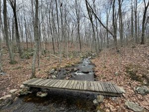
Down the trail from this are you reach an unnamed stream that runs through the property. After recent heavy rains the stream was still only a small flow so it must be pretty dry in summer. On my visit however there were a couple tiny cascades and pools of cool clear water right along the trail.
At the backside of the loop there is a crossover if you want to shorten your hike. I continued onto the West Loop which does offer a spur trail to the Christy Hill Road parking which actually has a tiny lot for easier parking than on Long Cove Road. The rest of the west loop is mostly open forest and rocky wash which gradually climbs back towards the Barrett Shed and trailhead.
History:
Preserved in 1994.
Links:
The information shown here is for general reference purposes only. exploreCT.org gives no warranty, expressed or implied, as to the accuracy or reliability of this data. Parking in all areas, whether designated here or not, is at your own risk. exploreCT.org is not responsible for any damage or loss to vehicles or contents.
Trail MapTrails: 1.5 miles Trail Difficulty: Moderate ⓘ Rating System:Easiest – Paved, Accessible Trail
Easy – Dirt, mostly smooth and wide
Moderate – Rolling terrain, variable width, standard rocks and roots
Difficult – Steep elevation and/or challenging
Strenuous – Likely long or technical segments with possible drops/exposure.Rating:★★☆☆☆ ⓘ Rating System:★☆☆☆☆ – Unmaintained, short hike, or not much to explore
★★☆☆☆ – Enjoyable short hike usually for locals
★★★☆☆ – Great hike with highlights, worth seeking out
★★★★☆ – Great area to explore worth repeat visits
★★★★★ – Must-see
I hiked from the adjacent Babcock Ridge property taking the unblazed Pond Loop at the north end of the property. The trail map notes parking at the end of the blue trail, but based on the disuse of that trail my guess is that no one is taking advantage of the narrow shoulder parking when they could go just a bit farther to the Babcock lot.
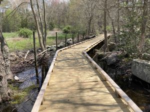
The trail heads downhill through the forest until climbing atop an esker that cuts between a marshy pond and wetlands area. A boardwalk clips the edge of this marshy pond for a nice view. The trail then works through thick undergrowth along the wetlands to a ambitious yet rickety bridge over a different water stretch.
The trails have been ‘meandered’ fairly recently, taking what was once straight shots up and down hills and making them curve this way and that while blocking use of the original trail. It’s certainly a long term sustainability thing for erosion control and water management but since it’s so new it felt a bit silly.
The trail map notes the trail splitting into a main blue and an alternate blue, looks like I took the main blue trail and did not notice any alternates branching off at either end.
The next site is the rock ledges section with one impressive overhang which could potentially make a great wall for sport climbing. From here the trail works over to Surrey Lane which is the only real suitable parking for this trail.
History:
Preserved in 1994.
Links:
The information shown here is for general reference purposes only. exploreCT.org gives no warranty, expressed or implied, as to the accuracy or reliability of this data. Parking in all areas, whether designated here or not, is at your own risk. exploreCT.org is not responsible for any damage or loss to vehicles or contents.
Tritown Forest has about 9 miles of trails ranging from the rugged blue to the flat red. From impressive stone walls, farm foundations, and landscape modified from farming this property has great terrain to explore.
Hiking
Blue Loop – 5 miles
Yellow Loop – 2.5 miles
From the main trailhead off Miller Rd the trail starts off wide and flat on old Axis Road. The blue trail soon splits off to the left with a sign noting it as “more difficult”. A bit past that is the yellow trail also off to the left that calls itself easier. I took the yellow trail and soon started ascending. The trail climbs to a hilly ridge filled with rock outcrops and views down into the forest and the hills beyond. The most interesting part was a mysterious iron marker driven into the rock with the letters P & G. I later learned that was the border marker for the towns of Preston and Griswold.
Descending off the ridge crosses the red trail and I stayed on the yellow to reach Fen Overlook. Fen is a low marsh or wetland and is a much more poetic term than swamp. The trail turns north again and interlinks with the blue to make its way around Lost Pond. The pond is a visual oddity amongst the rocky forest and the trail passes an old broken dam that once held it.
The next section meets impressive stone walls and passes through Oak Alley with its old oaks and… two stone walls until winding to an abandoned quarry. A steep climb ascends Rixtown Mt. with more stonewalls over the summit. I’m not usually a sucker for stone walls but these were tenacious criss crossing the most difficult terrain. While some harken back the areas farming, Peter Marteka notes in his article (linked below) that some are even older serpentine walls made by Native Americans.
Coming off Rixtown Mt. the trail makes its way to the cellar hole of the Charles H Main Sr. farm. It is an interesting spot to explore with informational signs, an old well, and the foundation itself.
The whole area gave me the feeling of Miles of Ledges near Berlin and I look forward to a second visit to further explore the Blue and Yellow loops.
History:
Preserved in 2016 for $925,000 with the help of a $555,000 grant from the DEEP and bridge loan from the Conservation Fund.
The information shown here is for general reference purposes only. exploreCT.org gives no warranty, expressed or implied, as to the accuracy or reliability of this data. Parking in all areas, whether designated here or not, is at your own risk. exploreCT.org is not responsible for any damage or loss to vehicles or contents.
Pine Swamp Wildlife Corridor is the banner name for the parcels like the Slosberg-Andersen Woodlands, Dow Centennial Preserve, and Harry Leiser Preserve
While there are technically eight trailheads to this property I stared from the only one with off the road parking at Whalebone Road. The trail heads off into the woods on an old access road that winds down to a small view of the water passing blue blazes. You soon reach the utility corridor which is undergoing expansion work by Eversource through at least 2023.
The trail and power lines are a narrow strip through interesting ponds. They’re unnamed as far as I can tell and provide nice views and even some open water access on both sides encircling what I assume are the namesake swamps.
Following the gravel road through the construction zone you evenutally reach a sign for the turn off to the blue dot loop trail. At just 1.3 miles the loop is short but packs many different sights. Rocky glacial till, marshy seasonal stream, open pine forest, a sea of ferns, close to private private property, tight tunnel through thick overgrowth, and more all flowing into each other.
I missed the yellow trail out to Friar Tuck Drive, it may have been there and I just missed it. The red spur towards Hillside Drive was very clearly marked but I decided to skip the extra 1.3 out and back. The blue dot trail flowed right back into the blue blazed utility corridor. I searched the sides for the other yellow trail but didn’t have any luck. It’s possible it’s unmaintained while Eversource is working on the lines or I was just looking at the wrong points.
It turned out to a great and varied short loop with plenty of reasons to explore again on a return trip.
History:
This area was possibly known to the Pequots as Ohomowauke meaning ‘owls’ nest’ or Cuppacommock meaning ‘the hiding place’ as a refuge for its remoteness and inaccessibility.
In colonial times, Pine Swamp was known as “Mast Swamp” for its supply of ship masts and spars for over a century. The last known pines were removed from the swamp in 1820, the final ones having been cut to supply ships in the Revolutionary War and War of 1812.
The North Tract, 162.81 acres, comprising:
Dow Centennial Preserve, 97.17 acres (1997)
Slosberg-Andersen Woodlands, 55.98 acres (2003)
Town of Ledyard transfers, 4 parcels totaling 7.46 acres (2005)
Town of Ledyard transfers, 2 parcels totaling 2.2 acres (2014)
And the South Tract, 102.11 acres, comprising
Slosberg-Anderson Woodlands, 94.24 acres (2003)
Town of Ledyard transfers, 1.31 acres (2005)
Town of Ledyard transfer, 6.56 acres (2014)
Links:
Avalonia E-Trails Blog – Pine Swamp Wildlife Corridor Part 1 and Part 2 (2014)
The information shown here is for general reference purposes only. exploreCT.org gives no warranty, expressed or implied, as to the accuracy or reliability of this data. Parking in all areas, whether designated here or not, is at your own risk. exploreCT.org is not responsible for any damage or loss to vehicles or contents.