Site logo
    • Explore
      • Blue-Blaze Trails
      • Land Trusts
      • State Parks and Forests
      • By Town
    • exploreCT+
      • Membership
      • Shop
      • Events
    • Blog
    • Town Guides
    Sign in or Register
    Listing cover image

    Metacomet: Peak Mountain

    • Trails
      4 miles
    • Rating
      ★★★★☆
    • Address
      Metacomet Trail 1st Rock Height, 74 Newgate Rd, East Granby, CT 06026, USA
    • Explore
    • Trail Map
    • Reviews 0
    • New Page
    • prev
    • next
    • Bookmark
    • Share
    • Get directions
    • Report
    • prev
    • next
    At A Glance

    Metacomet: Peak Mountain and West Suffield Mountain

    Connecticut Blue Blaze Trail, Traprock Ridge Land Conservancy, and Suffield Land Conservancy

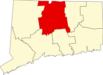
    142 acres in East Granby and Suffield, CT

    Parking:

    • South End: Shoulder parking near 8 Newgate Rd, East Granby, CT
    • North End: Shoulder parking near 2801 Phelps Rd, West Suffield, CT

    Trail Map         Trails: 4.3 miles     Rating: ★★★★☆

    This section of the blue blaze Metacomet/New England Trail run through two towns and is protected by a number of parcels from two land trusts (see History section below).  This another rugged section of trail with fantastic overlooks from the Metacomet Ridge.

    Hiking

    I first started this popular section of trail from the south end right of Route 20 in Granby.  The trail climbs very steeply on eroding trail just off the busy road but quickly leaves the noise behind once reaching the ridge top.  The trail is well worn and easy to travel cutting close to private property on the eastern side in a couple places.  Big wind storms have through the area is the past couple years knocking down big trees all along the ridge, but all have been cleared from the trail.

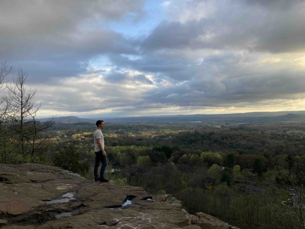
    After a fairly flat stretch atop the ridge the trail climbs again to the rocky knob of Peak Mountain about 1 mile into the hike for a fantastic overlook west and south over Granby that reminds me strongly of Pinnacle Overlook at Penwood State Park farther south. The spot is fantastic for sunset views.

    From the overlook the trail continues north along the ridge crossing into Suffield and reaches the Windsor Locks Primitive Campsite about 2 miles into the hike.  The site is a flat spot off the backside of the ridge accessed by a short trail marked by a ‘Tensite’ sign.  It doesn’t have a reliable water source nearby, but there are containers regularly refilled for general use in an insulated box (water should be filtered before drinking).

    The trail then heads over West Suffield Mountain along the backside of Sunrise Park.  It then passes Chimney Point before descending through the Spencer Woods Wildlife Preserve to reach Phelps Road and Rt. 168.

    Heading north: 0.1 mile road walk to reach Alcorn Preserve | North Terminus

    Heading south: 0.2 mile road walk on Newgate Rd coming from Tariffville Gorge and Hatchett Hill

    History

    The 28.9 acre Old Newgate Ridge property was acquired by the East Granby Land Trust (merged in 2023 to become the Traprock Ridge Land Conservancy) in 1979. The Suffield Land Conservancy acquired the 39.5 acre Ridgetop Preserve in 2002 and September 2017, the 12 acre Dildillian Woodlot in December 1983, the 9.9 acre Harmon Woodlot in December 1981, and the 51.7 acre Spencer Woods Wildlife Preserve in 1981 and September 2017.

    Links

    CTMQ – Metacomet Trail: Section 14 (2020)

    Peter Marteka – West Suffield Mountain Offers One Of The ‘Best Views In State’ (2012)

    Tags
    • ★★★★☆
    • 2023
    • 2024
    • Explored
    • Backpacking
    • East Granby
    • Hartford County
    • Metacomet Trail
    • Metacomet Ridge
    • New England Trail
    • Overlooks
    • Peter Marteka
    • Suffield
    • Suffield Land Conservancy
    • Sunset Views
    • Traprock Ridge Land Conservancy
    Last Updated

    The information shown here is for general reference purposes only. exploreCT.org gives no warranty, expressed or implied, as to the accuracy or reliability of this data. Parking in all areas, whether designated here or not, is at your own risk. exploreCT.org is not responsible for any damage or loss to vehicles or contents. Last updated April 16th, 2023

    Trail Map
    Location
    • Metacomet Trail 1st Rock Height, 74 Newgate Rd, East Granby, CT 06026, USA

      Get Directions
    Gallery
    Categories
    • Hiking
    • Camping
    Gallery
  • No comments yet.
  • Add a review

    Leave a Reply · Cancel reply

    Your email address will not be published. Required fields are marked *

    Overall Rating

    You May Also Be Interested In

    Spruce Brook Falls

    • ★★★★★
    • 16 miles
    Featured
    FW6F+CW Beacon Falls
    • Quick view
    • Bookmark

    Thach Preserve

    • ★★☆☆☆
    • 1 miles
    123 Brush Hill Rd
    • Quick view
    • Bookmark

    Mendell's Folly

    • ★★★★☆
    • 3.8 miles
    390 Beacon Rd
    • Quick view
    • Bookmark

    Hi, I’m Matt.

    I’m building ExploreCT to be the guide for all your outdoor adventures. All the trails, views, and waterways this great state has to offer.

    Now get out and explore!

    Monthly Newsletter

    Each month I share site updates or an interesting article in my newsletter. It’s short, sweet, and practical.

    600+ explorers read it, I’d love for you to join.

    Thank you!

    You have successfully joined our subscriber list.

    X-twitter Youtube Envelope Instagram

    Cart

      • Facebook
      • X
      • WhatsApp
      • Telegram
      • LinkedIn
      • Tumblr
      • Reddit
      • VKontakte
      • Mail
      • Copy link
      • Share via...
      • Threads
      • Bluesky