Site logo
    • Explore
      • Blue-Blaze Trails
      • Land Trusts
      • State Parks and Forests
      • By Town
    • exploreCT+
      • Membership
      • Shop
      • Events
    • Blog
    • Town Guides
    Sign in or Register
    Listing cover image

    Quinebaug Trail North Terminus

    • Trails
      3 miles
    • Rating
      ★★☆☆☆
    • Address
      309 Plainfield Pike, Plainfield, CT 06374, USA
    • Explore
    • Trail Map
    • Reviews 0
    • New Page
    • prev
    • next
    • Bookmark
    • Share
    • Get directions
    • Report
    • prev
    • next
    At A Glance

    CFPA Blue Blaze Trail

    acres in Plainfield, CT

    Parking: Small pull off near 309 Plainfield Pike, Plainfield, CT

    Trail Map      Trails: 2.8 miles       Rating: ★★☆☆☆

    Hiking

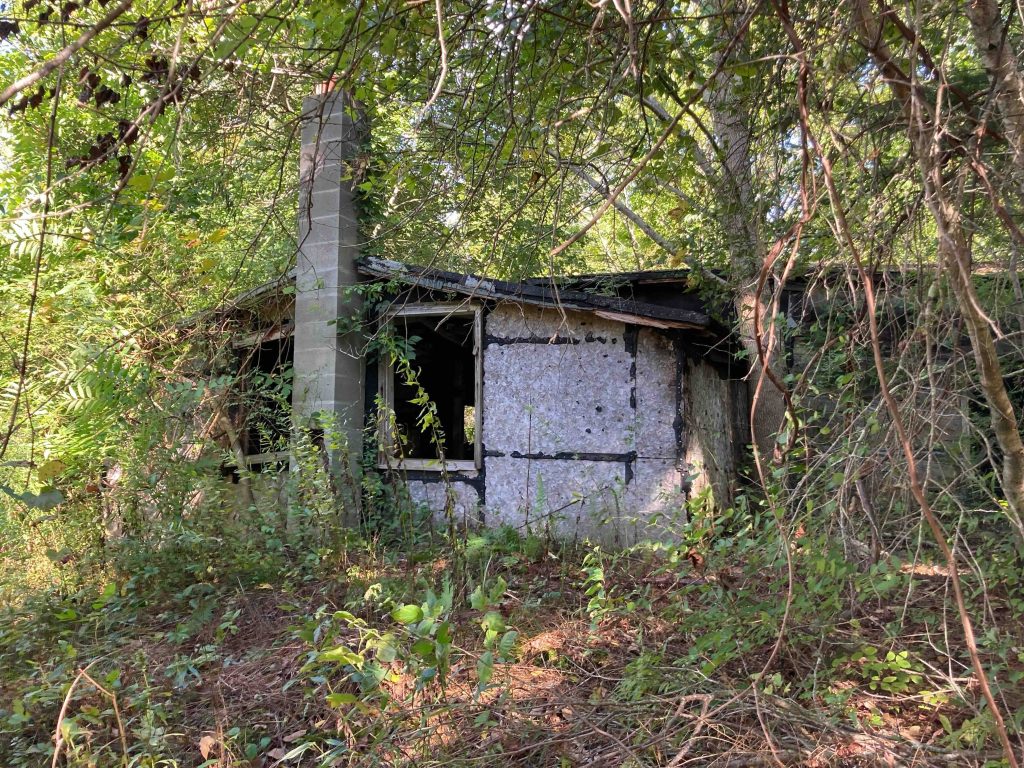
    The Quinebaug Trail‘s north terminus starts just off Rt. 14A heading off on a path cut into thick overgrowth.  Right off the start is an abandoned house on the left long left to collapse now screened off by a massive pine that broke in the December 2022 windstorms.

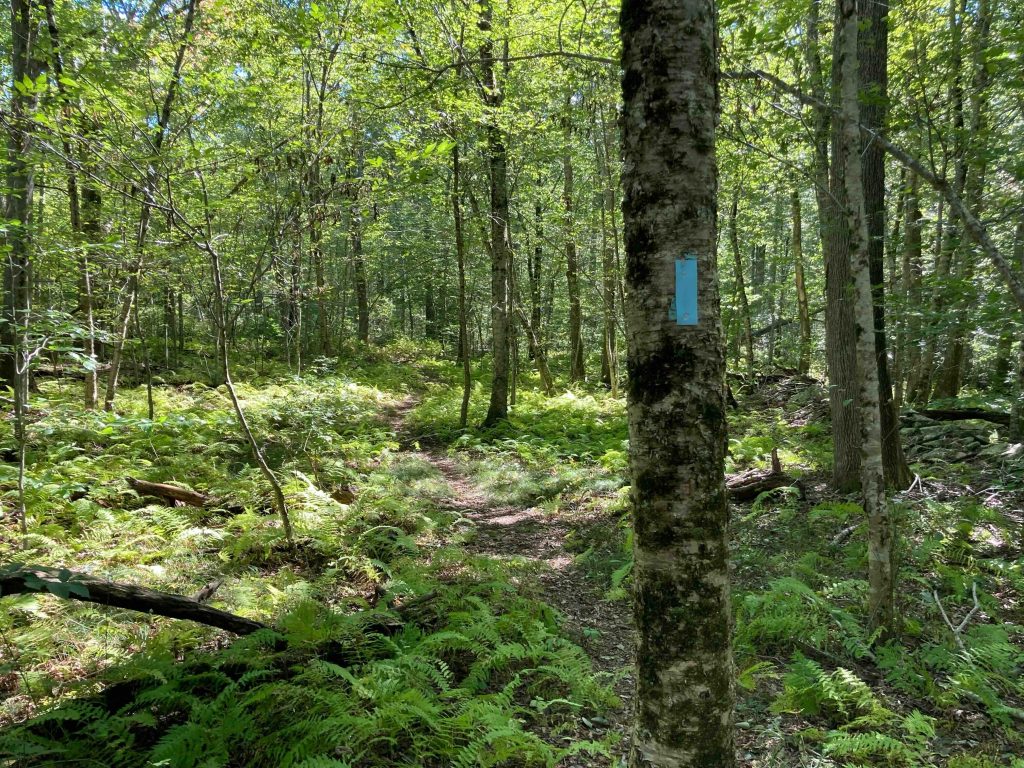
    The trail heads south between twin stonewalls in what must be an old farm before skirting a marshy area and entering an area of tall pines.  After just over a half mile you’ll cross Spaulding Road.  This stretch is lightly traveled winding through largely empty forest for close to a mile.  You’ll then start to overlap with the Pachaug State Forest Enduro Trail, very popular with dirt bikes and ATVs.  The Quinebaug Trail splits off fairly quickly jumping over some fallen trees and I found the blazing at this turn a little lacking but found the way.  The trail here is just old forest roads that work over rough gravel and dirt bike tire tracks down to Locke’s Meadow Pond after 1.5 miles.

    I’ve seen reference to Locke’s Meadow Pond as Wildlife Management Area, but given their ever hazy status I’m never sure on accuracy.  I also wonder if Locke’s Meadow turned into the present day pond thanks to beaver activity first or if the rough road at the north end was a man-made dam.

    The Quinebuag Trail follows the western edge of the pond but is almost always flooded so you’ll have to climb the bank and work around.  On my last hike I also had to push through the thick growth to avoid another massive puddle as I worked my way south.  Unfortunately, you once again overlap with the Enduro Trail again for a good long while for the next two miles or so until reaching the next section of trail at Hell Hollow.

    The one bright spot is the flat rocks off Flat Rock Road which form a low ledge with an ok view south next to a small perched erratic.  Devil’s Den also used to exist in this area, but what remains is no longer worth seeking out.

    Heading south: Hell Hollow

    History

    This section of trail has remained consistent as far as I can tell since the trails original blazing.  The trail used to end at Spaulding Road (with a road walk to Rt. 14A) until the last section was added sometime in the late 80s/90s

    Tags
    • ★★☆☆☆
    • 2022
    • 2023
    • Explored
    • Pachaug State Forest
    • Plainfield
    • Quinebaug Trail
    • Wildlife Management Areas
    • Windham County
    Last Updated

    The information shown here is for general reference purposes only. exploreCT.org gives no warranty, expressed or implied, as to the accuracy or reliability of this data. Parking in all areas, whether designated here or not, is at your own risk. exploreCT.org is not responsible for any damage or loss to vehicles or contents. Last updated January 2nd, 2023

    Trail Map
    Location
    • 309 Plainfield Pike, Plainfield, CT 06374, USA

      Get Directions
    Gallery
    Video
    Categories
    • Hiking
    Gallery
  • No comments yet.
  • Add a review

    Leave a Reply · Cancel reply

    Your email address will not be published. Required fields are marked *

    Overall Rating

    You May Also Be Interested In

    Spruce Brook Falls

    • ★★★★★
    • 16 miles
    Featured
    FW6F+CW Beacon Falls
    • Quick view
    • Bookmark

    Thach Preserve

    • ★★☆☆☆
    • 1 miles
    123 Brush Hill Rd
    • Quick view
    • Bookmark

    Mendell's Folly

    • ★★★★☆
    • 3.8 miles
    390 Beacon Rd
    • Quick view
    • Bookmark

    Hi, I’m Matt.

    I’m building ExploreCT to be the guide for all your outdoor adventures. All the trails, views, and waterways this great state has to offer.

    Now get out and explore!

    Monthly Newsletter

    Each month I share site updates or an interesting article in my newsletter. It’s short, sweet, and practical.

    600+ explorers read it, I’d love for you to join.

    Thank you!

    You have successfully joined our subscriber list.

    X-twitter Youtube Envelope Instagram

    Cart

      • Facebook
      • X
      • WhatsApp
      • Telegram
      • LinkedIn
      • Tumblr
      • Reddit
      • VKontakte
      • Mail
      • Copy link
      • Share via...
      • Threads
      • Bluesky