Site logo
    • Explore
      • Blue-Blaze Trails
      • Land Trusts
      • State Parks and Forests
      • By Town
    • exploreCT+
      • Membership
      • Shop
      • Events
    • Blog
    • Town Guides
    Sign in or Register
    Listing cover image

    Aicher Preserve

    • Trails
      1 miles
    • Rating
      ★★☆☆☆
    • Address
      151 Freedley Rd, Pomfret Center, CT 06259, USA
    • Explore
    • Trail Map
    • Reviews 0
    • New Page
    • prev
    • next
    • Bookmark
    • Share
    • Get directions
    • Report
    • prev
    • next
    At A Glance

    Wyndham Land Trust

    189.8 acres in Pomfret, CT

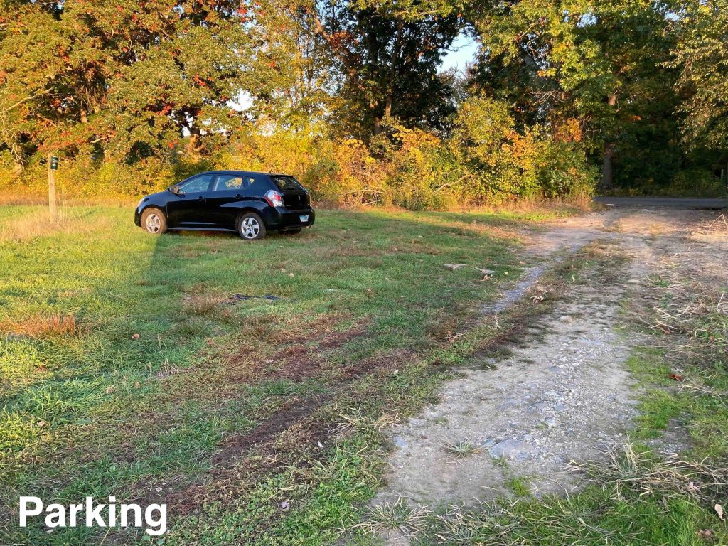
    Parking: Small lot inside the stonewall near 151 Freedley Rd, Pomfret Center, CT

    Trail Map          Trails: 1 mile        Rating: ★★☆☆☆

    Hiking

    When I first added this location to the site I was a bit skeptical there would be trails to hike here, but I’m glad to say there is a nice stroll, a hill climb, and even a bit of wooded trail.

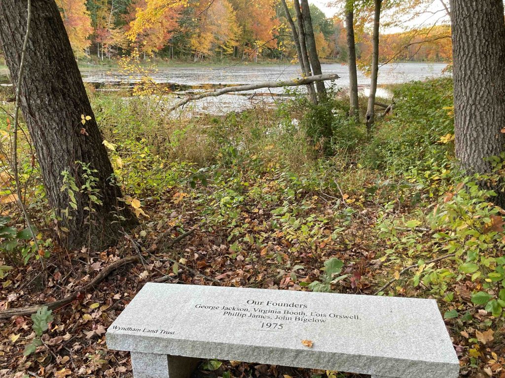
    On my Fall 2022 visit I parked in the small parking area inside the stonewall off Freedley Road.  The parking area is noted with a small sign between two active agricultural fields. The trail is a farm road leading down to small pond on Bark Meadow Brook.  There is a nice stone bench with a view of the pond dedicated to the founders of the Wyndham Land Trust (George Jackson, Virginia Booth, Lois Orswell, Phillip James, and John Bigelow in 1975).  Either beaver activity or recent rains had raised the water level just enough to cover the trail but I was able to hop over using some well placed stones and sticks.

    From the pond the trail enters another active hayfield and begins to climb a 505 foot hill.  Thick grass was thankfully only shin high and I followed the track of some machinery up the steep climb.  There is a side path (not marked on the trail map above) about a third of the way up the hill that winds its way through the forest just north of the field and rejoins at the northwest corner.  It has occasional worn blue blazes but seems to be roughly maintained and I took it on my trip back to the parking area.  On the way up the hill I wanted to get to the summit and take in the view.  It might be luck of the draw depending on the time of year you visit if this is easily accessible, but you get a decent view over the tree line which reminded me a lot of Knowlton Hill or Horsebarn Hill.

    The trails follows the line of the field to the corner where a narrow path (and a hay bale that rolled down the hill) connects to another field which you can follow out to Harrisville Road where this is rough parking across the road.

    It is also occasionally the site of Civil War reenactments.

    History

    Land preserved in 1998 and 2005.

    The preserve was logged in January to April of 2020 by Hull Forestry primarily of White Ash trees due to the anticipated arrival of the Emerald Ash Borer and the high prevalence of ash trees on the property.

    Tags
    • ★★☆☆☆
    • 2022
    • Explored
    • Pomfret
    • Windham County
    • Wyndham Land Trust
    Last Updated

    The information shown here is for general reference purposes only. exploreCT.org gives no warranty, expressed or implied, as to the accuracy or reliability of this data. Parking in all areas, whether designated here or not, is at your own risk. exploreCT.org is not responsible for any damage or loss to vehicles or contents. Last updated October 11th, 2022

    Trail Map
    Location
    • 151 Freedley Rd, Pomfret Center, CT 06259, USA

      Get Directions
    Gallery
    Categories
    • Hiking
    Gallery
  • No comments yet.
  • Add a review

    Leave a Reply · Cancel reply

    Your email address will not be published. Required fields are marked *

    Overall Rating

    You May Also Be Interested In

    Spruce Brook Falls

    • ★★★★★
    • 16 miles
    Featured
    FW6F+CW Beacon Falls
    • Quick view
    • Bookmark

    Thach Preserve

    • ★★☆☆☆
    • 1 miles
    123 Brush Hill Rd
    • Quick view
    • Bookmark

    Mendell's Folly

    • ★★★★☆
    • 3.8 miles
    390 Beacon Rd
    • Quick view
    • Bookmark

    Hi, I’m Matt.

    I’m building ExploreCT to be the guide for all your outdoor adventures. All the trails, views, and waterways this great state has to offer.

    Now get out and explore!

    Monthly Newsletter

    Each month I share site updates or an interesting article in my newsletter. It’s short, sweet, and practical.

    600+ explorers read it, I’d love for you to join.

    Thank you!

    You have successfully joined our subscriber list.

    X-twitter Youtube Envelope Instagram

    Cart

      • Facebook
      • X
      • WhatsApp
      • Telegram
      • LinkedIn
      • Tumblr
      • Reddit
      • VKontakte
      • Mail
      • Copy link
      • Share via...
      • Threads
      • Bluesky