The Wealth Around Us

One of the things that really kicked off ExploreCT for me was that as I tried to find more places to hike, instead of having to travel further, more kept turning up nearby. At first, I was only aware of local state parks and a couple of nearby town parks. Then I was introduced to Joshua’s Trust and later realized the power of the blue-blaze trails. As I continued to look, the number of trails nearby to… well anywhere, seemed to be applicable across the entire state. The goal of this post is to show what can turn up with a little looking.
Let’s dig in a bit:

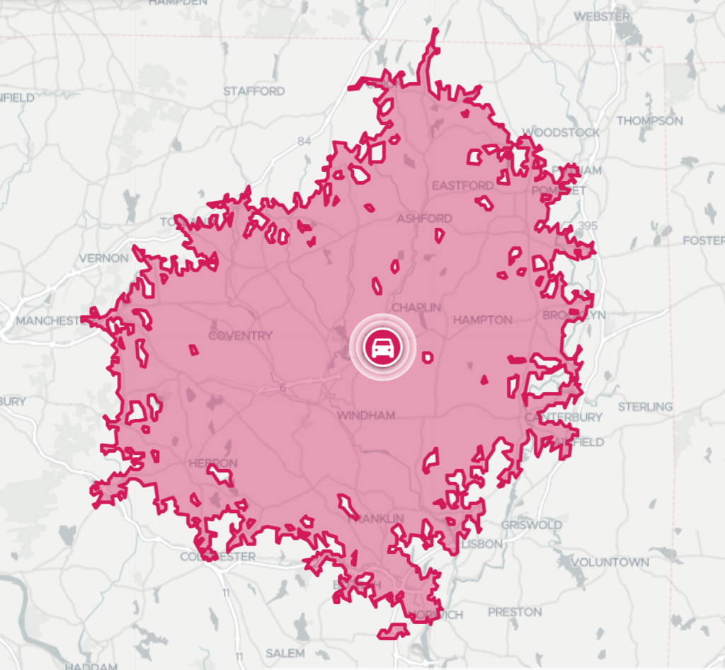
My hometown is Chaplin, CT located in the quiet corner of the state and it’s the area with which I’m most familiar. It is also the area where I can be most sure I’ve mapped nearly every hikeable location. The first map shows how far you can drive in 30 minutes from the center of Chaplin. It covers an area of approximately 500 square miles.

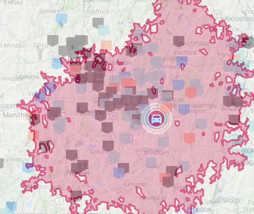
First, let’s figure out how many places there are to hike just within this area. Overlaying that drive radius onto the ExploreCT map gets the rough approximation below. I started by trying to count all the markers within the rough range of the overlay. After a couple of attempts I consistently came up with 121, but I couldn’t shake that I had missed more than a few.
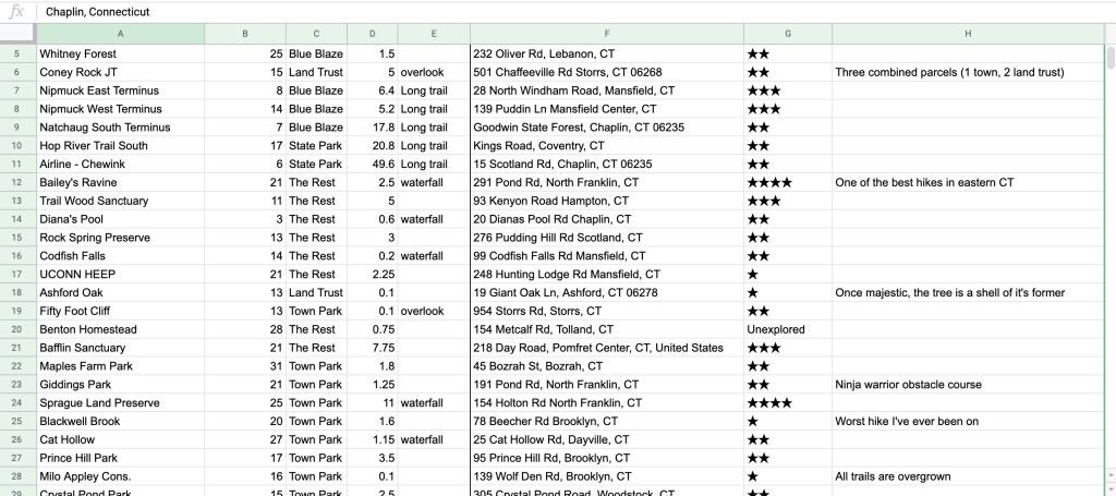
So next I decided to spend a couple of days building a spreadsheet that calculates the drive time instead of eye-balling it. Which included inputting each location, writing a formula to calculate the drive time, and rounding it out with some extra data.

Check out the full sheet at: https://docs.google.com/spreadsheets/d/1vzEV4_l8JgLC3wTyuYSO0CqNHAQTMh8y9SIMXdMr3I/
As it turns out there are 144 areas!
That’s access to 5 entire blue blaze trails, 46 land trust properties, 23 state parks (forests, WMAs, etc), 62 town parks, and 8 others. If you’re willing to add a few more minutes there are easily another 25 as well.
Within all those properties are 480 miles of trail. Four hundred and Eighty!
Now to be fair I did include the full length of trails like the blue blaze Shenipsit and the Airline and Hop River Linear Trails because you could go as far as you wanted on any of them. So just for a sense of completeness and to appease any sticklers, if you reduce any trail above ten miles down to reasonable day hike, say five miles, we still end up with 325 miles.
That’s hundreds of miles of trail through thousands of acres of forest, rolling hills, and river valleys. Past glacial erratics and stonewalls, rocky ledges and mossy riverbanks. A dozen waterfalls and just as many overlooks. Sites of native american lore and colonial history. Areas preserved for their headwaters or scenic beauty or ownership by prominent families.
Hiking may be a narrow band of life between family, work, and the to-do list. It can be a nice outdoorsy activity on a sunny weekend afternoon. However, when you dig in and lay it all out in this way, it shows this band isn’t so narrow at all. In fact, it’s more like a rich vein offering a wealth of opportunity. Now get out and explore!
Recent Adventures
The past months have been slow but steady adventuring. The highlights:
I paddled out to the island on Mono Pond to see if claims of a cave were true. I found secret campsites and an abandoned building in Mansfield Hollow. Played disc golf and explored the unused trails at Cross Farms. Checked out the reopened Sleeping Giant to see the recovery from storm damage. Hiked and filmed 32 miles with Mat Jobin from Reach Your Summit for CT Trails Day 2019 (movie on my YouTube channel).
Site Updates
I ran into my first real obstacle in a while with this website. The main map is only capable of displaying the 200 most recent locations I’ve added. Currently, this caps my vision of the map as being able to zoom into any spot in Connecticut and see all the hiking nearby. As a silver lining result, I’ve spent a good amount of time improving/working on the tag system for the site. This means that all properties can be narrowed by county (New London, Windham, etc), town (Mansfield, insert your town here), activity (hiking, boating, disc golf), feature (waterfall, overlook, history), by blue-blaze (Nipmuck, Shenipsit), rating (★★★★★, ★★), and more. Tags are located near the bottom above the “related listings” feature. I’m well aware most users don’t interact with the site this deeply, but it lays the groundwork for that ‘Where to Start’ page I’m perpetually working on. So play around with the tags and let me know what you think!
As always, email all Chaplin facts, hiking spreadsheets, and tag ideas to matt@exploreCT.org. Thanks for joining the newsletter.
– Matt
