Site logo
    • Explore
      • Blue-Blaze Trails
      • Land Trusts
      • State Parks and Forests
      • By Town
    • exploreCT+
      • Membership
      • Shop
      • Events
    • Blog
    • Town Guides
    Sign in or Register
    Listing cover image

    Sunrise Park

    • Trails
      1 miles
    • Rating
      ★★☆☆☆
    • Explore
    • Trail Map
    • Reviews 0
    • New Page
    • prev
    • next
    • Bookmark
    • Share
    • Report
    • prev
    • next
    At A Glance

    Suffield Town Park

    134 acres in Suffield, CT

    Parking: Medium sized lot near 2075 Mountain Rd, West Suffield, CT

    Trail Map          Trails: 1.3 miles     Rating: ★★☆☆☆

    Note: On weekends and holidays from Memorial Day through Labor Day non-Suffield residents will be charged $35/car up to 5 people (and $5 per additional adult 14 years and over). Suffield residents should obtain a sticker from the Town Clerk for free parking

    Sunrise Park is a great well maintained park with hiking trails, a beach and pond, pavilion, playscape, fitness trail, horseshoes, open field, and disc golf course. The $35 I believe was instituted in 2021, but thankfully I visited on a nice October day.

    Hiking

    The trail map shown above includes a huge green ‘Boundary Trail’ and an orange ‘Over the Mountain Trail’ both unfortunately appear to be no longer maintained.  There are however 1.3 miles of well traveled trails around the pond.

    • West Shore Trail – Yellow Blaze – 0.4 miles
      • Starting from the beach area at the south end of the pond the yellow blazed trail heads up into the trees to a picnic grove among the pines and just beyond that a small campsite and tent platform.  You likely have to request access from the park superintendent to camp in the park.
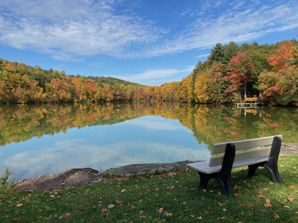
      • The trail follows the namesake west shore and is very rocky and rooty with a couple old foot bridges and muddy slips.  There are a number of great views of the pond from the trail.
    • Eagle Cliff Trail – Blue Blaze – 0.5 miles
      • Eagle Cliff could just easily be known as the east shore trail though it provides fewer views of the water and instead has a handful of small rocky features. There is also an outdoor amphitheater with benches grown into the trees, a grassy area with benches for viewing the pond, and the pavilion right on the water.
    • Austin Brook Trail – Red Blaze – 0.4 miles
      • Unexplored
    • Deer Run Trail – Green Blaze – 0.4 miles
      • A steep forested climb from the north end of the pond towards West Suffield Mountain connecting to the blue blaze Metacomet Trail for extended hikes.
    Disc Golf

    The disc golf course here should only be played late-fall to early spring when the $35 isn’t required to enter the park for non-residents.  The course, installed in 2009, is 9 holes made by using different tee pads for four different baskets.  It can be reached by taking a left on the entrance road before reaching the pond.

    The course is mostly open and easy for beginners with some nice chip and putt shots, but certainly difficult to play if anyone else is on the course.

    History

    Purchased by the residents of Suffield through fundraising in a town-wide donation process, the property is from the estate of Edward M. White. It was dedicated as a town park on July 2, 1966. The name was suggested by Mrs. Karl Kulle because of the Easter Sunday Services held there annually.

    The dam and pond were created by Edward White who copied an 1890s plan for the town’s first municipal water system that was instead ignored in favor of deep wells near the town center.

    Links

    CTMQ – Sunrise Park (2018)

    Tags
    • ★★☆☆☆
    • 2022
    • Explored
    • Hartford County
    • Metacomet Trail
    • New England Trail
    • Suffield
    Last Updated

    The information shown here is for general reference purposes only. exploreCT.org gives no warranty, expressed or implied, as to the accuracy or reliability of this data. Parking in all areas, whether designated here or not, is at your own risk. exploreCT.org is not responsible for any damage or loss to vehicles or contents. Last updated October 16th, 2022

    Trail Map
    Gallery
    Categories
    • Hiking
    • Swimming
    • Boating
    • Fishing
    • Disc Golf
    Gallery
  • No comments yet.
  • Add a review

    Leave a Reply · Cancel reply

    You must be logged in to post a comment.

    You May Also Be Interested In

    Spruce Brook Falls

    • ★★★★★
    • 16 miles
    Featured
    FW6F+CW Beacon Falls
    • Quick view
    • Bookmark

    White Oak Preserve

    • Unexplored
    • 0.2 miles
    600 Raymond Hill Rd
    • Quick view
    • Bookmark

    Woodlands Nature Preserve

    • Unexplored
    • 0.5 miles
    99 Beacon Hill Dr
    • Quick view
    • Bookmark

    Hi, I’m Matt.

    I’m building ExploreCT to be the guide for all your outdoor adventures. All the trails, views, and waterways this great state has to offer.

    Now get out and explore!

    Monthly Newsletter

    Each month I share site updates or an interesting article in my newsletter. It’s short, sweet, and practical.

    600+ explorers read it, I’d love for you to join.

    Thank you!

    You have successfully joined our subscriber list.

    X-twitter Youtube Envelope Instagram

    Cart

      • Facebook
      • X
      • WhatsApp
      • Telegram
      • LinkedIn
      • Tumblr
      • Reddit
      • VKontakte
      • Mail
      • Copy link
      • Share via...
      • Threads
      • Bluesky