The Narragansett Trail currently runs 15 miles across North Stonington to the Rhode Island border. The trail continues into Rhode Island switching to yellow blazes.
Currently a thru-hike is only possible with a road walk:
Wintechog Hill section has been temporarily closed since 2015 with no route around reopened as of 2024 though is as yet unblazed
Groton Sportmans Club section is permanently closed requiring a road walk reroute
Lantern Hill–★★★★– 1.2 miles – The trail starts with a bang from the popular overlooks and rich history of Lantern Hill
Unblazed section over Wintechog Hill — 2 miles – This section was closed for 9 years while “clearing a large property for pastureland”, recently reopened and unexplored
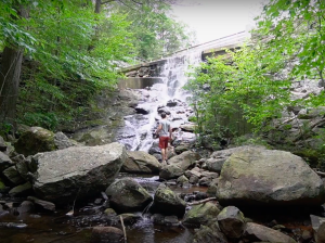
Cossaduck Bluffs–★★★– 3.3 miles – Climbing to rocky ledges and a nice overlook before following the Yawbucs Brook north
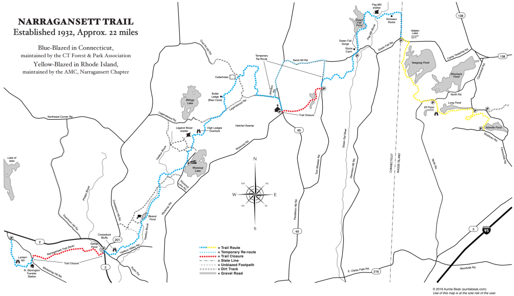
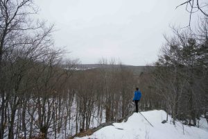
Legend Wood— ★★★ — 4.1 miles – A high overlook of Wyassup Lake, a lean-to, and a cave in this section of the Pachaug State Forest
Camping Area Legend Wood Shelter lean-to several hundred feet northwest of the High Ledge Overlook
Unblazed Road walk — 1.9 miles – Left on Legend Wood Rd ➜ Left onto Johnson Rd ➜ Left onto Rt. 49 ➜ Right onto Tom Wheeler Rd ➜ Right onto Sand Hill Rd
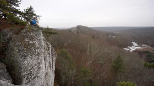
Green Fall Pond–★★★– 1 mile – This trail is unused though passable off Sand Hill Rd, but once you reach the Green Fall river and the ravine it becomes fantastic and a hidden gem
Camping Area Peg Mill Shelter
Dinosaur Rocks–★★– 1.2 miles – I found the Dinosaur rocks underwhelming, but there is another cave on this eastern terminus section
Cross into Rhode Island
The Narragansett Trail is one of Connecticut’s older blue blaze trails completed in 1936