Site logo
    • Explore
      • Blue-Blaze Trails
      • Land Trusts
      • State Parks and Forests
      • By Town
    • exploreCT+
      • Membership
      • Shop
      • Events
    • Blog
    • Town Guides
    Sign in or Register
    Listing cover image

    Macricostas Preserve

    • Trails
      6 miles
    • Rating
      ★★★★☆
    • Address
      124 Christian St, New Preston, CT 06777, USA
    • Explore
    • Trail Map
    • Reviews 0
    • New Page
    • prev
    • next
    • Bookmark
    • Share
    • Get directions
    • Report
    • prev
    • next
    At A Glance

    Steep Rock Association

    560 acres in Washington, CT

    Parking: Medium sized lot near 124 Christian St, New Preston, CT

    Trail Map         Trails: 5.6 miles          Rating: ★★★★☆

    The Macricostas Preserve quickly jumped near the top of my list for favorite hikes with well managed trails, two great overlooks, and many natural touches.

    Hiking

    Started from the parking lot the trailhead sits just over the bridge installed in 2020.  There is a short loop through the Judea Garden a small community garden, but the majority of trails fork to the right towards Bee Brook.  Passing a bench dedicated to a former president of the Steep Rock Association, cross the bridge over Bee Brook, walk the long boardwalk, and take the log lined steps up among into the field.  This area is fantastic for bird watching with bird houses dotting the fields.  I even spotted a blue heron gliding its way to Meeker Swamp.

    Walking through a tree line leads to an active hay field which has its own 1.2 mile loop around its edge.  I hiked over to the backside and took the short side trail to the Meeker Swamp viewing platform (built in part by volunteers like John Aiello).  The platform is a good 10 feet tall looking down over the swamp and a signboard highlights the area’s designation as an Audubon Important Bird area, part of the Shepaug Forest Block.

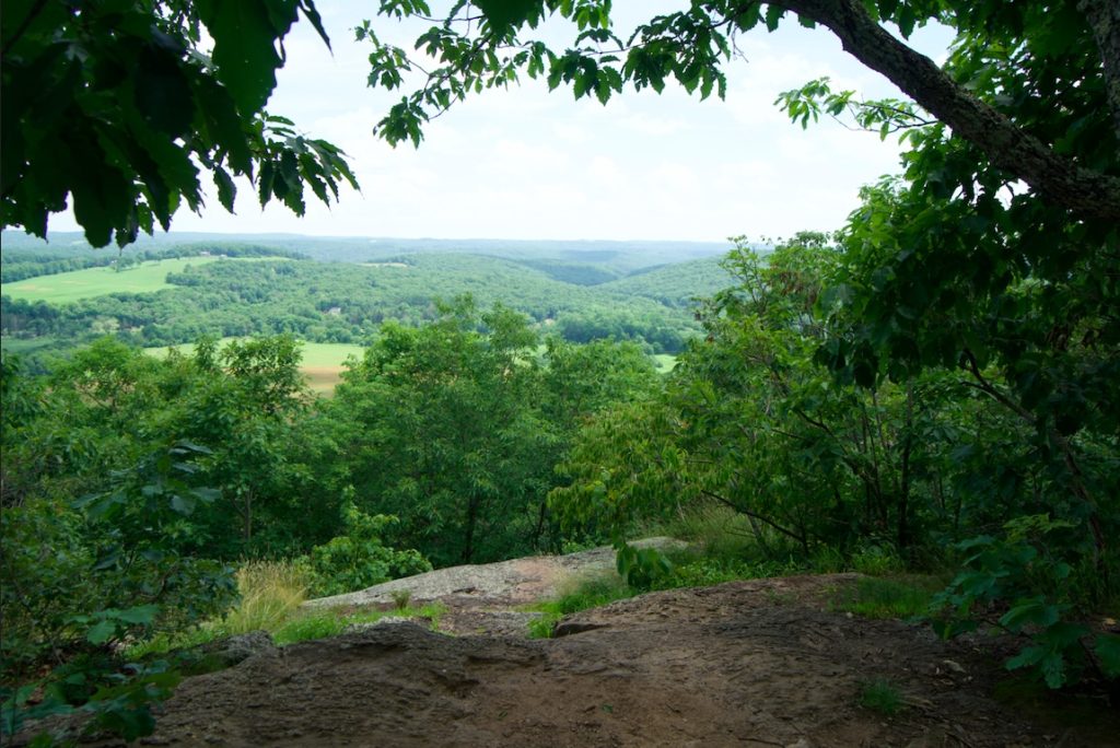
    Back on the yellow trail you’ll cross Bee Brook again (on a newly rebuild Clarke’s Bridge built in spring 2022) and another series of boardwalks before making the steep climb to the first overlook.  It is a challenging climb, but well worth the effort.  The Macricostas Overlook has views south down over the field you just hiked through and beyond to the hills of Washington.

    Past the overlook is another climb towards Waramaug’s Rock.  The ground does eventually level out and the humid (at least in June) buggy lowlands are replaced by breezy highlands.

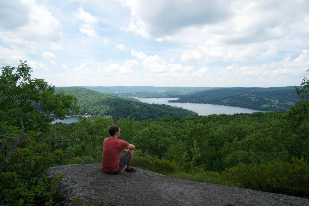
    Waramaug’s Rock is an amazing view, easily in my top 10 for the state.  The rocky area has three good views north down to Lake Waramaug and west towards New York.

    There is also Waramaug’s Trail which leads steeply down to June Road along the lake.  This trail dates back to at least the 70s and was once the main way to reach the overlook. It was officially protected in 2012.

    History

    The Macricostas Preserve was first preserved in 2000 when the original 238 acres were purchased from the Macricostas Family.  The Association has received other gifts and easements over the past couple decades expanding the preserve. Between 2017 and 2019 the Association added 100 acres at the northern boundary in the ‘Pinnacle Valley’ area and hopes to add at least another 200 acres and 10 more miles of trails.

    In September 2022, Steep Rock added 15 acres adjacent to the preserve

    Links

    Peter Marteka – Washington’s Macricostas Preserve: As Close To Perfection As It Gets (2013)

    CTMQ – SRA: Macricostas Preserve (2013)

    Steep Rock Association – Macricostas Preserve Expansion (2018)

    Tags
    • ★★★★☆
    • 2021
    • Explored
    • Litchfield County
    • Overlooks
    • Peter Marteka
    • Steep Rock Association
    • Washington
    Last Updated

    The information shown here is for general reference purposes only. exploreCT.org gives no warranty, expressed or implied, as to the accuracy or reliability of this data. Parking in all areas, whether designated here or not, is at your own risk. exploreCT.org is not responsible for any damage or loss to vehicles or contents. Last updated June 28th, 2021

    Trail Map
    Location
    • 124 Christian St, New Preston, CT 06777, USA

      Get Directions
    Gallery
    Video
    Categories
    • Hiking
    Gallery
  • No comments yet.
  • Add a review

    Leave a Reply · Cancel reply

    Your email address will not be published. Required fields are marked *

    Overall Rating

    You May Also Be Interested In

    Spruce Brook Falls

    • ★★★★★
    • 16 miles
    Featured
    FW6F+CW Beacon Falls
    • Quick view
    • Bookmark

    Bartholomew Open Space

    • Unexplored
    • 0.6 miles
    72 Buttonball Rd
    • Quick view
    • Bookmark

    Avery Nature Preserve

    • Unexplored
    • 2.6 miles
    60R Scotch Cap Rd
    • Quick view
    • Bookmark

    Hi, I’m Matt.

    I’m building ExploreCT to be the guide for all your outdoor adventures. All the trails, views, and waterways this great state has to offer.

    Now get out and explore!

    Monthly Newsletter

    Each month I share site updates or an interesting article in my newsletter. It’s short, sweet, and practical.

    600+ explorers read it, I’d love for you to join.

    Thank you!

    You have successfully joined our subscriber list.

    X-twitter Youtube Envelope Instagram

    Cart

      • Facebook
      • X
      • WhatsApp
      • Telegram
      • LinkedIn
      • Tumblr
      • Reddit
      • VKontakte
      • Mail
      • Copy link
      • Share via...
      • Threads
      • Bluesky