Kettletown State Park
605 acres in Oxford and Southbury, CT
Parking: Several small lots at 1400 Georges Hill Rd, Southbury, CT
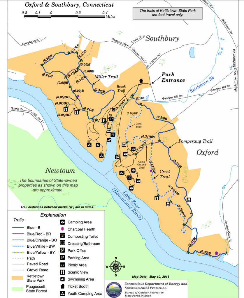
Trail Map Trails: 5 miles Rating: ★★★☆☆
Note: Closed as of 8/20/24 due to heavy rains and flooding damaging trails
Kettletown State Park has about six miles of trails in two loops as well as a brookside trail. There are a number of overlooks along the northern Miller Trail and the southern Crest Trail that provide views of Lake Zoar and the Housatonic River. The trails also pass historical charcoal hearths.
Kettletown offers 60 camping sites including six cabins and one site with water and electric hookups. The camping map can be found here. There are also picnicking spots, an amphitheater, and horseshoe pits.
There is also a small beach and swimming area.
History:
Established as a state park in 1950. From the DEEP site, it was, “originally inhabited by the Pootatuck Indians, members of the Algonquin group. Early colonists reportedly traded one brass kettle for use of the land for hunting and fishing. Eventually, the settlers acquired complete rights to the area and, by 1758, the Pootatucks had either migrated to the northwest or perished.”
Links:
- The Geology of Kettletown State Park
- Peter Marteka – Kettletown State Park Offers Views, And A History Lesson (2015)
The information shown here is for general reference purposes only. exploreCT.org gives no warranty, expressed or implied, as to the accuracy or reliability of this data. Parking in all areas, whether designated here or not, is at your own risk. exploreCT.org is not responsible for any damage or loss to vehicles or contents.
Visited 4186 times, 2 Visits today