Site logo
    • Explore
      • Blue-Blaze Trails
      • Land Trusts
      • State Parks and Forests
      • By Town
    • exploreCT+
      • Membership
      • Shop
      • Events
    • Blog
    • Town Guides
    Sign in or Register
    Listing cover image

    Jones Mountain

    • Trails
      3 miles
    • Rating
      ★★★☆☆
    • Address
      161 Steele Rd, New Hartford, CT 06057, USA
    • Explore
    • Trail Map
    • Reviews 0
    • New Page
    • prev
    • next
    • Bookmark
    • Share
    • Get directions
    • Report
    • prev
    • next
    At A Glance

    New Hartford Land Trust

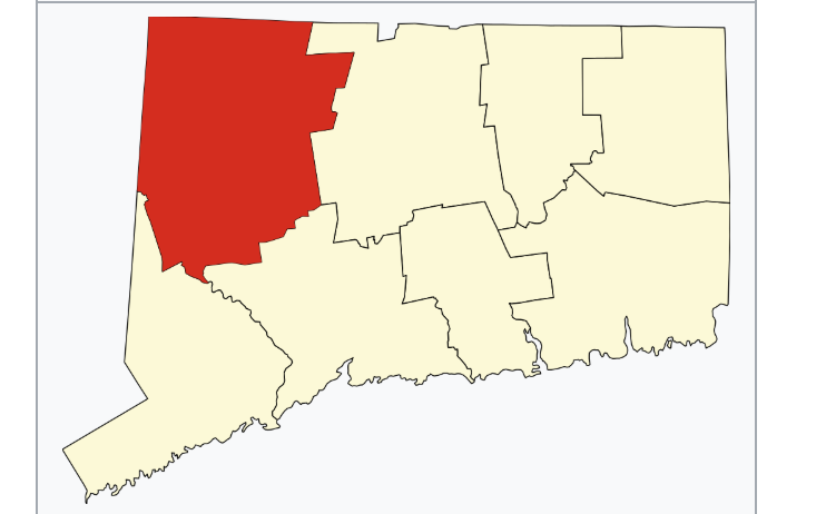
    284 acres in New Hartford, CT

    Parking: Shoulder parking near 161 Steele Rd, New Hartford, CT

    Trail Map         Trails: 2.5 miles       Rating: ★★★☆☆

    Jones Mountain has a small parking area along Steele Rd for about 8 cars.  The property features old carriage path trails, a vista overlook, and old farm ruins.

    Hiking

    Starting from the parking area past the kiosk a rocky white blazed access trails leads up to the red loop.  Taking a left will reach the ruins and overlook sooner, but I took the right heading uphill through open forest.

    As the trail crests the hill it turns onto one of the properties old carriage roads built in the early 1900s providing a wide flat path crosses a well-built wooden footbridge over an unnamed stream.  Ropes, signs, and warnings all prevent you from leaving the trail to the right as the adjacent property is a private hunting area belonging to the Kingdom Game Club.

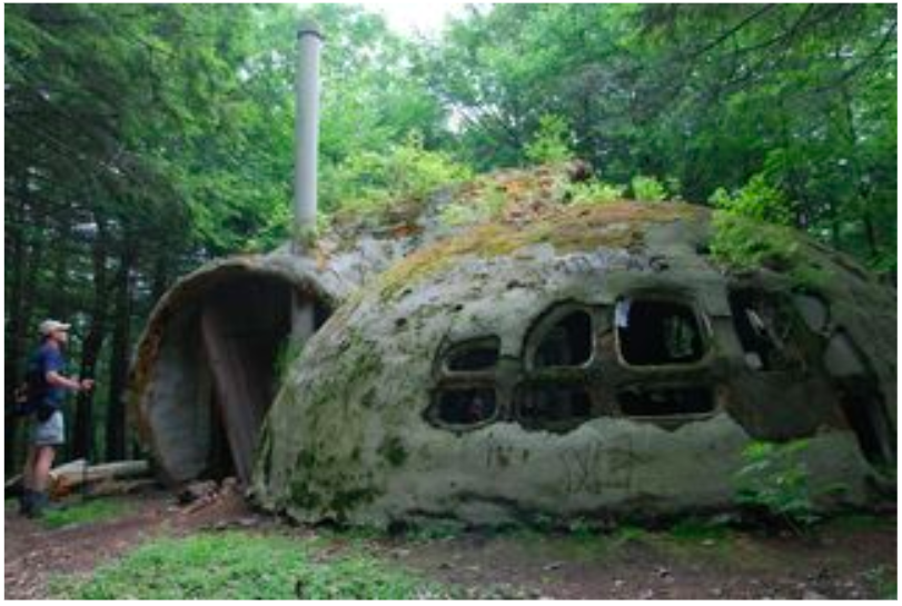
    The red trail then loops around the summit of Jones Mountain (elevation 985′) and on the backside there is a short trail to all the remains of the “foam dome” that used to be here.  Today there is only the remains of the structure’s chimney.

    Overlook

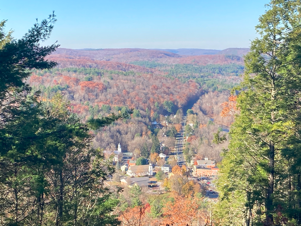
    The red trail next reaches the overlook, a 200ft clearing down the slope with views to downtown New Hartford and Rt. 44 as it curls along the Farmington River.  If you search along the ledges there are names and dates carved into the rock dating as far back as the 1830s.

    The overlook was most recently cleared in 2018 when the town removed at least 75 trees and a nicely tiled 10′ by 24′ terrace was installed with New York blue stone purchased from Torrington’s O&G Industries Inc. A bench dedicated to Joni Ellett Norton, “whose effervescence brought light to those around her.” was added to sit and enjoy the view.

    Taking the red trail back towards the parking area heads downhill on the old carriage road along stone lined culverts and a handsome stone bridge that reminded me of Wadsworth Falls bridges.  There is a brief detour off the carriage road to navigate around private property.  The trail soon reaches the ruins of what must have been a barn and holding pond which feature some rusting farming equipment.  From here is a short walk back to the parking.

    I also missed a side trail somewhere in this section to memorial for the Jones family on a large boulder squared by stone walls.

    History

    The original 158 acres was preserved in 2006.

    The property was formerly the Jones family homestead known as “The Woodlands”.  The Jones were one of the first settlers of New Hartford around 1670 and owned the land for five generations.

    The ‘foam dome’ was built by a Jones family member as an architecture project in the 1970s.  It was often referred to as a Hobbit House and was slowly reclaimed by nature and disrupted by vandals.  The town started talking about removing it in 2012, but apparently it was a fire that ultimately destroyed it sometime around 2015.

    The ‘foam dome’ in 2010. Photo by David K. Leff

    Jones Mountain was also the sight of a ‘notorious murder case‘ in 1978.

    Links

    Jones Mountain Environmental Review Report (2004)

    Peter Marteka – There’s Magic On New Hartford’s Jones Mountain (2010)

    Peter Marteka – A Place Where Trolls Could Roam (2011)

    Tags
    • ★★★☆☆
    • 2020
    • Explored
    • Litchfield County
    • New Hartford
    • New Hartford Land Trust
    • Overlooks
    • Peter Marteka
    • Ruins
    Last Updated

    The information shown here is for general reference purposes only. exploreCT.org gives no warranty, expressed or implied, as to the accuracy or reliability of this data. Parking in all areas, whether designated here or not, is at your own risk. exploreCT.org is not responsible for any damage or loss to vehicles or contents. Last updated November 9th, 2020

    Trail Map
    Location
    • 161 Steele Rd, New Hartford, CT 06057, USA

      Get Directions
    Gallery
    Categories
    • Hiking
    Gallery
  • No comments yet.
  • Add a review

    Leave a Reply · Cancel reply

    You must be logged in to post a comment.

    You May Also Be Interested In

    Spruce Brook Falls

    • ★★★★★
    • 16 miles
    Featured
    FW6F+CW Beacon Falls
    • Quick view
    • Bookmark

    Anderson Pond Boat Launch

    • Unexplored
    441 Cossaduck Hill Rd
    • Quick view
    • Bookmark

    White Oak Preserve

    • Unexplored
    • 0.2 miles
    600 Raymond Hill Rd
    • Quick view
    • Bookmark

    Hi, I’m Matt.

    I’m building ExploreCT to be the guide for all your outdoor adventures. All the trails, views, and waterways this great state has to offer.

    Now get out and explore!

    Monthly Newsletter

    Each month I share site updates or an interesting article in my newsletter. It’s short, sweet, and practical.

    600+ explorers read it, I’d love for you to join.

    Thank you!

    You have successfully joined our subscriber list.

    X-twitter Youtube Envelope Instagram

    Cart

      • Facebook
      • X
      • WhatsApp
      • Telegram
      • LinkedIn
      • Tumblr
      • Reddit
      • VKontakte
      • Mail
      • Copy link
      • Share via...
      • Threads
      • Bluesky