
Geology of Connecticut
Geology at a Glance
The State has three major geologic regions—the eastern and western highlands, each composed of older, metamorphic rock, and a central valley, largely composed of basalt overlain by sandstone.
This page is a work in progress if you’re interested in more information, shoot me an email (see bottom of the page) and let me know how this page could be of better use to you!

History
- 1842 James Gates Percival – Report on the Geology of Connecticut
- In 8 months surveyed the state East to West at 4 mile intervals. The resurveyed again East to West at intervals between the former to bring him in contact with each of the 4600 square miles of the state.
- He collected estimated 8000 specimens, as well as noted dips, bearings, and formations making it likely the most accurate survey ever conducted of the state
- However, despite two years of survey and he was “rushed” by the state legislature and wrote a “hasty outline” of over 500 pages
- 1906 Manual of the Geology of Connecticut and Preliminary Geological Map by William North Rice and Herbert Ernest Gregory
- 1924 H. H. Robinson – State Geological and Natural History Survey
- 1977 The Connecticut Assembly names Garnet the state mineral
- 1985 John Rodgers (compiler) Bedrock Geological Map of Connecticut
- 1842 James Gates Percival – Report on the Geology of Connecticut
Links
- Bedrock Map
- State of Connecticut Geological Survey
- Metacomet Ridge
- Caves of Connecticut
- Connecticut’s Garnet Trail
- Meteorites in Wethersfield and Weston — Unexplored
Geologic Reports of Parks
State Parks
- Bluff Point – Surficial and bedrock geology can be studied here. Of note is the beach composition and the rocky bluffs at the point
- Bolton Notch – At the very top of the “notch” is marble exposure and along the face are several caves large enough to accommodate a human. Calcite is the predominate mineral in the marble.
- Campbell Falls – The park is covered in glaical till, the falls are part of the Dalton Formation with nearly vertical granitic gneiss
- Chatfield Hollow – Monson Gneiss, rockfall caves
- Day Pond – Brimfield Schist
- Dennis Hill
- Devil’s Hopyard
- Dinosaur – A 200 million year old sandy lakeshore is now a sandstone layer of the East Berlin formation preserving the tracks
- Gay City
- Gillette Castle
- Hammonasset Beach
- Haystack Mountain
- Kent Falls
- Kettletown
- Macedonia Brook
- Mansfield Hollow
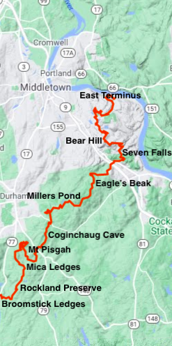
- Millers Pond
- Mount Tom
- Osbournedale
- Penwood
- Putnam Memorial
- Rocky Neck
- Sherwood Island
- Sleeping Giant
- Southford Falls
- Wadsworth Falls
Other Parks”]
{{label}}: {{displayValue}}
{{displayValue}}
{{displayValue}}
{{locationDetails}}
Browse sub-categories
Showing 1 result
Showing {{ showing }} out of {{ foundPosts }} results
