Site logo
    • Explore
      • Blue-Blaze Trails
      • Land Trusts
      • State Parks and Forests
      • By Town
    • exploreCT+
      • Membership
      • Shop
      • Events
    • Blog
    • Town Guides
    Sign in
    Listing cover image

    Gallows Hill Natural Area

    • Trails
      3 miles
    • Rating
      Unexplored
    • Address
      8HCR+5V Redding, CT, USA
    • Explore
    • Trail Map
    • New Page
    • prev
    • next
    • Share
    • Get directions
    • Report
    • prev
    • next
    At A Glance

    Gallows Hill Natural Area & Yovan Tract

    Redding Town Park

    72.9 acres in Redding, CT

    Parking: 

      • Gallows Hill: Shoulder parking near 142 Gallows Hill Rd, Redding, CT
      • Yovan Tract: Shoulder parking near 53 Drummer Ln, Redding, CT

    Trail Map            Trails: 2.5 miles       Rating: Unexplored

    This is a partial/incomplete listing as I have not yet explored the Gallows Hill Natural Area or the Yovan Tract.

    History

    From the Redding Book of Trail,

    "Formerly known as the Falasca Tract, the Gallows Hill Natural Area was acquired by the Town of Redding in 1974. The trails system was designed in 1980 by Clifford Emanuelson, director of Devil's Den Preserve in Weston. The woodland here is typical successional Yankee forest, and watercourses flow generally south to the Saugatuck River.
    In the winter of 1779, troops under the command of General Israel Putnam were encamped in these woods. The "Fifth Connecticut" refers to a Colonial regiment comprised of men from Redding and Ridgefield (though the Fifth camped elsewhere). The "Noose" refers to the hanging nearby of a redcoat spy-thus, Gallows Hill."

    Tags
    • Unexplored
    • Redding
    • Fairfield County
    • History
    Last Updated

    The information shown here is for general reference purposes only. exploreCT.org gives no warranty, expressed or implied, as to the accuracy or reliability of this data. Parking in all areas, whether designated here or not, is at your own risk. exploreCT.org is not responsible for any damage or loss to vehicles or contents.

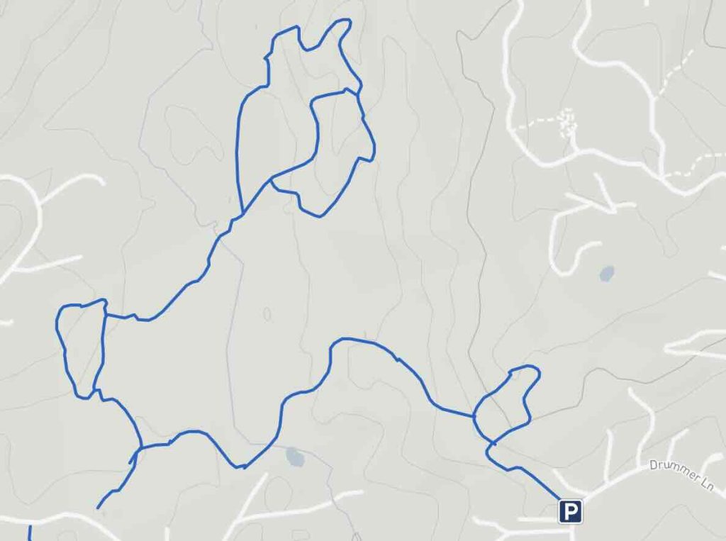
    Trail Map
    Location
    • 8HCR+5V Redding, CT, USA

      Get Directions
    Categories
    • Hiking
    Gallery

    You May Also Be Interested In

    Spruce Brook Falls

    • ★★★★★
    • 16 miles
    Featured
    FW6F+CW Beacon Falls
    • Quick view
    • Bookmark

    Mary Anne Guitar Preserve

    • Unexplored
    • 2.8 miles
    12 Old Mailcoach Rd
    • Quick view
    • Bookmark

    McCormack Preserve

    • Unexplored
    • 3.5 miles
    1 George Hull Hill Rd
    • Quick view
    • Bookmark

    Hi, I’m Matt.

    I’m building ExploreCT to be the guide for all your outdoor adventures. All the trails, views, and waterways this great state has to offer.

    Now get out and explore!

    Monthly Newsletter

    Each month I share site updates or an interesting article in my newsletter. It’s short, sweet, and practical.

    600+ explorers read it, I’d love for you to join.

    Thank you!

    You have successfully joined our subscriber list.

    X-twitter Youtube Envelope Instagram

    Cart

      • Facebook
      • X
      • WhatsApp
      • Telegram
      • LinkedIn
      • Tumblr
      • Reddit
      • VKontakte
      • Mail
      • Copy link
      • Share via...
      • Threads
      • Bluesky