Site logo
    • Explore
      • Blue-Blaze Trails
      • Land Trusts
      • State Parks and Forests
      • By Town
    • exploreCT+
      • Membership
      • Shop
      • Events
    • Blog
    • Town Guides
    Sign in or Register
    Listing cover image

    Dinosaur Caves

    • Trails
      2 miles
    • Rating
      ★★☆☆☆
    • Address
      G6M5+35 Voluntown, CT, USA
    • Explore
    • Trail Map
    • Reviews 0
    • New Page
    • prev
    • next
    • Bookmark
    • Share
    • Get directions
    • Report
    • prev
    • next
    At A Glance

    Narragansett: Dinosaur Caves

    Connecticut State Forest and Blue Blaze Trail

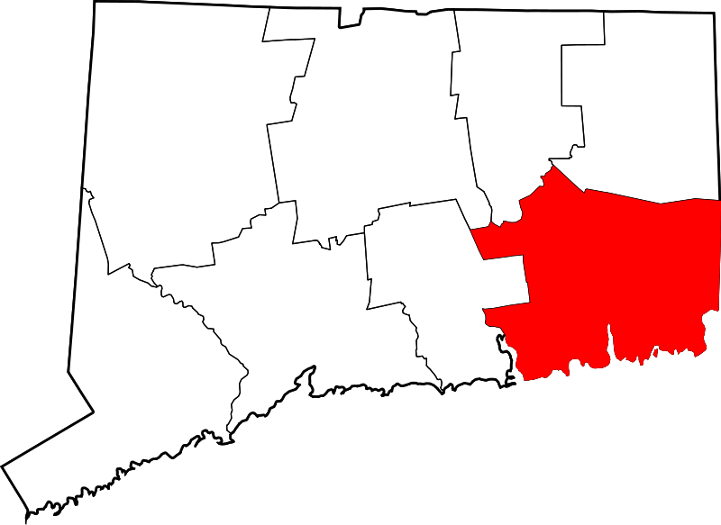
    200 acres in Voluntown, CT

    Parking: Small lot on Camp Yawgoog Rd, Rockville, RI

    Trail Map         Trails: 2 miles           Rating: ★★☆☆☆

    Hiking

    This section is the eastern terminus of the Narragansett Trail.

    Contrary to my descriptions of the other sections of the Narragansett Trail I’ll describe this one east to west.  The trail starts off the dirt Camp Yawgoog Road directly across from the stone pillar marking the CT/RI border.  The trail heads north along the border line between the two states and along the border of Pachaug State Forest and Camp Yawgoog.

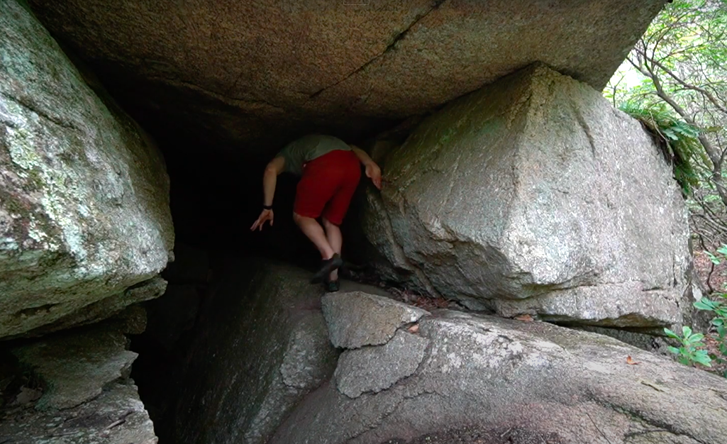
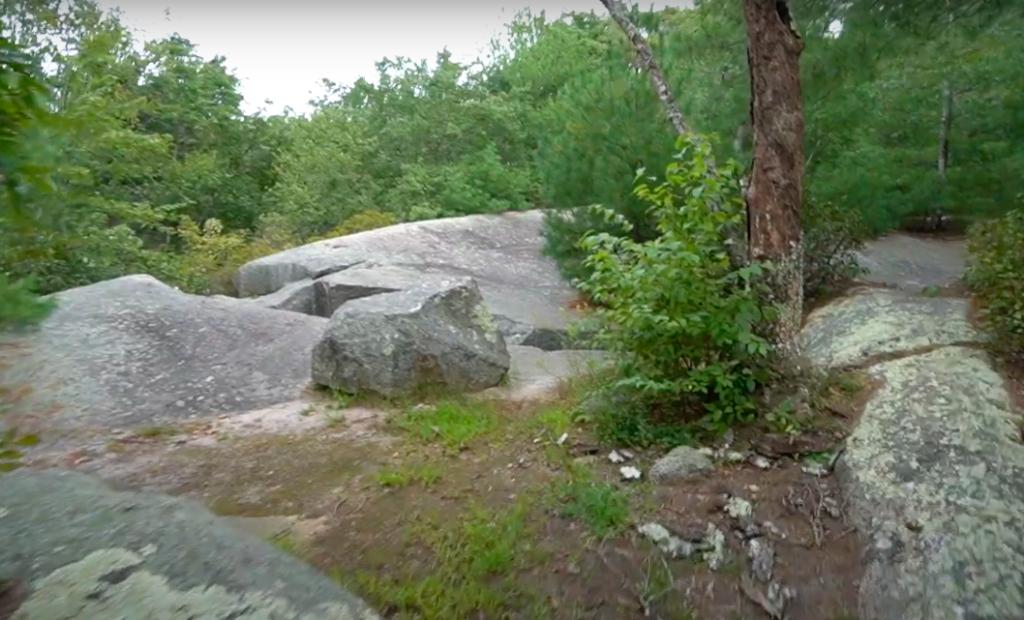
    In less than half a mile you’ll reach the Dinosaur Cave and Cliffs.  I was pretty underwhelmed on my hike as the cliffs are a rocky outcrop without a view.  The caves in this case are either deep fissures in the rock from above or overhangs from below and both require some imagination to be called caves. There are side trails to reach the bottom through it often swampy and impassable.

    The trail continues north along the border until reaching a fork with the Tippacansett trail heading right off into Rhode Island and the Narragansett traill heading left into Connecticut.  You’ll soon reach a stream and some open water.  It was once known as ‘Burnt Swamp’ but today seems to be called Green Fall Marsh.  There is a narrow unblazed trail here following the edge of the water north to wide rocks where a better cave can be found by poking around the boulders on the eastern edge.  This cave is about 50ft deep with upper and lower passages around a large boulder at the back but is still really just a rocky overhang.

    Back on the Narragansett Trail you’ll head west through thick mountain laurel until reaching the ruins of Peg Mill and the Peg Mill Shelter.

    Next section: Green Fall Pond

    History

    From the Story of the Yawgoog trails site,

    The trail eventually encounters the site of an old mill on Peg Mill Brook, a tributary of the Green Fall River. The mill’s complex stone foundation features a 200-foot (61-meter), underground sluiceway, which runs from southwest to northeast. The tunnel was fed by a little pond confined by a small, simple, stone and earth dam; water still flows through the sluiceway after a heavy rain. The Williams and Tracy version of the trail guide names the location as the “old Thomas Mill site” (p. 6) and the brook as “Mill Brook.” Hickox and Heyder refer to the mill as a “spool mill” (p. 17). The 1856 Map of Windham County labels the stream as “Saw Mill Brook.”

    Links

    Peter Marteka – A Journey To The Dinosaur Caves Of The Pachaug State Forest (2016)

    Story of the Yawgoog Trails – Green Fall Pond Area: Part I

    Tags
    • ★★☆☆☆
    • 2021
    • Caves
    • Explored
    • Narragansett Trail
    • New London County
    • Pachaug State Forest
    • Voluntown
    Last Updated

    The information shown here is for general reference purposes only. exploreCT.org gives no warranty, expressed or implied, as to the accuracy or reliability of this data. Parking in all areas, whether designated here or not, is at your own risk. exploreCT.org is not responsible for any damage or loss to vehicles or contents. Last updated August 28th, 2021

    Trail Map
    Location
    • G6M5+35 Voluntown, CT, USA

      Get Directions
    Gallery
    Video
    Categories
    • Hiking
    Gallery
  • No comments yet.
  • Add a review

    Leave a Reply · Cancel reply

    You must be logged in to post a comment.

    You May Also Be Interested In

    Spruce Brook Falls

    • ★★★★★
    • 16 miles
    Featured
    FW6F+CW Beacon Falls
    • Quick view
    • Bookmark

    White Oak Preserve

    • Unexplored
    • 0.2 miles
    600 Raymond Hill Rd
    • Quick view
    • Bookmark

    Woodlands Nature Preserve

    • Unexplored
    • 0.5 miles
    99 Beacon Hill Dr
    • Quick view
    • Bookmark

    Hi, I’m Matt.

    I’m building ExploreCT to be the guide for all your outdoor adventures. All the trails, views, and waterways this great state has to offer.

    Now get out and explore!

    Monthly Newsletter

    Each month I share site updates or an interesting article in my newsletter. It’s short, sweet, and practical.

    600+ explorers read it, I’d love for you to join.

    Thank you!

    You have successfully joined our subscriber list.

    X-twitter Youtube Envelope Instagram

    Cart

      • Facebook
      • X
      • WhatsApp
      • Telegram
      • LinkedIn
      • Tumblr
      • Reddit
      • VKontakte
      • Mail
      • Copy link
      • Share via...
      • Threads
      • Bluesky