
Explore Canterbury, CT
Canterbury at a Glance
Part of Windham County
If you’re looking for the best hiking trails in Chaplin this is the complete guide to all the long trails, waterfalls, and history it has to offer.
Chaplin has well over 500 acres of protected land hosting:
- 11 hiking areas for 8.4 miles of hiking trails
- 1 whitewater boating area
- 3 spots for fishing
- 1 disc golf course
Trails range from the wide flat out-and-backs of the Air Line to short hilly and wooded loops. The town boasts one of the best swimming holes that is not a swimming hole at Diana’s Pool as well as one of the rare whitewater runs in the state. For a more relaxed day, cast a line along the Natchaug River or try your hand at the 9 hole disc golf course at Garrison Park. Seek out the paper mill ruins, the hidden waterfall, or just pass through historic Main Street.
My Highlights
- The quiet trails at Kinne Preserve
Hiking
Town Parks
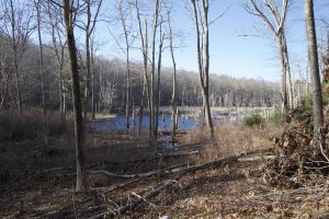
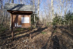
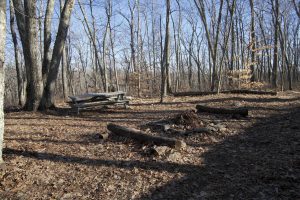
- Kinne Preserve –★★– 1.2 miles – A short loop with a camping area and views of an unnamed brook
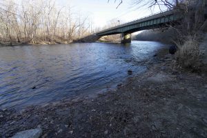
- Manship Park –★– Sports fields with a 0.3 mile walking track and a boat launch into the Quinebaug River
Land Trust
- None
State Parks / Forest
- None
Blue Blaze
- None
The Rest
- None
Boating/Fishing
- Quinebaug River
- Boat Launch at Manship Park
- Quinebaug River
N/A
This Mohegan territory had a fort along the Quinebaug River here and called the area Peagscomsueck meaning “a great brook.” Owaneco, the son of Uncas and sachem of the Mohegans granted a title to a large tract known as the Quinebaug lands in 1680 to Major James Fitch of Norwich. Fitch settled in the area in 1697 and named his home Kent and others began to settle the west side of the river (then Plainfield) in the next few years.
It was set off from Plainfield and incorporated as the 34th town in Connecticut on October 14th, 1703. It was named from Canterbury in Kent, England (likely thanks to Fitch’s name for his home).
In 1832, Prudence Crandall, a schoolteacher created controversy when she opened the Canterbury Female Boarding School and admitted black girls as students. She was arrested and jailed, legal proceedings carried on and the school was forced to close in 1834 by a mob of Canterbury residents.
{{locationDetails}}
